Lofthus - Vøringsfossen
Die Föhnwetterlage war äußerst hartnäckig, aber der befürchtete Regen blieb aus und so konnten wir doch einige schöne Eindrücke sammeln. Ullensvang ist bekannt für seine Äpfel und vor allem Kirschen, die es überall zu kaufen gab. Ebenso bekannt ist das Kirschenfestival auf dem auch die norwegische Meisterschaft im Kirschkern-Weitspucken ausgetragen wird (Stand 2014: 14,25 m). Leider waren wir etwas zu früh dran und begnügten uns deshalb mit einer Fahrt zum Vøringsfossen, einem der bekanntesten Wasserfälle in Norwegen.
The Foehn weather turned out to be very persistent but dry and so we could gather quite a few nice impressions. Ullensvang is a well known growing area for apples and especially cherries which were sold everywhere. As popular as the cherries themselves is the cherry festival and the Norwegian Championship of cherry stone spitting (2014: 14,25 m) at Lofthus. Unfortunately we were a little bit too early to take part in this competition and so we visited Vøringsfossen instead, one of Norway's most popular waterfalls.
Karten/Maps: Fjordland - Jostedalsbreen
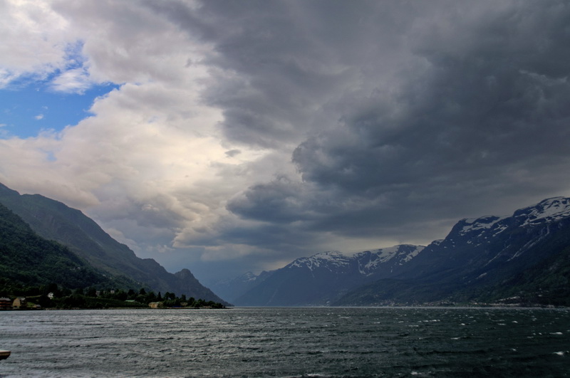
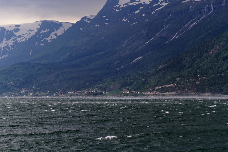
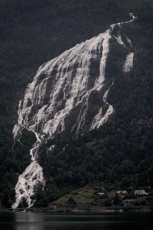
Vom Hotel aus ließ sich die Entwicklung des aufkommenden Föhnsturms gut mitverfolgen. Der Wasserfall Skrikjofossen 900 m über dem Fjord zeigt an, wie sich der Föhnsturm zuerst in der Höhe und später bis zum Boden durchsetzt.
From the hotel we were able to follow the formation of the upcoming storm. Skrikjofossen, a waterfall 900 meters above, was indicating the storm which started blowing at higher altititudes and slowly made its way down to fjord level.
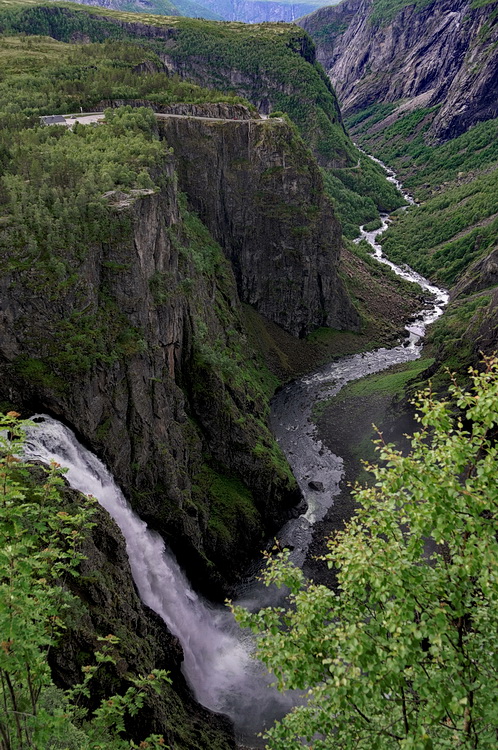

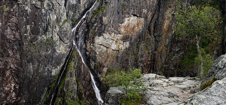
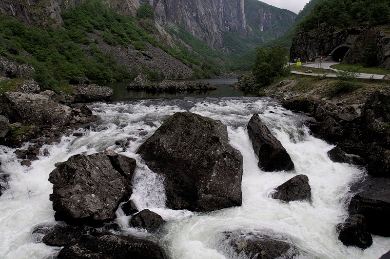
Von einem Parkplatz direkt an der Straße führt ein Weg zu einem Felsvorsprung oberhalb des Wasserfalls (linkes oberes Bild), mit eindrucksvollen Tiefblicken in die Schlucht des Bjoreio Flusses. Vom Vøringsfossen selbst sieht man allerdings wenig. Warnschilder mahnen zur Vorsicht, nur am Aussichtspunkt selbst ist ein Geländer angebracht.
A footpath is leading from the parking to a rock spur above the waterfall with a stunning view into the gorge of the river Bjoreio. Vøringsfossen however is partly hidden behind the rocks. Signs are warning to act with caution as there are no railings except from the lookout itself.
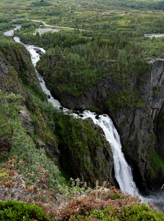
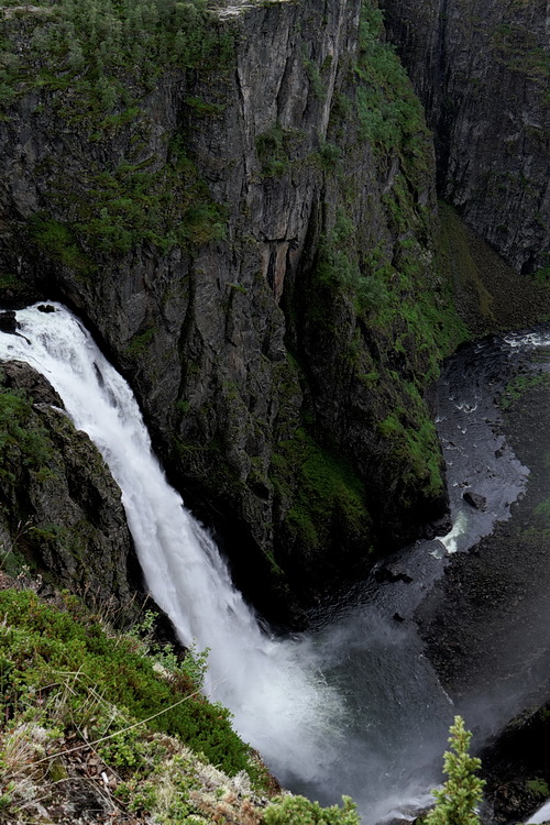
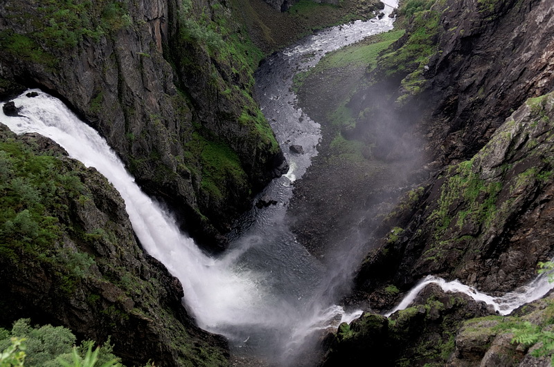

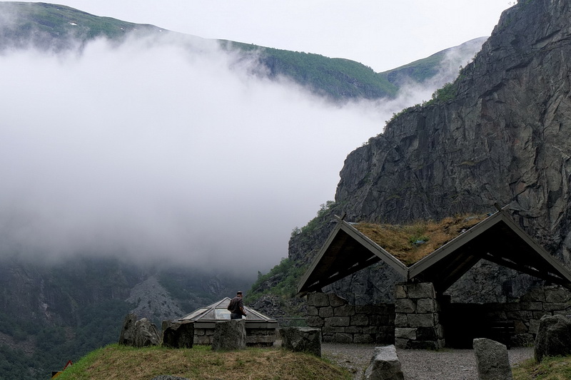
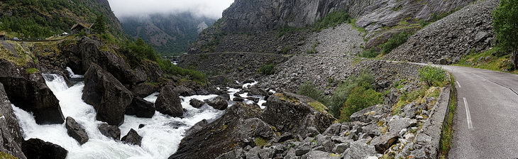
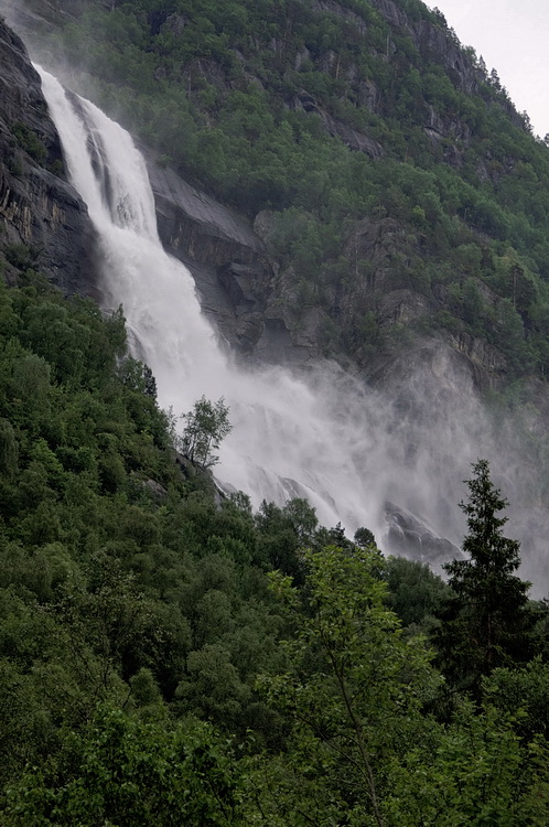
Den 182 m hohen Vøringsfossen sieht man am besten von der Aussichtskanzel beim Hotel Fossli. Da das Wasser des Bjoreio Flusses zur Energiegewinnung verwendet wird, ist die Wassermenge von 12 m³ pro Sekunde nur in den Sommermonaten garantiert.
The viewing platform near the Fossli Hotel is offering the best view of Vøringsfossen (182 m). As the water of the river Bjoreio is partly diverted for hydroelectric purposes the amount of 12 cubic meters per second is only guaranteed during the summer months.
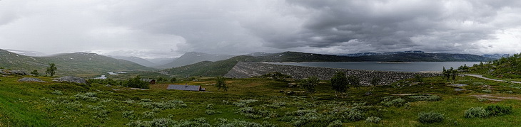
Die Höhe des Sysenvatn wird mit 940 - 874 m angegeben, je nach Füllhöhe des Stausees, der das Wasser für eines der größten Wasserkraftwerke Europas liefert. Der 1160 m lange Damm besteht aus 3,6 Millionen m³ Steinen und Schotter und staut sowohl das Wasser des Hardangerjøkulen, als auch des kleinen Flusses Bjoreio, der zu diesem Zweck teilweise umgeleitet wird.
The altitude of Sysenvatn is specified with 940 to 874 m depending on the filling level of the lake which is supplying one of the largest hydro-electric power plants in Europe. The dam with a length of 1.160 meters consists of 3.6 million cubic meters of stones and gravel and is damming the waters of Hardangerjøkulen as well as the river Bjoreio which is diverted partly for this purpose.
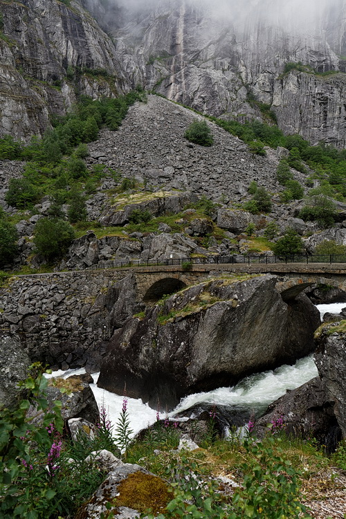
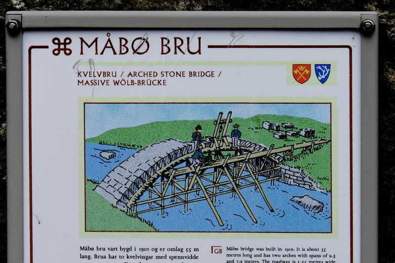
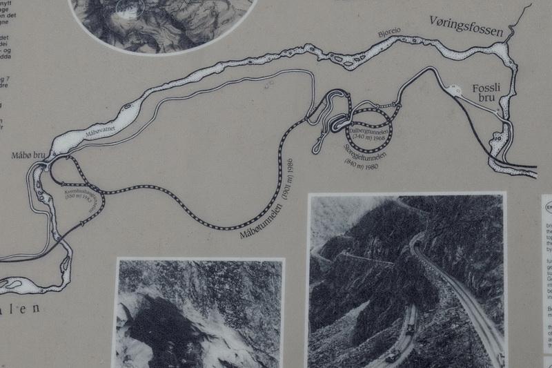
An einem kleinen Rastplatz an der Mabø Brücke auf der Rückfahrt vom Vøringsfossen ist die Streckenführung der 1986 neu gebauten Straße genau beschrieben. Die alte Straße dient mittlerweile als Rad- und Fußweg.
The new roadway built and in 1986 is described in detail at the little resting place near the Mabø bridge on the way back from Vøringsfossen. Today the old road is used as cycle- and footpath.
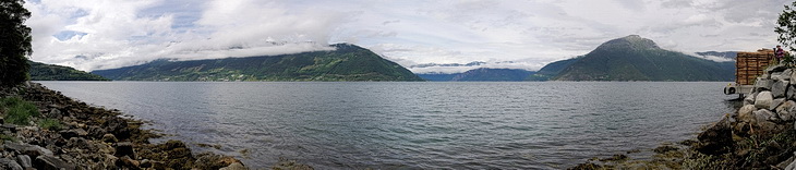
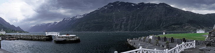
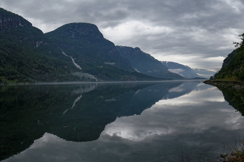
Wieder zurück in Ullensvang war die Wetterlage noch unverändert und eine düstere Stimmung lag über dem Fjord.
Back again in Ullensvang the weather conditions were still the same creating a dreary atmosphere.
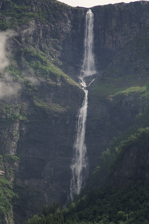
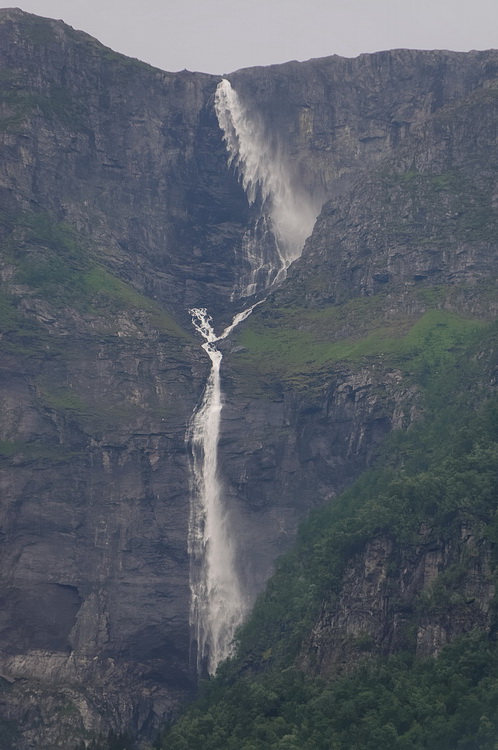
Der Ædnafossen am gegenüberliegenden Ufer und der Tjøndalsfossen direkt an der Straße nach Odda.
Ædnafossen on the opposite shore and Tjøndalsfossen on the road to Odda.
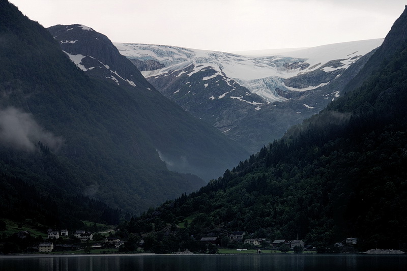
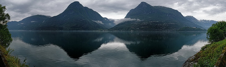
Unten links der See Sandevatnet, auf dessen Oberfläche sich eine Nebelschicht ausbreitet, hervorgerufen vom kalten Schmelzwasser des Buerbreen (rechtes Bild), einer Zunge des Folgefonna Gletschers.
The left picture below shows Sandevatnet lake where a layer of mist was spreading above the water which was caused by the cold melting water of Buerbreen, a part of the Folgefonna glacier.