Nepal: Annapurna Runde III - Thorong La -> Pokhara
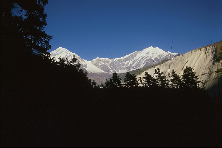
Der Abstieg vom Thorong La (5416 m) führte durch eine tibetisch anmutende, trockene Landschaft hinunter ins Kali Gandaki Tal. Zwischen Dhaulagiri und Tukuche Peak im Westen und Nilgiri, Annapurna und Machapuchare im Osten ging es danach immer am Fluss entlang bis nach Tatopani. Hier verliessen wir den Kali Gandaki und wandten uns nach Südosten zum Ghorapani Pass (2835 m) und wieder zurück nach Pokhara.
The descent of Thorong La (5416 m) leads through a dry, tibet-like landscape down to the Kali Gandaki Valley. Between Dhaulagiri and Tukuche Peak to the west and Nilgiri, Annapurna and Machapuchare to the east we followed the river to Tatopani where we left the Kali Gandaki River and turned south-east to the Ghorapani Pass (2835 m) and back to Pokhara.
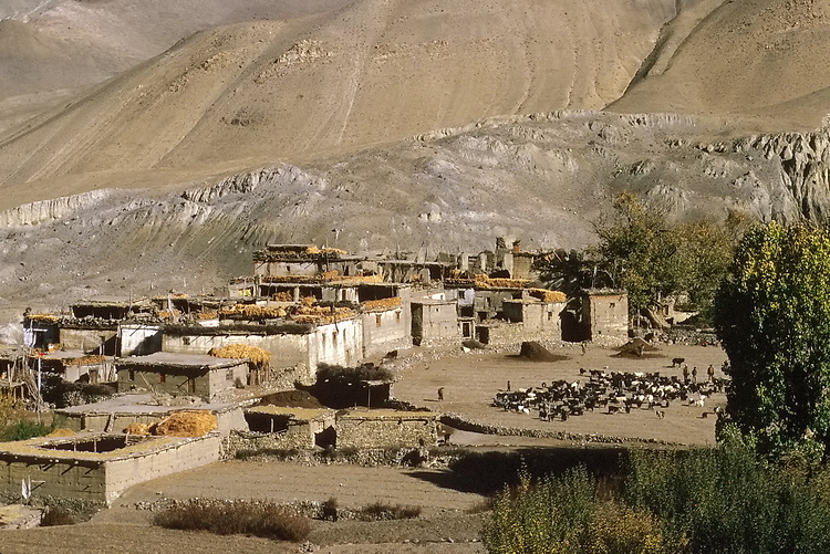
Abstieg vom Thorong La: Blick von Muktinath (3810 m) auf die Ortschaft Jharkot. Im Hintergrund die Berge Tibets.
Descent from the Thorong La The village of Jharkot seen from Muktinath (3810 m). Behind the mountains of Tibet.
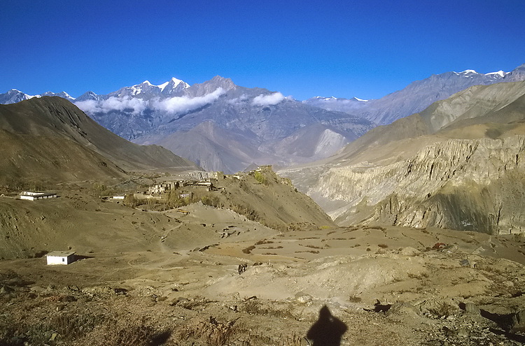
 Der erste Blick auf die Nordseite von Dhaulagiri (8167 m) und Tukuche Peak (6920 m) beim Abstieg von Muktinath nach Kagbeni. Etwas später bei Jomosom auf der anderen Talseite die Nordwand des Nilgiri North (7061 m). First view of Dhaulagiri (8167 m) and Tukuche Peak (6920 m) on the way down from Muktinath to Kagbeni. Later near Jomosom on the other side of the valley the north face of Nilgiri North (7061 m). |
 |
 |
Tilicho Peak (7134 m), Nilgiri North (7061 m) und Nilgiri Central (6940 m) von Tukuche aus. Tilicho Peak (7134 m), Nilgiri North (7061 m) and Nilgiri Central (6940 m) seen from Tukuche. |
 |
Links die Ostseite des Dhaulagiri - der Gipfel ist von hier nicht sichtbar - und Tukuche Peak von Kalo Pani. To the left the east face of Dhaulagiri - the summit is not visible from here - and Tukuche peak from Kalo Pani. |
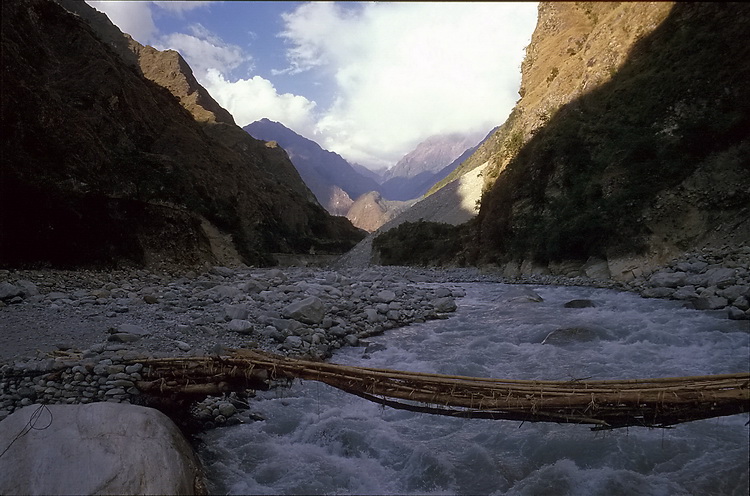 |
Das Kali Gandaki Tal bei Tato Pani, das wir nun in Richtung Ghorapani Pass verlassen. The Kali Gandaki valley near Tatopani which we now leave in direction to the Ghorapani Pass. |
 |
Fang und Annapurna South im Abendlicht von Chitre. Fang and Annapurna South near Chitre. |
 |
Ghorapani Pass (2835 m)
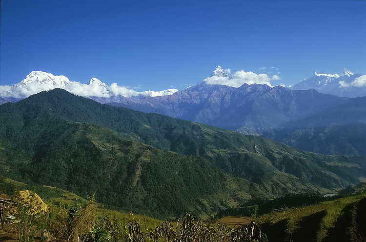
Annapurna South, Hiunchuli (6431 m), Glacier Dome (7202 m) Machhapuchhare (6999 m), Annapurna IV (7525 m), Annapurna II (7937 m). |
 |
Dhaulagiri Südwand. Dhaulagiri South Face. |

|
Ein Abstecher in Richtung Annapurna Base Camp führt zur Ortschaft Dhampus mit Blick auf Annapurna Süd links (7273 m), Patal Hiunchuli rechts (6441m - rechts), dazwischen der Annapurna Hauptgipfel (8091m - im Hintergrund). In direction to the Annapurna base camp one passes the village of Dhampus with Annapurna South (7273 m - left), Patal Hiunchuli (6441 m - right) and Annapurna main summit (8091 m - between in the background). |
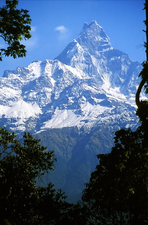 |
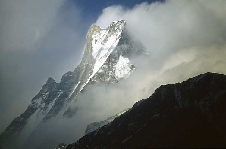 Der Machapuchare (6999m) westlich von Dhampus und von Chomrong. Machapuchare (6999m) seen from Dhampus and Chomrong. |