Langtang Trek: Syabru -> Gosainkund
Für den Rückweg über Syabru, Shin Gompa, Gosainkund und Tharepati nach Sundarjal benötigt man insgesamt 6 Tage, mit einer etwas anstrengenderen Etappe zwischen Laurebina Pass und Tharepati. Unterwegs bieten sich phantastische Ausblicke auf Ganesh Himal, Manaslu und Annapurna (bei Laurebina), sowie in die Langtangberge bis zum Everest (Tharepati).
The way back via Syabru, Shin Gompa, Gosainkund, Tharepati to Sundarjal takes 6 days including a more strenuous part between Laurebina pass and Tharepati. On the way you'll have phantastic views of the Ganesh Himal, Manaslu and Annapurna (near Laurebina) as well as the Langtang Range up to Everest (Tharepati).
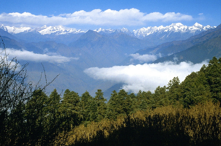
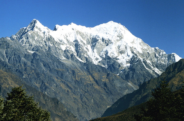
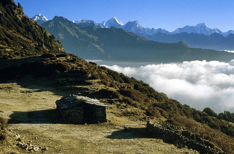
Im Aufstieg nach Shin Gompa wird auf etwa 3200 m der Blick zu den Sechs- und Siebentausendern im Grenzkamm zu Tibet frei. Unten das Tal des Trisuli. Von Shin Gompa führt der Weg über einen Höhenrücken zu den Heiligen Seen der Hindus nach Gosainkund. Rechts im Bild ein letzter Blick zurück zum Langtang Lirung (7246 m).
View to the mountain range at the border of Tibet while ascending Shin Gompa at 3.200 m. From Shin Gompa the path leads across a ridge to the holy lakes of the Hindus to Gosainkund. Right picture: Final view of Langtang Lirung (7.246 m).
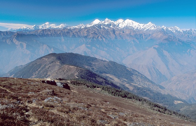
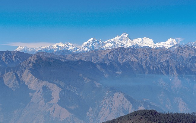
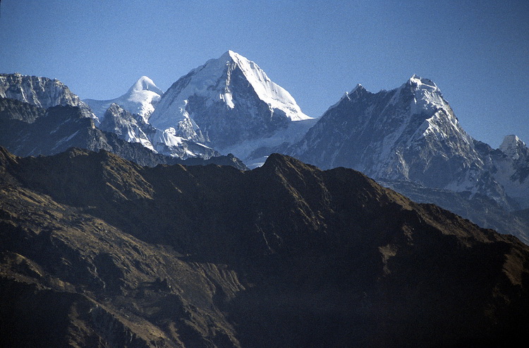
Unterhalb von Laurebina bietet tauchen neue Berge auf. In 100 km Entfernung die Annapurnagruppe mit Annapurna South und Machapuchare ganz links und Annapurna II in der Mitte. Rechts daneben der zum Gurkha Himal gehörige Baudha (6672 m). Daran anschliessend Himalchuli (7893 m), Peak 29 (Manaslu II - 7835 m) und Manaslu (8156 m).
Below Laurebina new peaks appear. At a distance of about 100 km the Annapurna range with Annapurna South and Machapuchare to the left and Annapurna II in the middle. More to the right Baudha (6672 m) which belongs to the Gurkha Himal range. Continuing to the right Himalchuli (7893 m), Peak 29 (Manaslu II - 7835 m) and Manaslu (8156 m).
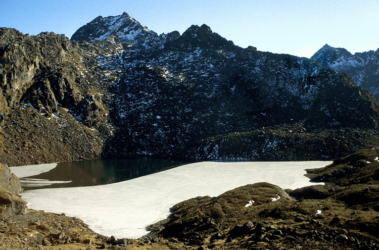
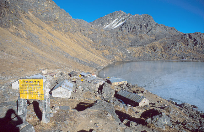
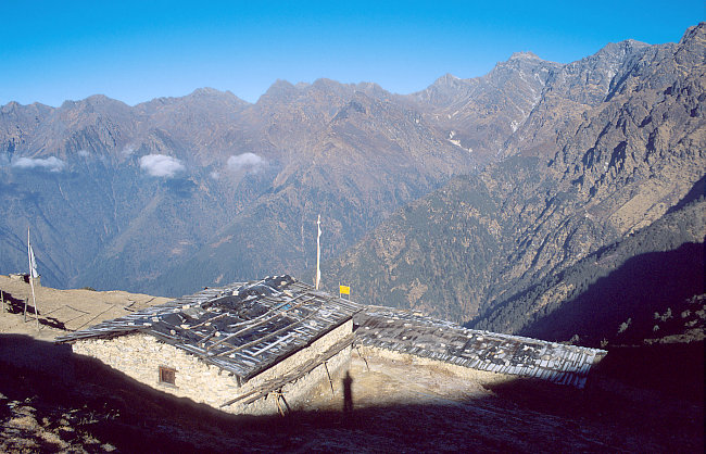
Nach einer Wegbiegung in ein Seitental hinein verschwindet das Panorama und der erste Heilige See - der Saraswatikund (kund bedeutet See) - taucht auf. Vorbei am Bhairavkund führt der Weg zum Gosainkund, wo man in einigen einfachen Lodges auch im Winter übernachten kann. (zumindest wenn kein Schnee liegt wie 1997). Im Hintergrund der Weg zum Laurebina Pass (rechtes Bild).
Following the path into a side valley the panorama disappears and the first of the holy lakes - Saraswatikund (kund means lake) - appears. Passing the Bhairavkund the path leads to Gosainkund, where also in the winter season you can stay overnight (at least if there is only little snow as in 1997). Behind the trail to the Laurebina Pass (picture right).
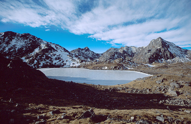 |
Kurz vor der Passhöhe des Laurebina La (4609 m) kommt man am zugefrorenen Surja Kund vorbei. Die Etappe bis Tharepati ist recht anstrengend, da man hier mehrere Gegenanstiege zu bewältigen hat. Short before the Laurebina Pass (4609 m) one passes the frozen Surja Kund. The following part to Tharepati is a little bit strenuous as you have to descend and re-ascend several times. |
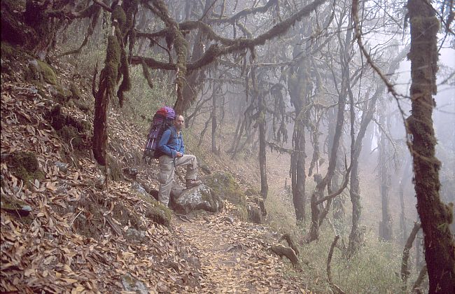
Im Nebelwald zwischen Laurebina Pass und Thare Pati. Blick von Tharepati auf den langen Abstieg vom Laurebina Pass.
In the forest between Laurebina Pass and Tharepati. View vom Tharepati on the long descent from Laurebina Pass.
 |
Ein letzter Blick zum Dorje Lagpa (6973 m) von Tharepati aus. Der Eisgipfel links im Hintergrund ist der Lengpo Kang (oder Big White Peak - 7085 m). Final view of Dorje Lagpa (6.973 m) from Tharepati. The glacier summit left in the background is Lengpo Kang (or Big White Peak - 7.085 m). |
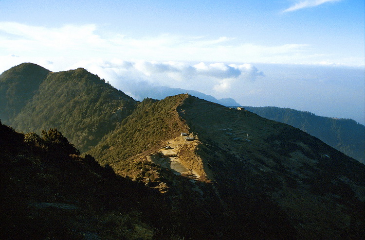
Tharepati liegt auf einem Höhenrücken mit herrlicher Aussicht auf die Langtang Berge (von links: Kang Chenpo (6297 m), Dorje Lagpa (6973 m), Phurbi Chyacha 6722 m) und über die Täler von Helambu bis zum Melungtse und Gaurisankar.
Tharepati is situated on a ridge with magnificent view to the Langtang mountains - left to right: Kang Chenpo (6297 m), Dorje Lagpa (6.973 m), Phurbi Chyacha (6.722 m) and across the valleys of Helambu up to Melungtse and Gaurisankar.
 |
Von Tharepati führt der Weg über einen langen Höhenrücken abwärts (mit grösseren Gegenanstiegen) in 3 Tagen nach Kathmandu zurück. From Tharepati the route leads back to Kathmandu in 3 days with considerable descents and re-ascents. |