Pyrenäen: Ordesa Nationalpark
Der Ordesa Nationalpark liegt in den aragonischen Pyrenäen in der Provinz Huesca und wurde bereits 1918 zum Nationalpark erklärt. Das Tal von Ordesa, das dem Park den Namen gab, wird von dem Fluss Arazas mit seinen zahlreichen Wasserfällen durchquert. Am Eingang zum Nationalpark startet unsere Rundtour, die uns zunächst durch den Canyon de Araza zur Goriz Hütte (2250 m) führt. Die Besteigung des Monte Perdido (3355 m) ist unschwierig, allerdings kann Vorsicht geboten sein, wenn sich unter dem Schutt noch hart gefrorene Altschneereste befinden. Durch teilweise wüstenhaftes Terrain führt der Weg weiter zur eindrucksvollen Breche de Roland und über Reste eines ehemaligen Gletschers hinunter zur Sarradets Hütte, der Aussichtskanzel über dem Cirque de Gavarnie.
Auf dem Rückweg zum Ausgangspunkt unserer Tour passierten wir noch einmal die Breche de Roland, und stiegen durch einen Seitencanyon wieder ins Valle de Araza ab. Im September 1980 trafen wir nur wenige Wanderer, dies soll sich in der Zwischenzeit geändert haben. Nicht geändert haben dürfte sich die unvergleichliche Landschaft, die teilweise an den Grand Canyon erinnert.
The Ordesa National Park (since 1918) is situated in the Aragon Pyrenees and belongs to the province of Huesca. The valley of Ordesa after which the park is named is flown through by the river Arazas with its numerous cascades. At the entrance of the national park we started our round-tour which lead us through the Canyon de Araza to the Goriz Hut (2250 m). The ascent of Monte Perdido (3355 m) is easy but can be tricky just below the summit if there is ice underneath the debris. Through a desert-like landscape we passed the impressive Breche de Roland and went down across the remainders of a former glacier to the french Sarradets Hut - the vantage point just above the Cirque de Gavarnie.
On the way back to our starting point we again passed the Breche de Roland and descended through a side canyon into the Araza valley.In September 1980 we only met few hikers on our tour, a fact that might have changed by now. What definitely didn't change is the unique landscape that sometimes reminds of the Grand Canyon.
 |
Im Valle de Arazas. Der Anstieg zur Goriz Hütte führt durch die Felswand links der Bildmitte. The valley of Arazas. The route to the Goriz Hut leads through the rocks left of the centre. |
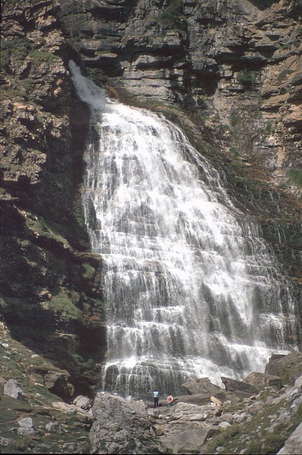
Am Talende vor dem Aufstieg die Cascada del Caballo (Pferdeschwanz Wasserfall). Der Weg führt nun über eine kurze Felspassage, die 1980 mit Ketten gut abgesichert war.
At the end of the valley the Cascada del Caballo (horsetail fall). The path now passes a short rock passage belayed with iron chains (at least in 1980).
Durch ein Hochtal führt der Weg weiter zur Goriz Hütte auf 2250 m mit Blick auf den Monte Perdido (rechts).
On the way to the Goriz Hut (2.250m) Monte Perdido appeared for the first time.
 |
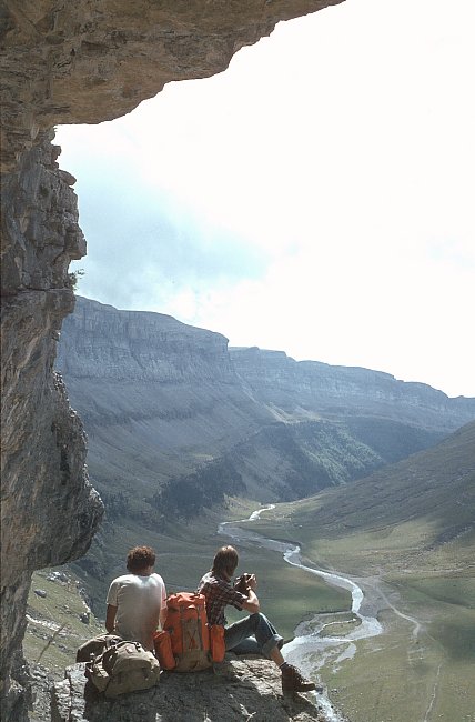
Aufstieg zum Monte Perdido und der Blick zurück zum Canon de Araza. View back to the Canyon de Araza from the ascent route of Monte Perdido. |
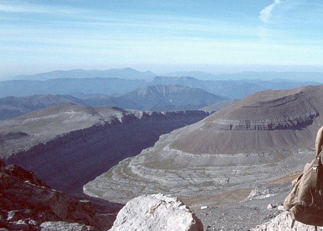
Faszinierende Tiefblicke in jeder Richtung: Der Canyon de Araza und das Tal des Rio Cinca vom Gipfel des Monte Perdido.
Fascinating views down to the Araza Canyon or the Rio Cinca valley from the summit of Monte Perdido.


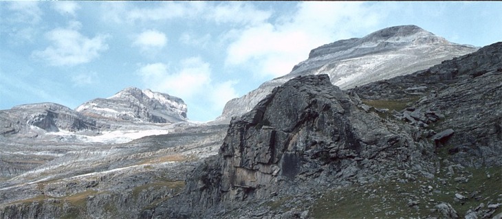
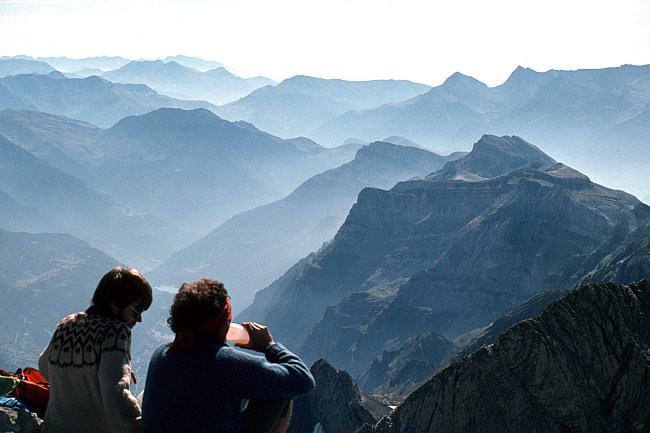
Auf der gegenüberliegenden, französischen Seite ist das Neouvielle Massiv zu erkennen und in direkter Nachbarschaft ein weiterer Dreitausender, die Vignemale (3298 m).
On the opposite (french) side we could see the Neouvielle massif and another 3000 m peak, Vignemale (3298 m) in close vicinity.
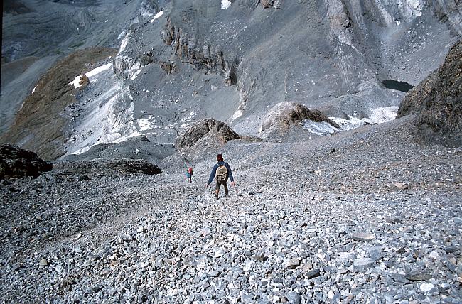

Der schnelle Abstieg zum Eissee beginnt mit einer langgezogenen Schutthalde, die grüßeren Brocken sind eher für Kletterspezialisten geeignet.
A debris-covered slope leads down to the Ice-lake and guarantees a quick descent whereas the bigger ones are are 'for climbers only'.
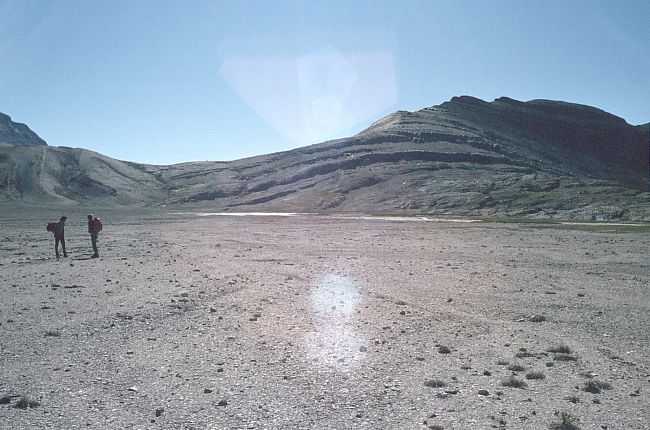
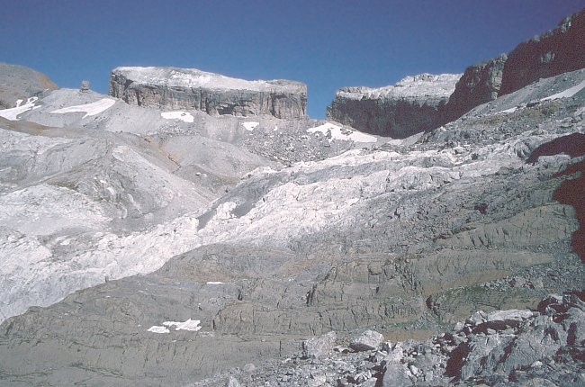
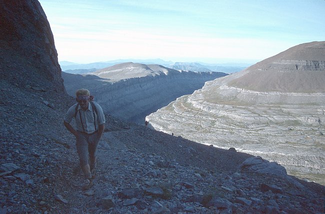
Auf der spanischen Seite zwischen der Goriz Hütte und dem Refuge des Sarradets herrschen wüstenhafte Verhältnisse bis zur Breche de Roland (2800 m) der Übergang zur französischen Seite.
On the Spanish side we found desert-like conditions until to the Breche de Roland (2800 m) which we passed on the way to Sarradets Hut.
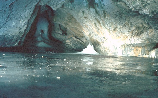 |
Ein angenehmer Platz bei 35 Grad. Die Eishöhle liegt oberhalb des Wegs zur Breche de Roland. A pleasant place to cool down at 35 degrees. The ice cave is situated just above the path to the Breche de Roland. |
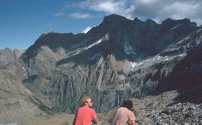 |
Der Blick vom Refuge de Sarradets (2587 m) hinunter in den Cirque de Gavarnie und die Grande Cascade. View down to the Cirque de Gavarnie and the Grande Cascade from the Sarradets Hut (2587 m). |
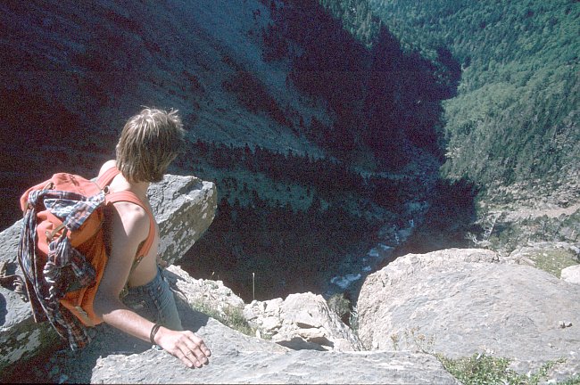 |
Auf dem Weg von der Breche de Roland zurück zum Ausgangspunkt trafen wir auf eine kurze, luftige Felspassage, die mit Eisenstäben versehen war. On the way back to our starting point we found a short airy rock passage belayed with iron bars. |
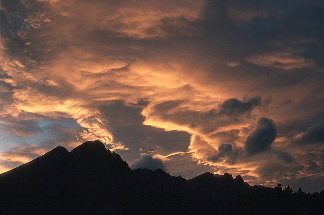 |
Föhnstimmung in den Pyrenäen. Not only an alpine phenomenon - the foehn. |