Rundfahrt Sunnmøre Alpen
Nach der Überfahrt von Sæbø nach Leknes geht es zunächst am Nordufer des Norangfjords entlang und durch das Norangdalen nach Hellesylt am westlichen Ende des Geirangerfjords. Hier beginnt auch die weltberühmte Fährfahrt durch den Geirangerfjord (1 Stunde bis zur Ortschaft Geiranger), den wir bereits auf einer früheren Reise besuchten.
After the ferry crossing from Sæbø nach Leknes we continued along the northern shore of Norangfjord and further through the Norang valley to Hellesylt at the western end of Geirangerfjord. Hellesylt is also the place to start the famous ferry trip to Geiranger which takes about one hour.
Karten/Maps: Fjordland - Jostedalsbreen
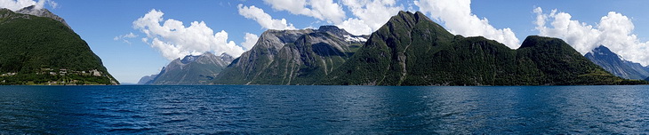
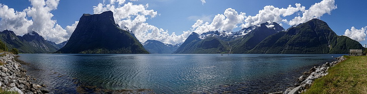
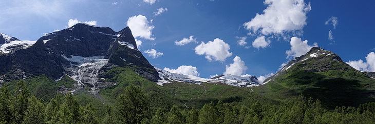
Die landschaftlichen Eindrücke auf der Überfahrt von Sæbø nach Leknes gehören zu den absoluten Highlights dieser Reise. Der Blick nach Norden in Richtung Ålesund zeigt die Weite der Fjorde während die mächtigen Felsklötze von Stålberghornet und Slogen schon fast bedrohlich wirken.
The scenic impressions during the crossing from Sæbø and Leknes belong to the highlights of this trip. The vastness of this landscape becomes apparent looking in northern direction towards Ålesund while the massive rocks of Stålberghornet and Slogen appear slightly threatening.

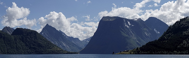
Noch spektakulärer wirkt der Stålberghornet von der anderen Seite des Norangsfjords auf dem Weg ins Norangsdalen.
Even more spectacular: Stålberghornet seen from the other side of Norangsfjord on the way to Norang valley.


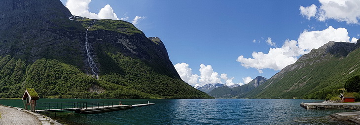
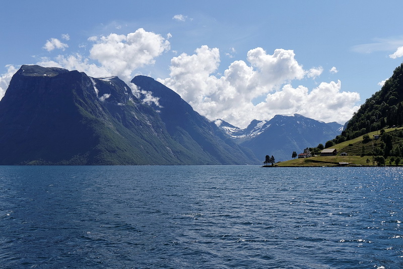
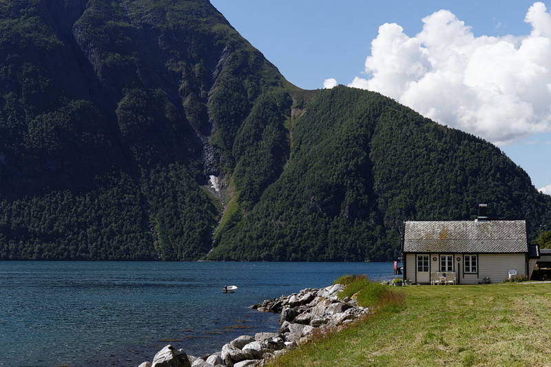
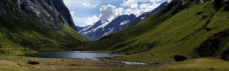
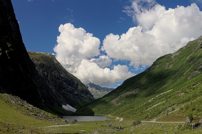
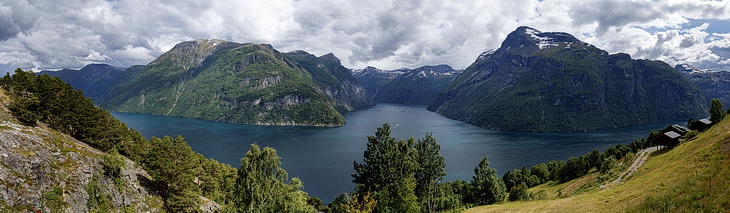
Am Ende des Norangsfjorden bei Øye, direkt unterhalb des Slogen befindet sich dieser nette Rastplatz. Das Norangsdalen verbindet die inneren Sunnmøre Alpen mit dem Nordfjord und war bereits am Ende des 19. Jahrhundert ein wichtiges Ziel für den Tourismus.
A nice place to stop is Øye at the end of Norangsfjord just below Slogen Peak. The Norangsdalen valley is connecting the inner part of the Sunnmøre Alps with the Nordfjord an has been an important destination for tourism since the end of the 19th century.
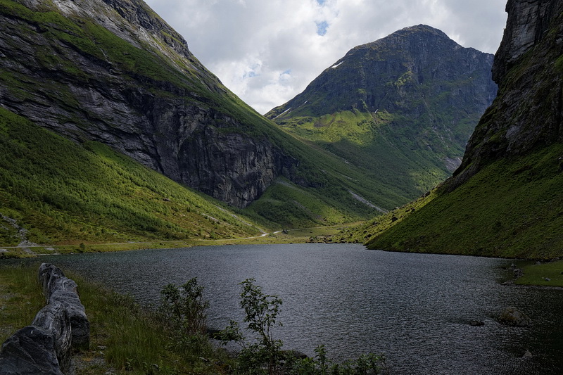
Eine Steinlawine vom Berg Keipen am 26.5.1908 versperrte das Tal und bildete einen Damm, der den Lyngnstøylvatnet aufstaute. Die Überreste einer aus 9 Hütten bestehenden Alm sind heute noch zu sehen.
A debris avalanche coming down from Keipen peak at the 26th of May 1908 was blocking the valley and dammed a new lake called Lyngnstøylvatnet. The remainders of the local mountain pasture consisting of 9 huts are still visible.
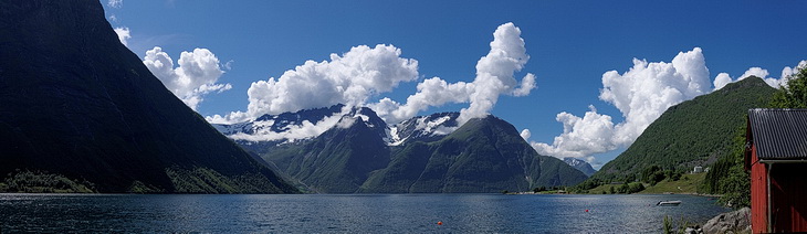
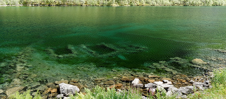
Stavbergvatnet (211 m) im Norangsdalen mit der Kvitegga (1717 m), dem höchsten Gipfel in der Region Fjellheimen.
Lake Stavbergvatnet (211 m) in the Norang valley with Kvitegga (1717 m) the highest mountain in the Fjellheimen area.
Geirangerfjord

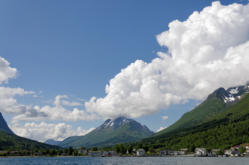
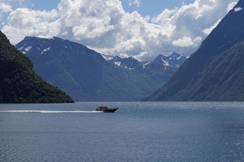
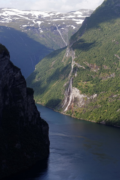
Wenige km nördlich von Hellesylt mündet der 15 km lange und 290 m tiefe Geirangerfjord in den Sunnylvsfjord. In Hellesylt legt auch das Schiff an, mit dem man den wohl bekanntesten Fjord Norwegens durchfahren kann. Die Einsiedelei Matvika am Nordufer des Geirangerfjords liegt klimatisch so günstig, dass dort schon Aprikosen geerntet wurden.
Geirangerfjord is 10 miles long, 290 m deep and definitely one of the most famous fjords in Norway. Together with the Nærøyfjord it has become part of the UNESCO world heritage in the year 2005. Due to a special climate even apricots can be planted here as for example at the hermitage Matvika on the northern shore.
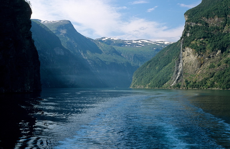
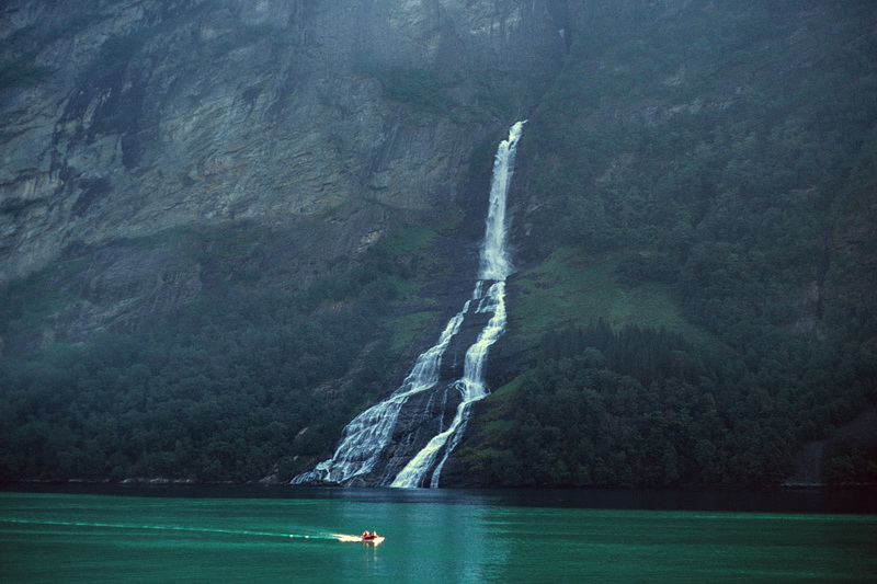

Der "Freier" und die "Sieben Schwestern" sind die bekanntesten Wasserfälle im Geirangerfjord.
'Freier' and the 'Seven Sisters' are the most popular waterfalls in the Geiranger Fjord.