Nordnorwegen: Bodø ➟ Moskenes ➟ Svolvær
Fähreüberfahrt von Bodø nach Moskenes auf den Lofoten
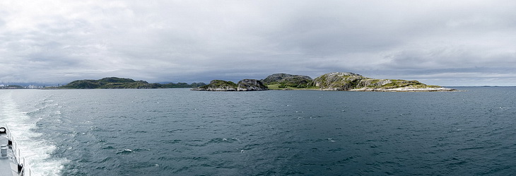
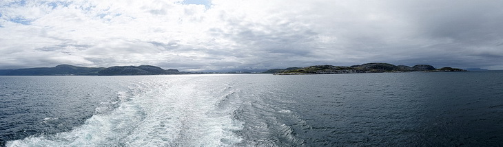
Bei nicht ganz idealen Wetterverhältnissen verlassen wir Bodø in Richtung Lofoten. Neben vorgelagerten Inseln Store Hjartøya und Skipsholmenden passieren wir auf den ersten 30 km auch zahlreiche kleine Inseln.
The weather conditions are far from being ideal when we are starting our passage to the Lofoten islands. Besides the offshore islands of Hjartøya und Skipsholmenden we are also passing numerous small islands during the first 20 miles.
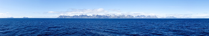
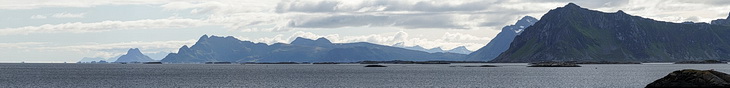
Noch 50 km entfernt aber schon wieder in stahlendem Sonnenschein: Die Gipfelkette der Lofoten mit den beiden Inseln Mosken und Værøya (links)
Still 30 miles away but in bright sunshine: The skyline of the Lofoten peaks with the islands Mosken and Værøya to the left.
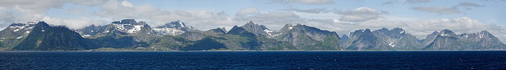
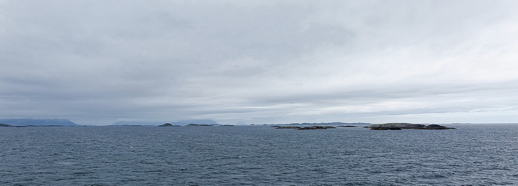
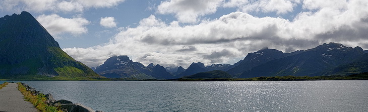
Moskenes das Ziel der dreieinhalbstündigen Fährüberfahrt (links). Die Pyramide am Beginn des rechten Drittels ist der Olstinden an dessen Fuß das Fischerdorf Reine liegt.
Moskenes the destination of the 3.5 hours passage (left). Reine the popular fishing village lies at the foot of the pyramid-like mountain at the beginning of the right third.
Reine
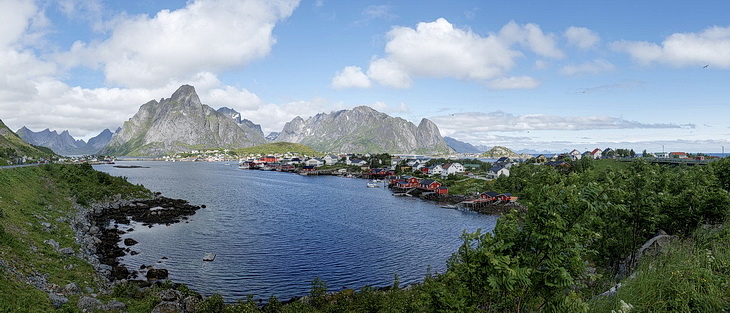
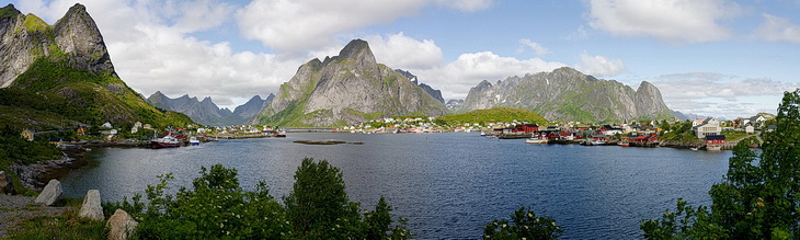
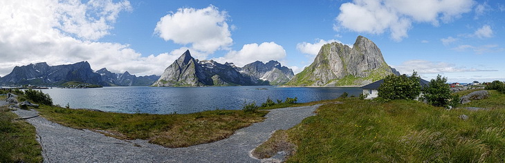
Das bekannte Motiv: Reine eingerahmt von steilen Bergen (Olstindan und Lilandstindan).
The famous panorama: Reine fremed by steep mountains (Olstindan und Lilandstindan).
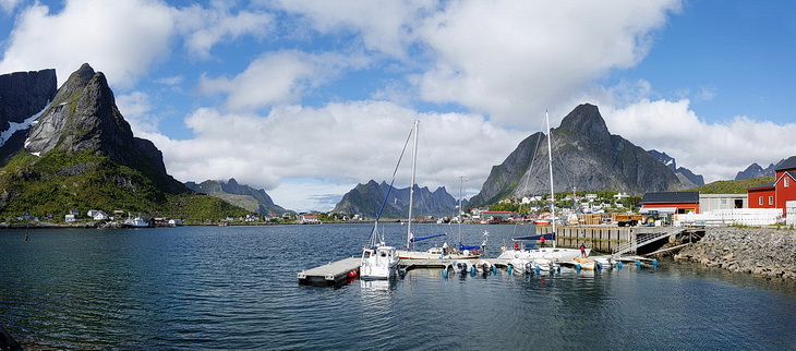
Der Hafen von Reine dahinter links die beleuchtete Pyramide des Navaren (699 m).
The harbour of Reine with the sunlit pyramid of Navaren (699 m - left).
Topøya bei Reine mit Panoramablick auf die Gipfel am Reinefjorden.
Topøya near Reine with a panoramic view of the peaks around Reinefjorden.
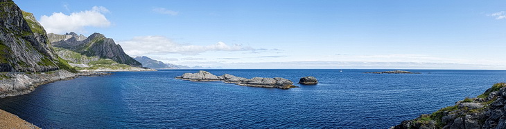
Blick nach Osten entlang der Südostküste.
View in eastern direction along the south-eastern coastline.
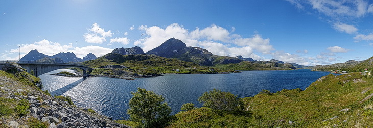
Brücke über den an dieser Stelle nur etwa 200 m breiten Kåkersundet.
Bridge across Kåkersundet which at this point is just about 200 m wide.
Ähnlich wie der Saltstraumen auf dem Festland findet man auch zwischen den Inseln der Lofoten starke Gezeitenströme wie hier am Sundstraumen zwischen den Inseln Moskenesøya (im Hintergrund) und Flakstadøya.
Similar to Saltstraumen on the mainland strong tidal currents are found between the islands of the Lofoten archipelago like here at the Sundstraumen between the islands of Moskenesøya (in the background) and Flakstadøya.
Links die Brücke nach Fredvang auf Moskenesøya, rechts Ramberg auf Flakstadøya.
Bridge leading to Fredvang on Moskenesøya, the village on the right side is Ramberg on Flakstadøya.
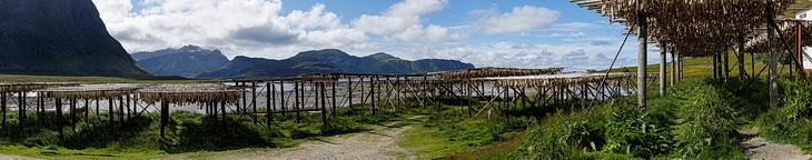

Der berühmte Stockfisch (Kabeljau) wird in Holzgestellen getrocknet.
The famous Stockfish (cod) is dried on wooden racks.
Hafenmole von Ramberg mit der Pyramide des Volandstinden (457 m).
The harbour of Ramberg and the pyramid of Volandstinden (457 m).
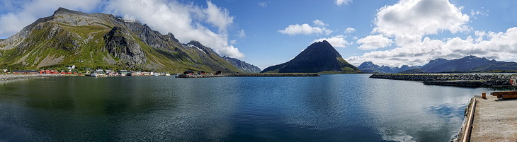
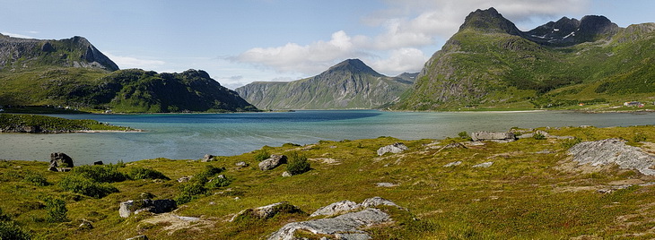
Dicht an dicht reihen sich die Gipfel von Moskenesøya im Südwesten.
The close-packed mountains of Moskenesøya in south-western direction.
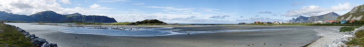
Bei Ebbe liegen hier große Flachwasserbecken frei.
At low tide shallow basins are falling dry.
Die Bucht Flakstadpollen auf der Insel Flakstad.
Flakstadpollen Bay on Flakstad island.
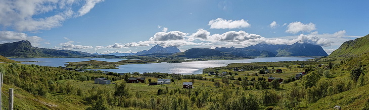
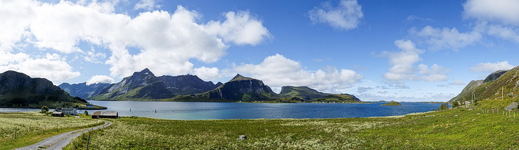
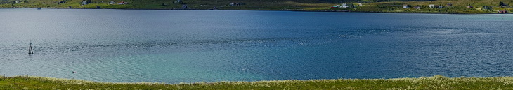
17 km nordöstlich von Leknes: Die Seenlandschaft von Inner- und Ytterpollen sowie Krikktindan und Himmeltindan (954 m) auf Vestvågøya.
11 miles north-east of Leknes: The lake scenery of Inner- und Ytterpollen as wellas Krikktindan und Himmeltindan (954 m) on Vestvågøya
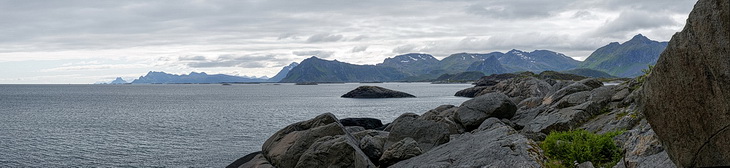
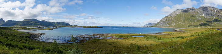
12 km vor Kabelvåg liegt die felsige Bucht Knutshola von wo man einen schönen Blick auf die Südostküste von Vestvågøya hat.
The rocky bay of Knutshola about 8 miles ahead of Kabelvåg. Nice view along the south-eastern coast of Vestvågøya.
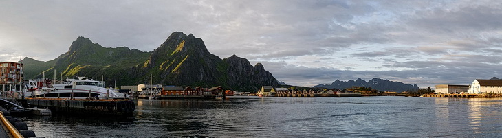
Abendstimmung im Hafen von Svolvær, überragt von des Blåtindan (621 m) und Fløya (590 m - Bildmitte).
Evening atmosphere at Svolvær harbour towered by the sheer rock faces of Blåtindan (621 m) and Fløya (590 m).