Alaital und Pamirlager Atschik Tash
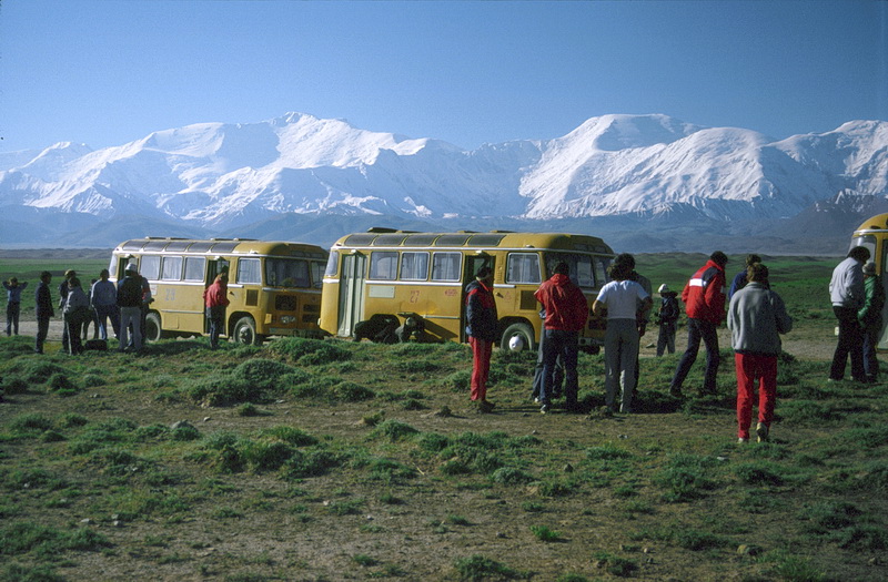
Ausgangspunkt der meisten bergsteigerischen Unternehmungen im Pamir ist das Internationale Bergsteigerlager Atschik Tasch am Nordfuss des Pik Lenin, von wo aus man die anderen Lager mit dem Hubschrauber erreicht. Nach Atschik Tash gelangt man entweder in einer 10-stündigen Busfahrt von Osh im Fergana Becken, über den Taldyk Pass (3625 m mit dem ersten Blick auf die Gletschergipfel jenseits des Alaitales) und Sary Tash, oder nach einem 45 minütigem Flug über die Alaikette nach Daraut Kurgan. Das Alaital erstreckt sich schnurgerade in Ost-West-Richtung, flankiert von der Alaikette im Norden und der Transalaikette im Süden. Wie eine Mauer aus Eis staffeln sich die Gipfel der Transalaikette mit dem Pik Lenin (7134 m) und dem Pik Dsershinsky (6713 m) bis zum Horizont.
Starting point for most summit climbs in the Pamirs is the International Mountaineers' Camp Atschik Tash (3600 m) at the north foot of Pik Lenin, from where the other camps can be reached by helicopter. One can get there from Osh Airport in the Fergana Basin either by a 10 hours' bus ride via Taldyk Pass (3615 m, where you have the first glimpses of the glacier peaks beyond the Alai Valley) and Sary Tash, or by a 45 minutes' flight in small jet planes across the Alai Mountains to Daraut Kurgan. The Alai Valley, a treeless prairie 3000 m above sea level, extends straightly in east-west direction to a distance of nearly 100 miles, between the Alai Mountains to the north and the Transalai Range in the south. Like a wall of ice the peaks of the Transalai Range file one after another up to the horizon, centered by Pik Lenin (7134 m) and Pik Dsershinsky (6713 m).
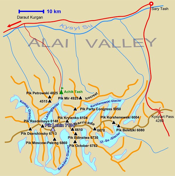 |
Karte des Tourengebiets am Pik Lenin. Map of the Pik Lenin area. |
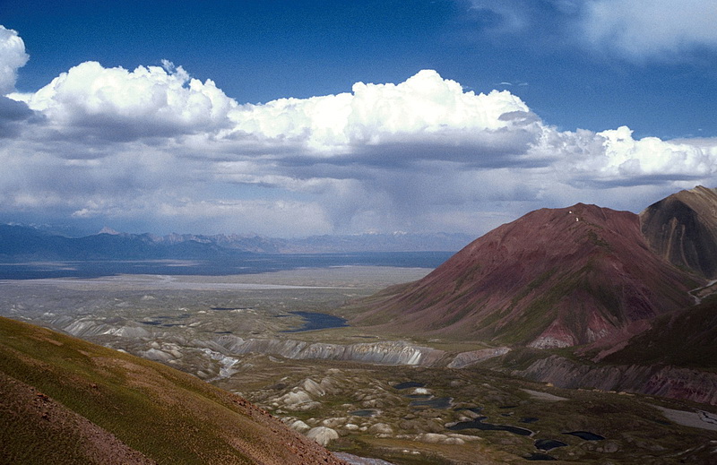
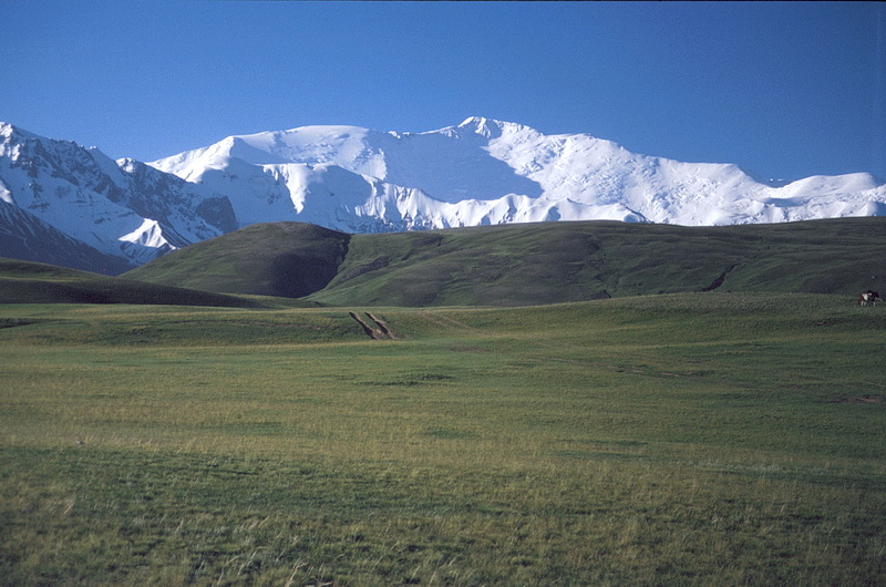
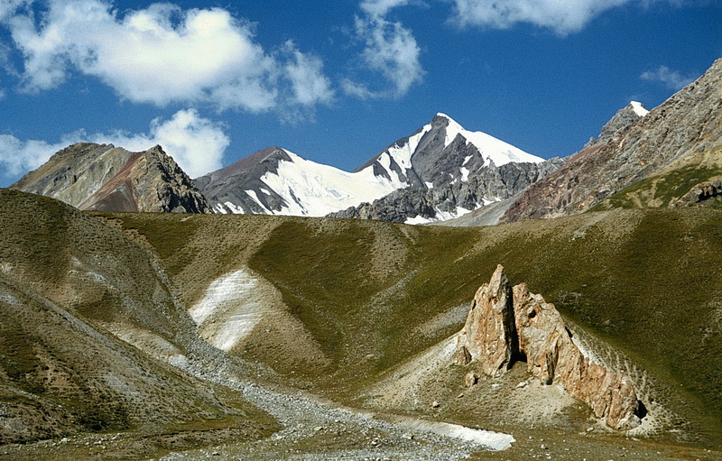
Das nahezu baumlose Alaital verläuft etwa 150 km in Ost–West Richtung auf einer Höhe von 2400 bis 3000 m. Vom Taldyk Pass (3615 m) kommend blickt man südostwärts auf die Gipfel des Kurumdy Massivs (6500 m). Rechts ausserhalb des Bildes führt eine Strasse über den Kysylart Pass (4280 m) zum Karakul See.
The treeless Alai Valley extends about 150 km in east-western direction at an altitude of 2400 - 3000 m. Arriving from Taldyk Pass (3615 m) the Kurumdy Range (6500 m) dominates the view in south-eastern direction. To the right outside the picture the road continues to Kysylart Pass (4280 m) and Karakul Lake.
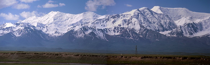
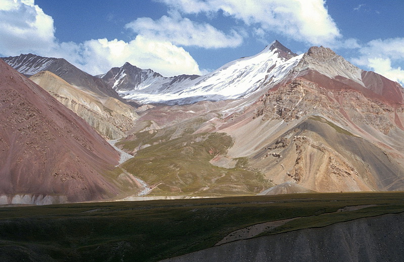
Das Panorama, vom Alaital aufgenommen, zeigt die etwa 6600 m hohen Gipfel der Barricade links und den Pik Edinstwa (6730 m) rechts. Der gesamte Kammverlauf ist etwa 15–20 km lang.
This panorama is taken from the Alai Valley and shows the summits of the Barricade (approximately 6600 m - left) and Pik Edinstwa (6730 m - right). The entire length of this ridge is about 15-20 km.
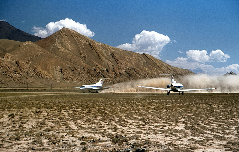
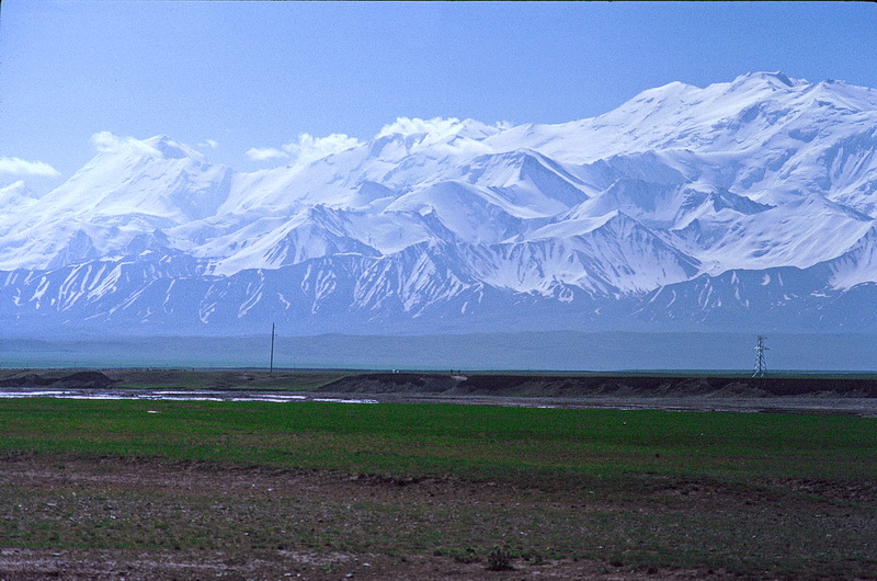
Hat man das Glück, von Osh einen Flug zu bekommen, landet man nach 45 Minuten auf dem Steppenflugplatz von Daraut Kurgan (2470 m). Etwa in der Mitte zwischen Daraut Kurgan und Sary Tash biegt eine holprige Schotterpiste zum 25 km entfernten Pamirlager Atschik Tash ab. Erstmals kommen der Pik Lenin (7134 m -links) und der Pik Dsershinsky (6713 m) ins Blickfeld.
The flight from Osh (if you are lucky enough to get one) takes about 45 minutes and ends at the 'steppe-airport' of Daraut Kurgan (2470 m). About halfway between Daraut Kurgan and Sary Tash a bumpy road leads to the Atschik Tash Camp about 25 km away. For the first time Pik Lenin (7134 m - left) and Pik Dsershinsky (6713 m) become visible.

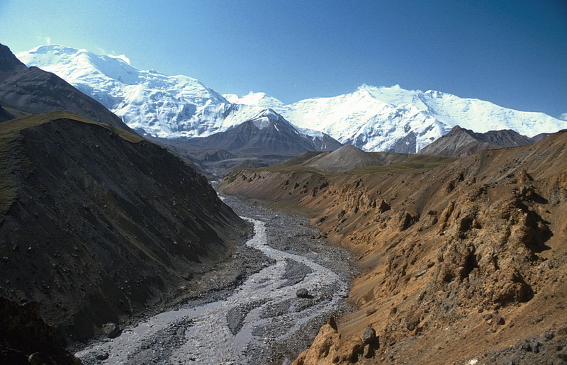
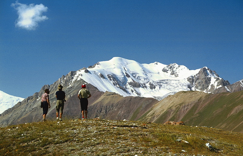
Im Juli sind die Pamirberge oft noch tief verschneit wie hier der Pik Dsershinsky (6713 m). Zahlreiche Flüsse strömen eingebettet in kilometerbreite Schuttfelder von den Gletschern herab. Hinter der Grassteppe des Alaitales erhebt sich als Blickfang der Pik Lenin, der einzige Siebentausender der Transalai Kette.
Even in Juli the Pamir mountains are heavily snow-covered like Pik Dsershinsky (6713 m). Numerous rivers find their way down from the glaciers across wide areas of debris. Pik Lenin, the only 7000 m peak of the Transalai Range is dominating the Alai Valley.
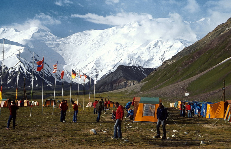 |
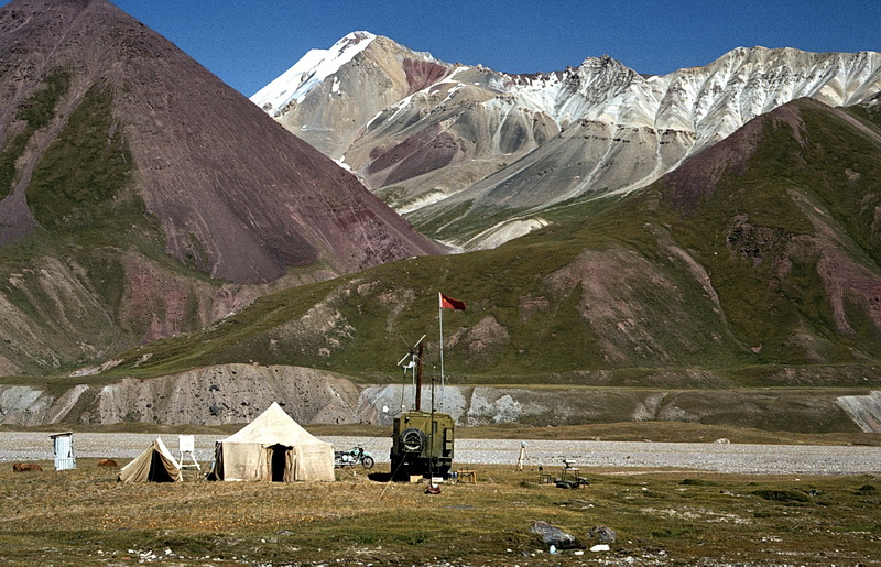
Das Internationale Pamirlager Atschik Tash (3600 m) mit Küche, Duschen und Wetterbericht mit Satellitenfoto, ist Ausgangspunkt für die meisten Bergtouren im Pamir. Rechts Pik Lenin (7134 m), links der Pik Krylenko (6104 m), dazwischen der Krylenkopass. The International Pamir Camp Atschik Tash (3600 m) equipped with kitchen, showers and also satellite-based weather report is the basis for most alpine undertakings in the Pamir area. Right Pik Lenin (7134 m), left Pik Krylenko (6104 m) with the Krylenko Pass between. |
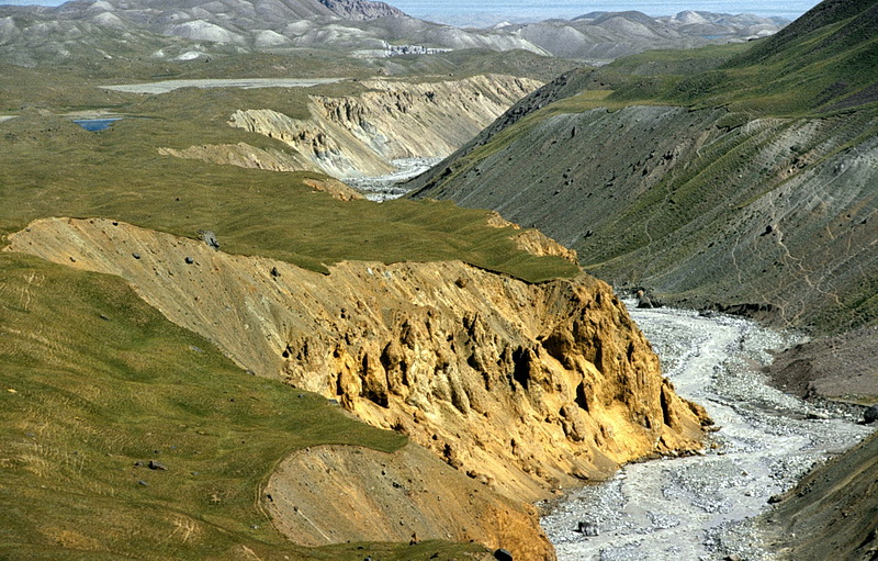
Der Atschik Tash Fluss entwässert den etwa 10 km langen Lenin Gletscher. Im Hintergrund links der Pik 19. Parteitag (5950 m), rechts der Pik Lenin. Nahe dem Atschik Tash Lager fliesst der Atschik Tash Fluss durch einen wilden Canyon mit interessanten Lehmpyramiden.
The Atschik Tash River drains the 10 km Lenin Glacier. Behind to the left Peak of the 19th Party Convention (5950 m) and Pik Lenin to the right. Near the camp the Atschik Tash River flows down a canyon with interesting clay pyramids.
 |
Die Wetterstation des Pamirlagers in einer Jurte. Im Hintergrund der rechte Talwächter (4712m) des Atschik Tash Tales. The meteorological station is placed in a jurt. In the background the right guardian (4712 m) of the Atschik Tash Valley. |
Nach sommerlichem Schneefall im Atschik Tash Tal beleuchtet die Abendsonne die umliegenden Berge. Nach Abschmelzen des Neuschnees zeigen sich wieder die in verschiedenen Farben gefalteten Gesteinsschichten. Rechts der Pik Mir (4925m).
The mountains around the Atschik Tash Camp after another summer snowfall. After the snow melted away the different colours of the folded rock layers become apparent again. To the right Pik Mir (4925 m).
Ein formschöner, namenloser Gipfel – mit Punkt 4515 m bezeichnet – liegt südwestlich des Pamirlagers und ist bequem vom Atschik Tash Lager aus als Tagestour besteigbar. Hausberg des Pamirlagers ist der Pik Petrowski (4845 m), zur Akklimatisation als Tagestour über den Grat, der sich nach links zieht, ersteigbar.
A well-shaped, nameless summit - marked as point 4515 m - rises southeast of the camp and can be climbed easily in one day. Pik Petrowski (4845 m) is the 'local' summit of the camp. It can be climbed in one day via the ridge in the foreground as an acclimatisation tour