Ortler: Rundtour über Cevedale und Monte Vioz
Eine imposante Gletscherbegehung ist das sogenannte Hufeisen zwischen Casatihütte, Monte Cevedale, Monte Vioz und Pizzo Tresero in der südlichen Ortlergruppe. Hierzu benötigt man neben der entsprechenden Gletschererfahrung auch eine gute Akklimatisation, da man sich mehrere Tage über 3000 m aufhält.
The so-called 'Horseshoe' in the southern part of the Ortler Range is an outstanding glacier hike between Casati Hut, Monte Cevedale, Monte Vioz and Pizzo Tresero. For this tour appropriate glacier experience is a must, good acclimatisation is also important as one stays above 3000 m for several days.
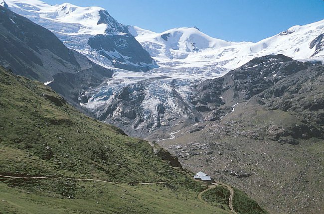 |
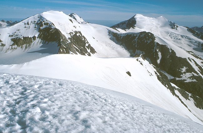
Eine zweistündige Panorama
Wanderung auf gutem Weg führt von der Forno- zur
Pizzinihütte. Im Hintergrund ein Teil des 'Hufeisens' mit dem
Fornogletscher und der Punta Cadini (3524 m). A two hours walk leads from the Forno- to the Pizzini Hut. In the background a part of this 'horseshoe' with Forno Glacier and Punta Cadini (3524 m). |
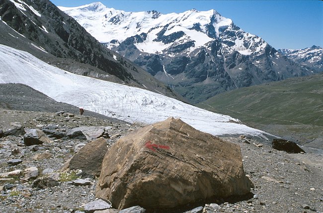 |
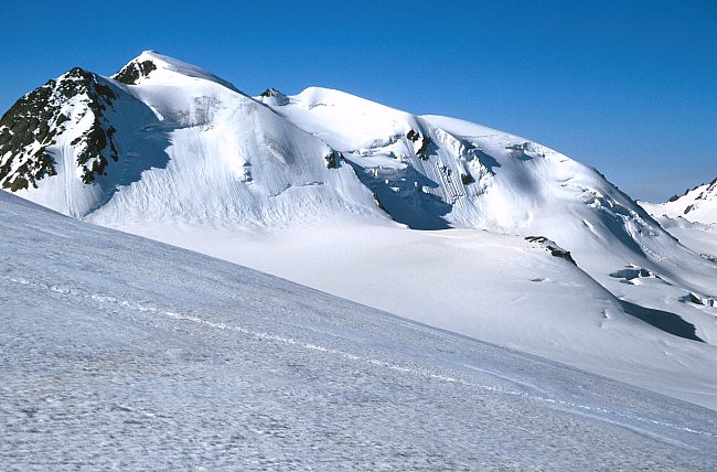
Von der Pizzini- zur
Casatihütte. Im Vordergrund der Cedecgletscher, welcher vom
Cevedale herunterfliesst, im Hintergrund Punta San Matteo (3678 m),
Cima Dosegu (3560 m), Punta Pedranzini (3599 m) und Pizzo Tresero (3594
m). On the way from the Pizzini- to the Casati Hut we were passing the Cedec Glacier which flows down from Monte Cevedale. In the background Punta San Matteo (3678 m), Cima Dosegu (3560 m), Punta Pedranzini (3599 m) and Pizzo Tresero (3594 m). |
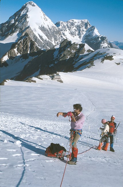
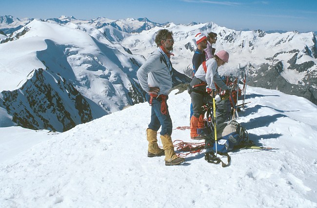
Aufstieg zum Cevedale: In Bildmitte die Casatihütte auf 3270 m, dahinter Königspitze und Ortler mit Hintergrat. Der Normalanstieg auf die Königsspitze führt über die steile Firnflanke.
The ascent to Monte Cevedale starts at the Casati Hut (3270 m). In the background Königsspitze and Ortler with the Hintergrat Ridge. The standard ascent to Königsspitze (3851 m) leads up the steep snow slope.
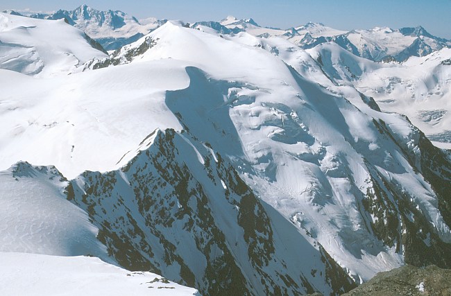
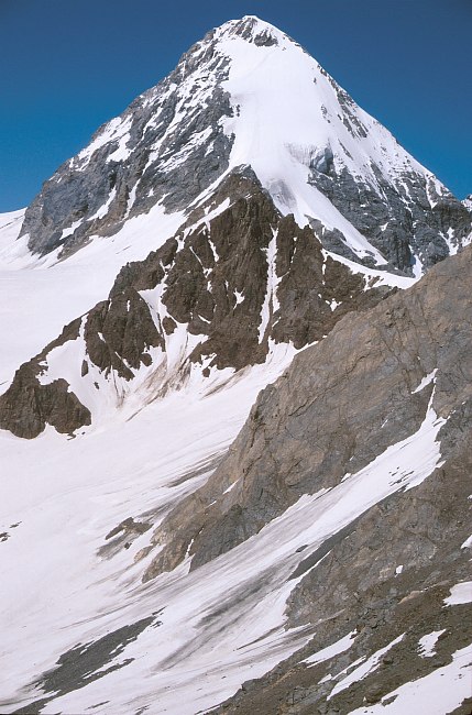
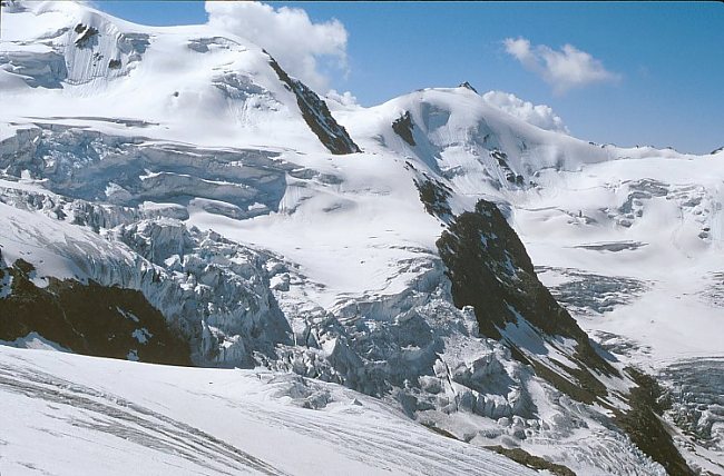
Am Gipfel des Cevedale: Links der Weiterweg über den Monte Rosole (3529 m) zum Palon della Mare (3685 m). dahinter von links nach rechts: Presanella (3558 m), Care Alto (3462 m), Lobbia (3185 m), Adamello (3554 m - rechts).
On top of Cevedale: The left part of the picture shows the route to Monte Rosole (3529 m) and Palon della Mare (3685 m). In the background from left to right: Presanella (3558 m), Care Alto (3462 m), Lobbia (3185 m), Adamello (3554 m).
Palon della Mare
 |
Gipfel des Palon della Mare. Blick nach Südwesten zur Punta San Matteo
(3675 m), Cima Dosegu (3560 m), Punta Pedranzini (3599 m) und zum
Tresero (3594 m). Rechts der Monte Sorbretta (3296 m) und -
wahrscheinlich - die Bernina. Summit of Palon Della Mare. South western view to Punta San Matteo (3675 m), Cima Dosegu (3560 m), Punta Pedranzini (3599 m), Tresero (3594 m), Monte Sorbretta (3296 m) and - most probably - the Bernina Range. |
 |
Punta Taviela (3612 m), Monte Giumella (3594 m), Punta San Matteo, Cima Dosegu , Punta Pedranzini , Pizzo Tresero. |
 |
Am frühen Morgen auf dem Monte Vioz... Early morning view from Monte Vioz... Cima Presanella (3558 m), Cima di Vermiglio (3458 m), Monte Cercen (3280 m), Cima Busazza (3326 m), Care Alto (3462 m), Crozzon di Lares (3354 m), Corno di Cavento (3402 m), Lobbia Alta (3196 m). |
 |
Blick zurück zur Vortagstour: Palon de la Mare, Königspitze (fast
verdeckt), der Doppelgipfel von Monte Cevedale (3769 m) und Zufallspitze
(3757m). View back to the first part of the tour: Palon Della Mare, Königsspitze (partly covered), the twin peaks of Monte Cevedale and Zufallspitze (3757 m). |
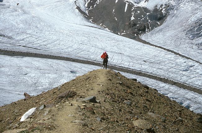
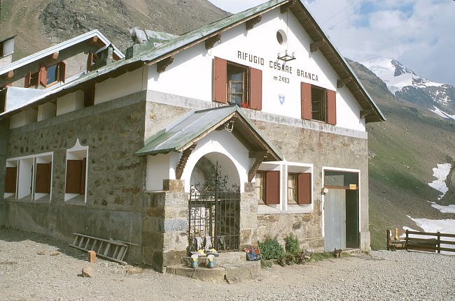
Abstieg vom Monte Vioz zur Branca Hütte: Punta Taviela (3612 m - links) und Cima di Peio (3549 m). Bevor man zur Brancahütte absteigt gibt es noch einen kurzen Gegenanstieg über den Südwestgrat des Palon.
Descending from Monte Vioz to the Branca Hut: Punta Taviela (3612 m - left) and Cima di Peio (3549 m). Before the final descent to the Branca Hut there is a short way up on the south western ridge of the Palon.