Ligurische Alpen: Val des Merveilles
Das Val des Merveilles unterhalb des Monte Bego liegt etwa 50 km nördlich von Nizza und gilt mit über 35.000 Felsgravuren als bedeutendste Felsbildfundstelle der Alpen. Die ältesten Gravuren an diesem mystischen Ort wurden auf etwa 2000 v. Chr. datiert. Von Saint Dalmas de Tende fährt man mit dem Bus bis Casterine (ca.1500 m). Von dort sind es 2,5 Stunden zum Refuge de Valmasque auf 2221 m. Von Nord nach Süd durchquert man in etwa 3 Stunden das Tal der Wunder über die Baisse de Valmasque (2549 m) bis zum Lac Long Superieur, wo man entweder im Refuge des Merveilles übernachten oder direkt zur Bushaltestelle am Lac de Mesches absteigen kann.
The Valley of Miracles below Mont Bego is situated about 50 kms north of Nizza. More than 35.000 pre-historic engravings make this valley the most important place where rock engravings were found in the entire alpine area. The oldest drawings were dated back roughly to the year 2000 BC. In Saint Dalmas de Tende one can take the bus up to Casterine (1500 m) and after another 2.5 hours the Valmasque Hut is reached at 2221 m. It takes about three hours to cross the Merveilles Valley from north to south via its highest point Baisse de Valmasque (2549 m) until to Lake Long. At this point one could either stay at the Merveilles Hut or descent directly to the bus stop at Lac de Mesches.
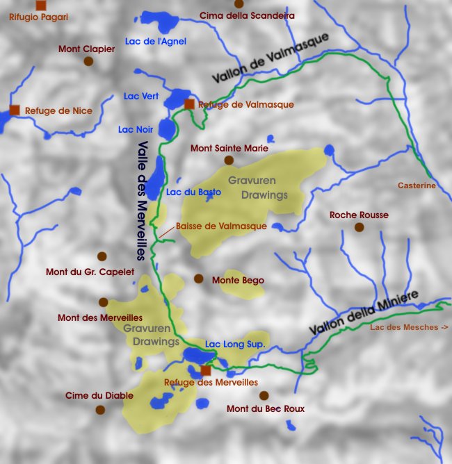 |
Karte des Gebiets rund um das Vallee des Merveilles. Map of the area around Vallee des Merveilles. |
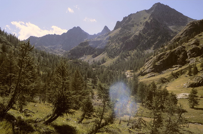
Von Casterine führt der Weg durch das Vallon de Valmasque zum nördlichen Talende des Vallée de Merveilles und zum Refuge de la Valmasque (2221 m).
From Casterine the path leads up the Valmasque Valley to the northern end of the Merveilles Valley and the Valmasque Hut (2221 m).
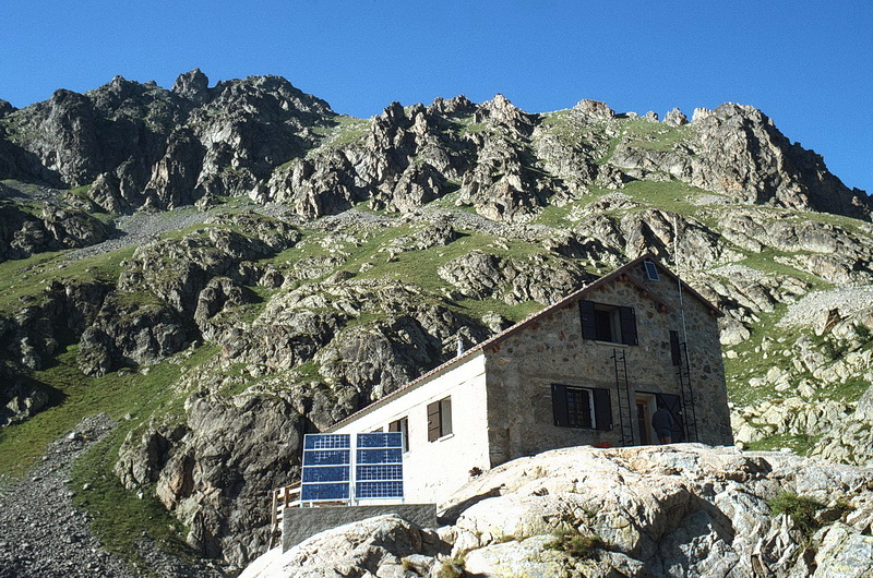 |
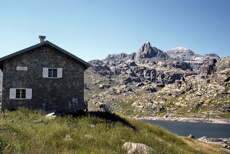
Das Refuge de la Valmasque war bereits vor über 25 Jahren mit Sonnenkollektoren ausgestattet. Already 25 years ago the Valmasque Hut was equipped with solar panels. |
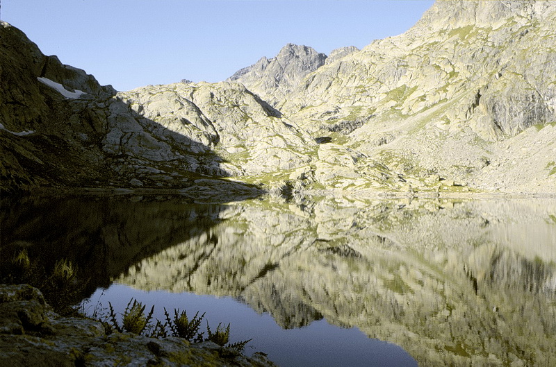
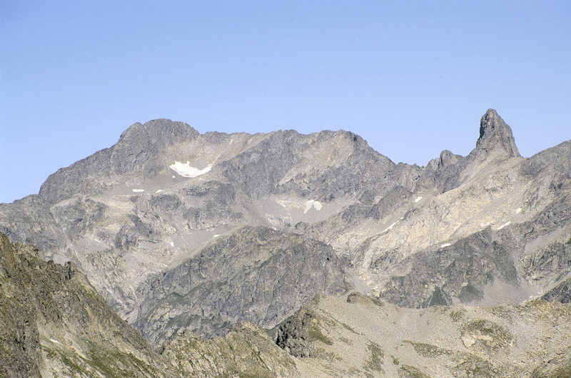
Der Lac Noir ist einer von mehreren Seen an denen der Weg vorbeiführt, im Hintergrund der Mont du Grand Capelet (2935 m). Daneben der Lac du Basto mit der Baisse de Valmasque (2549 m), dem höchsten Punkt im Val des Merveilles.
Lac Noir is one out of three lakes which is passed along the way, in the background Mont du Grand Capelet (2935 m). Right of it Lac du Basto and behind the Valmasque Pass (2549 m), the highest point in the valley.
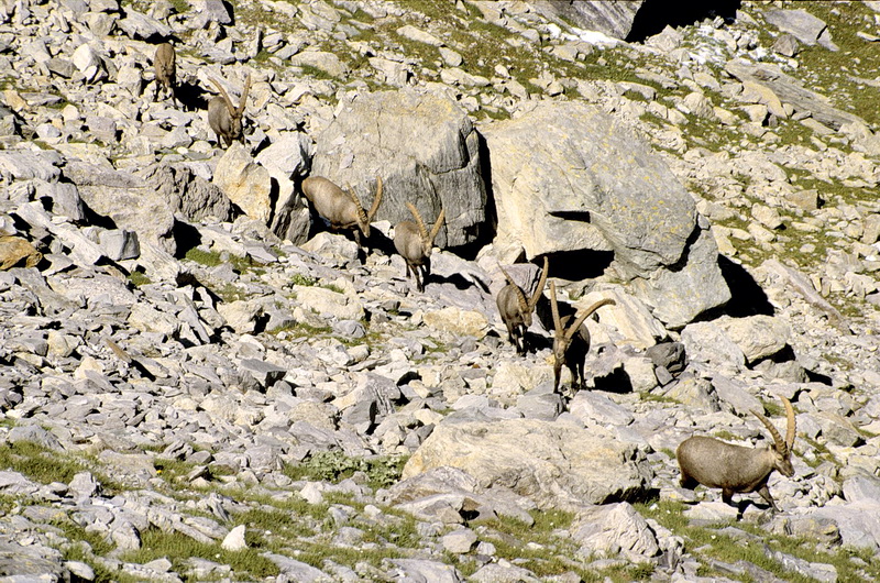
Nicht ungewöhnlich in diesem Gebiet: eine Gruppe von Steinböcken kreuzt den Weg. Oberhalb der Passhöhe bietet sich eine schöne Aussicht auf Cima dei Gelas (links) und Mont Clapier (Bildmitte im Hintergrund).
Not unusual in this area: a group of ibexes was crossing the path. On a little hill just above the pass one has a nice view towards Cime dei Gelas (left) and Mont Clapier (center of the picture in the background).
 |
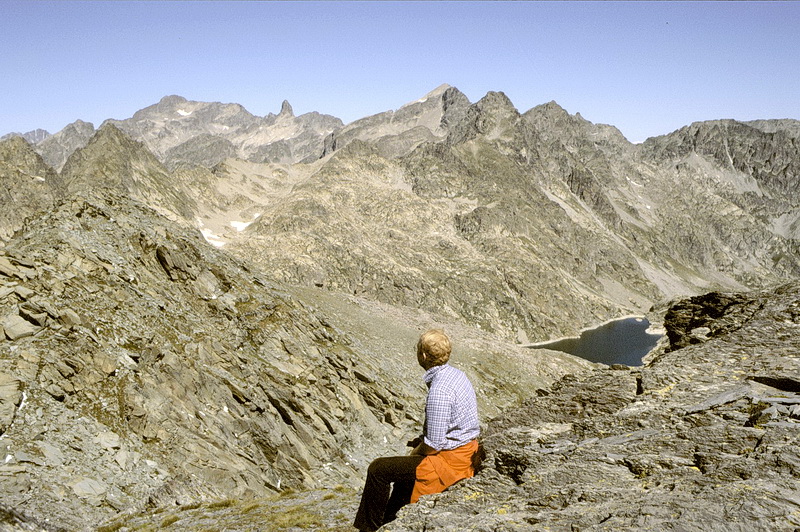
Noch einmal: die Südseite der Cima dei Gelas (3143 m) und die Cima della Maledia (3061 m). Once again: the south faces of Cima dei Gelas (3143 m) and Cima della Maledia (3061 m). |
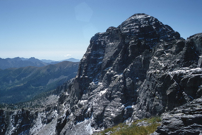 |
The impressive north face of Monte Bego (2872 m). Der Mont Bego (2872 m), mit seiner eindrucksvollen Nordwand. |
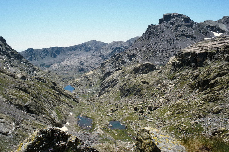 |
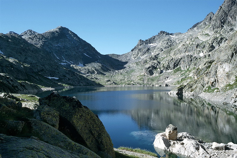
Zurück auf der Baisse de Valmasque (2549 m) geht der Weg hinab zum Lac Long. Back on the Valmasque Pass (2549 m) the path leads down to the Lake Long. |
 |
Der südlichste Punkt des Vallee des Merveilles ist der Lac Long Superieur mit dem Refuge des Merveilles (2111 m). The southmost part of Vallee des Merveilles is Lake Long and the Merveilles Hut (2111 m). |