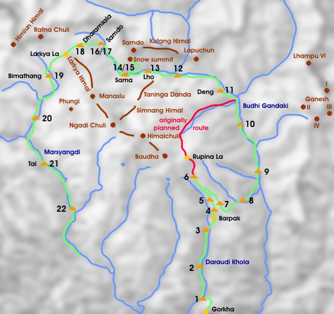
Manaslu Trek: Sama - Samdo
Etwa auf der Häflte der Manaslu Umrundung liegt das sagenumwobene Hochtal von Sama, direkt unterhalb der Ostabstürze des Manaslu Massivs. Das Dorf Sama liegt auf 3600 m und ist die größte Siedlung in dieser Region. Hier wäre die Möglichkeit für einen Tagesausflug ins Manaslu Basecamp. Wir entschieden uns jedoch für einen namenlosen Gipfel nördlich von Sama von wo wir herrliche Einblicke in die Nordseite des Manaslu Himal hatten.
About halfway of this trek we reached the legendary valley of Sama just below the east-face of the Manaslu Range. The village of Sama, the largest settlement of this area is situated at 3600 m. The Manaslu Basecamp is only a day's hike away but we decided to climb a nameless summit north of Sama where we had a phantastic view of the Manaslu Himal.
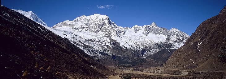
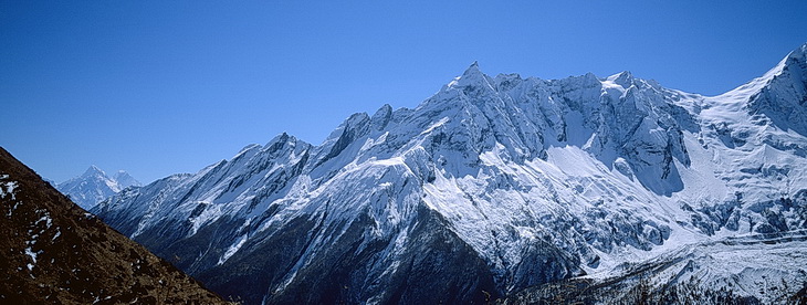
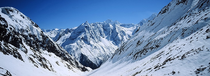
Im Hochtal von Sama (3390 m). Im Hintergrund der Larkya Himal an dessen rechtem Gratende sich der Larkya La befindet. The Pass is situated at the right end of this ridge. Im Osten die Gipfel von Lapuchun (5960 m) und Shringi Himal (7187 m).
The valley of Sama (3390 m). In the background the summits of the Larkya Himal Range. In eastern direction the summits of Lapuchun (5960 m) and Shringi Himal (7187 m).
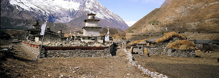
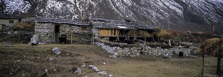
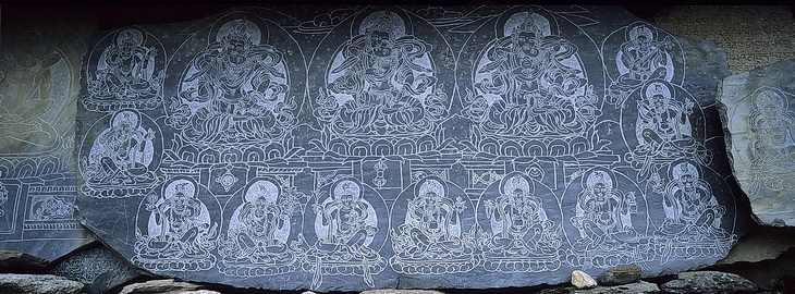
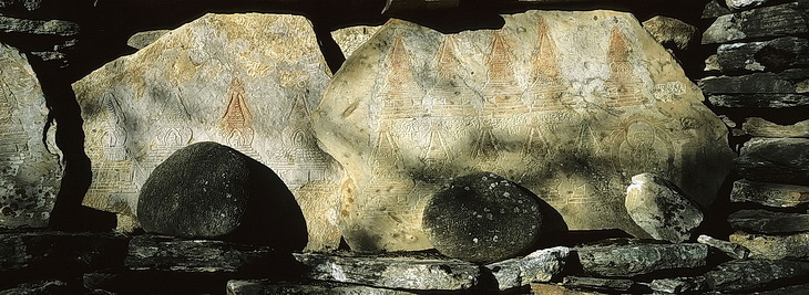
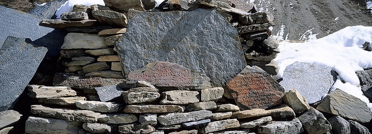
Eindrücke von Sama mit seiner großen Gompa.
Impressions of Sama and its big Gompa.
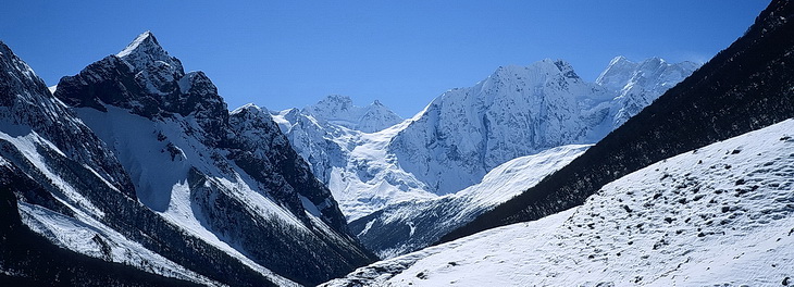
Ein wahrscheinlich unbenannter Schneegipfel nördlich von Sama war eine gelungene Alternative zum Tagesausflug ins Manaslu Base Camp. Bereits der Aufstieg bot beeindruckende Ausblicke:
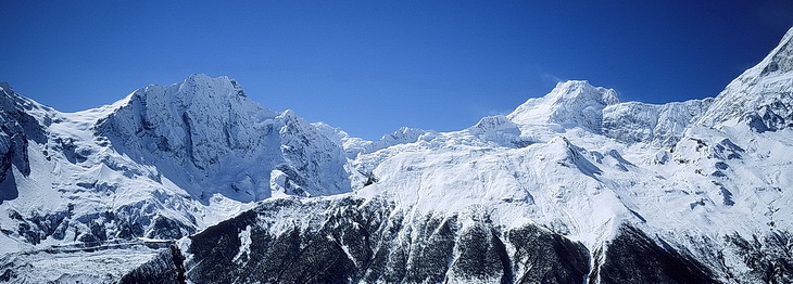
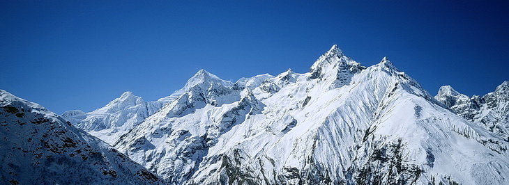
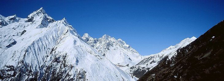
Bild 1: Der Blick nach Südosten auf den Grat des Taninga Danda.
Bild 2: Daran rechts anschliessend Simnang Himal (6251 m) und Ngadi Chuli (7871 m).
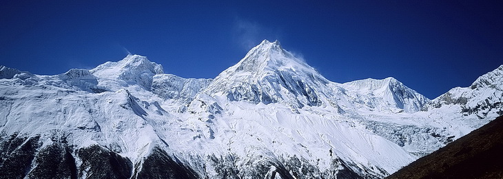
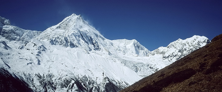
Bild 3: Daneben kommt der Manaslu (8163 m) ins Bild.
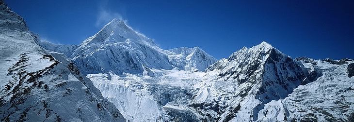
Bild 4: Schliesslich rechts neben dem Manaslu der Kamping und Larkya Himal an den sich rechts der Larkya La anschliesst.
A probably unnamed snow summit north of Sama turned out to be a worthwhile alternative to the Manaslu-Base-Camp walk. We had remarkable views already during the ascent:
Picture 1: South-eastern view towards the ridge of Taninga Danda.
Picture 2: Right of it Simnang Himal (6251 m) and Ngadi Chuli (7871 m).
Picture 3: Continuing to the right Manaslu (8163 m) becomes apparent.
Picture 4: Finally we have Kamping and Larkya Himal which would be continued by the Larkya Pass.

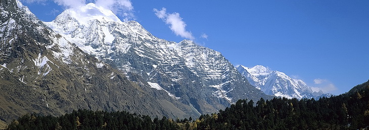
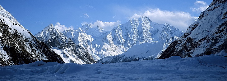
Am Gipfel auf ca 4470 m konnten wir neben dem Manaslu und Larkya Himal auch einen Blick nach Süden zum Himalchuli werfen.
At the summit at about 4470 m we still had an impressive view of Manaslu and Larkya Himal as well as Himalchuli in southern direction.
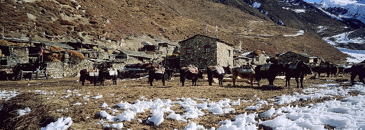
Vorbei an Mani Mauern führte unser Weg nach Samdo. Hinter uns Simnang Himal (6251 m) und der Himalchuli (7895 m).
Passing mani walls we carried on to Samdo. Behind us Simnang Himal (6251 m) and Himalchuli (7895 m).
Auch auf unserem weiteren Weg oberhalb von Samdo sind Manaslu und Larkya Himal die dominierenden Gipfel. Daran anschliessend zeigt das untere Bild unser nächstes Ziel, den über 5000 m hohen Larkya La.
The dominating peaks on our way from Samdo to Larkya La were Manaslu and Larkya Himal. Continuing to the right the second picture shows our next goal: the 5000 m pass Larkya La.
Ein letzer Blick zurück nach Süden auf Boudha Himal (6672 m) und Simnang Himal.
A final view back to Boudha Himal (6672 m) and Simnang Himal.