Aussichtspunkte rund um den Alpstein - Teil 2
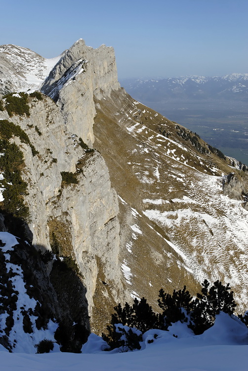
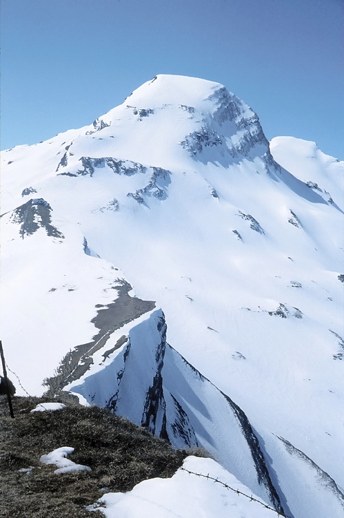
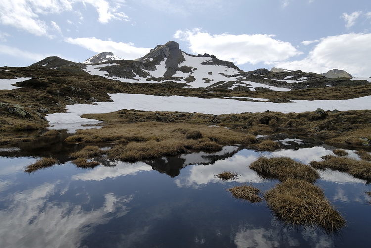
Südwestlich des Alpsteinmassivs befindet sich der Speer, der auf dem Normalweg von Amden aus bestiegen wird. Von Westen erreicht man den mit Drahtseilen versicherten Klettersteig über den Nordwestgrat (wegen der Rasenabsätze nur bei trockenem Wetter zu empfehlen). Der Speer ist der höchste Flyschgipfel (s. Bild unten) der Alpen, ein kleiner Hügel verglichen mit dem berühmtesten und höchsten dieser Spezies, dem Kailas in Tibet.
The first point of interest is Speer, a summit situated south-west of the Alpstein massif and normally climbed from Amden. For experienced climbers the Via Ferrata on the north-west ridge might be an alternative (only in dry conditions due to some grassy slopes which have to be crossed). Speer is formed by a rock layer called Nagelfluh or Flysch (see picture below) which makes him the highest 'Flysch mountain' in the alps - a small one compared to Kailas, the highest one on earth.
Speer
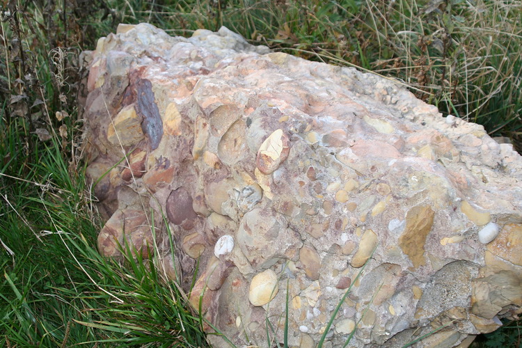 |
Konglomerat aus versteinerten, untermeerische Erdrutschen, Flysch oder Nagelfluh genannt. Conglomerate of fossilized submarine landslides called Flysch or Nagelfluh. |

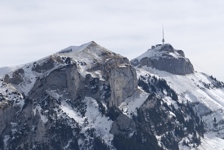
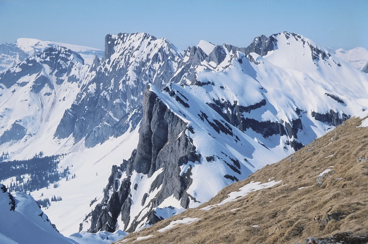
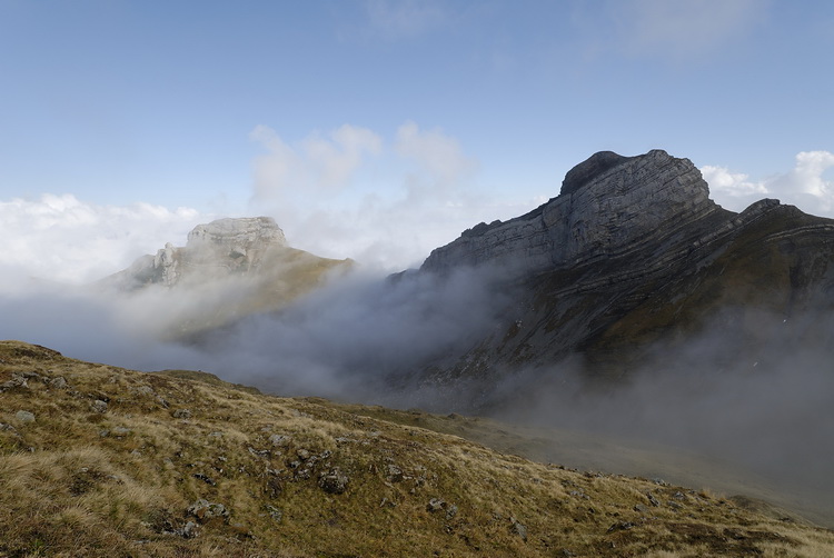
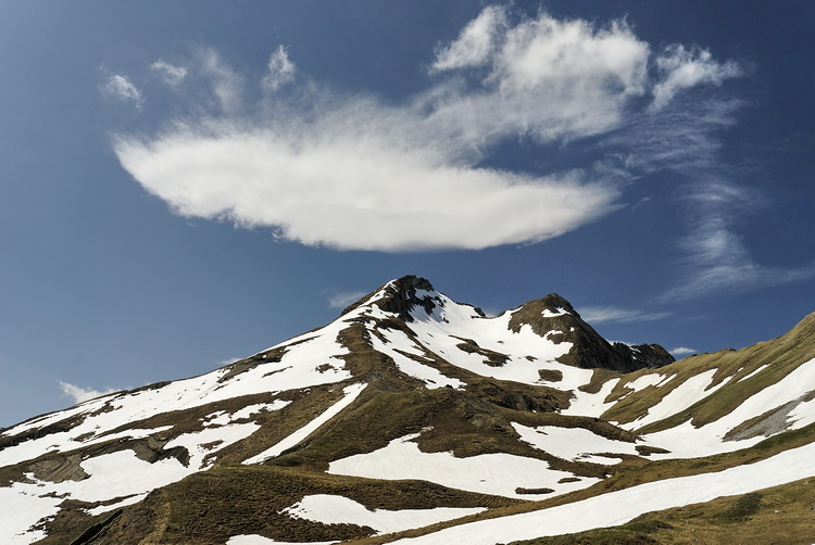
Rechts der auffällig geformte Gipfel des Speer und die nicht minder interessant geformten Felsen des Goggeien links davon. Vom Toggenburg aus läßt sich der Speer in einer Tageswanderung ersteigen.
Formed like a spearhead the summit of Speer (Speer means spear) is easy to recognize as well as the rocks of Goggeien left of the center. From the Toggenburg side Speer can be climbed in a days' hike.
 |
Auf dem Weg zum Gipfel: Der Tiefblick nach Süden ins Tal der Linth mit der Glärnisch. During the ascent there are some nice views like the Linth Valley and the Glaernisch massif in southern direction. |
 |
Der obere Zürichsee mit dem Fahrdamm von Rapperswil nach Pfäffikon. The upper part of Lake Zurich and the dam between Rapperswil and Pfaeffikon. |
 |
Ganz am westlichen Horizont sind Rigi und Pilatus erkennbar. Rigi and Pilatus in western direction. |
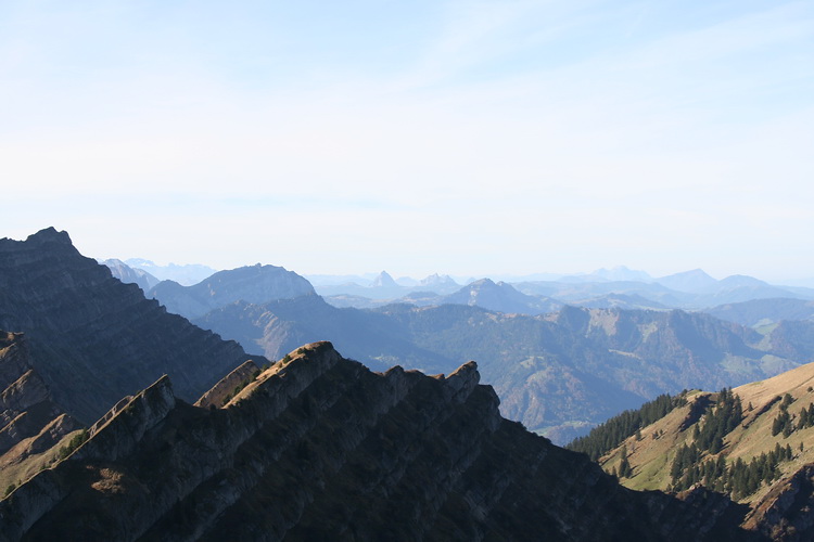
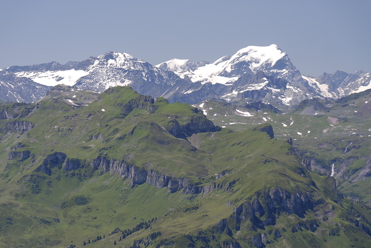
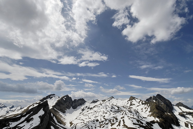
Kurz vor dem Speergipfel der Panoramablick zum Alpstein.
Just below the summit of Speer the panorama view of the Alpstein massif.
Gulmen II
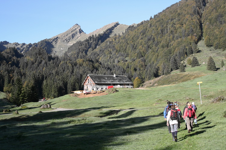
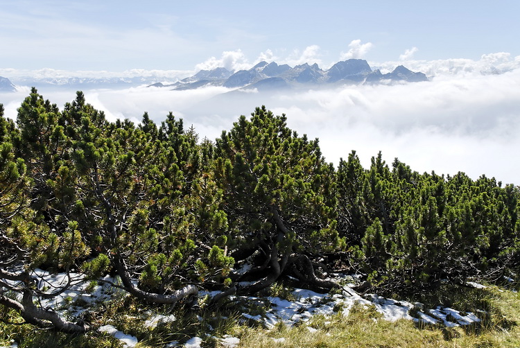
Durch Latschenkiefernwald führt ein Pfad von der AlpTesel hinauf zum Gulmen, einer Aussichtsloge über dem 1500 m tiefer gelegenen St.Galler Rheintal. Rechts die Südwände des Gätterifirsts. A forest of mountain pines is passed on the way from Alp Tesel to the summit of Gulmen, a vantage point 1.500 m above the Rhine Valley. Right picture: the south face of Gaetterifirst. |
 |
Gipfelblick vom Gulmen über das Rheintal zur Alvierkette und schließlich Naafkopf und Falknis.
Summit view from Gulmen across the Rhine Valley to the Alvier massif and finally to Naafkopf and Falknis.
Höchst (2024 m)
 |
Zwischen Alvierkette und Churfirsten erhebt sich der Höchst knapp über die 2000 m Grenze. A rather inconspicious peak of only about 2000 m is Hoechst, situated between Alvier and Churfirsten. |
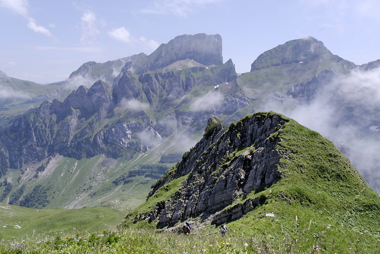

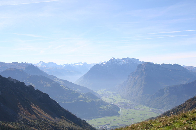
Im Osten blickt man auf die schroffen Wände von Gamsberg (Mitte) und Sichelkamm. Die Südwände von Gamsberg und Sichelkamm brechen in Stufen zum Walensee ab.
In eastern direction the precipitous walls of Gamsberg (center) and Sichelchamm. The southern faces of Gamsberg and Sichelchamm are breaking off in steps down to Lake Walensee.
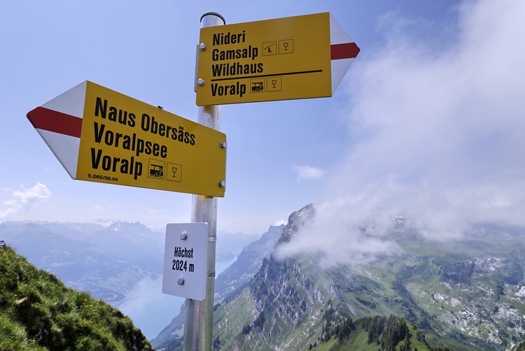 |
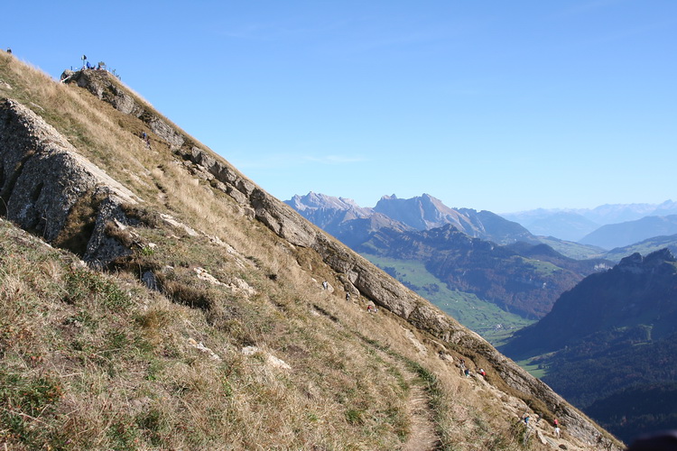
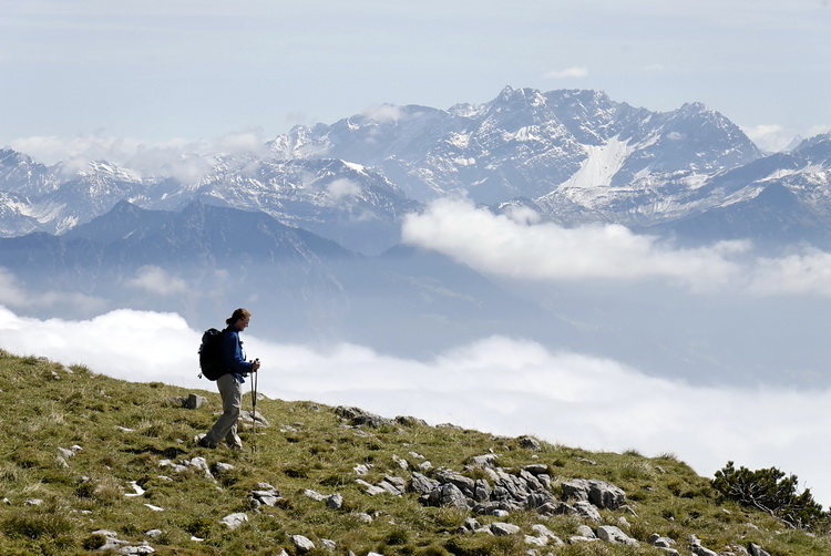
Alle Wege rund um den Alpstein sind vorbildlich beschildert. All hiking trails around (and in) the Alpstein area are perfectly signposted. |

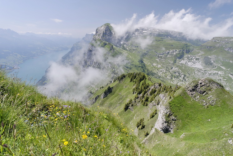
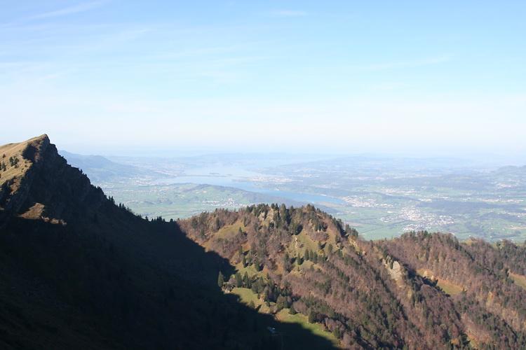
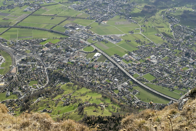
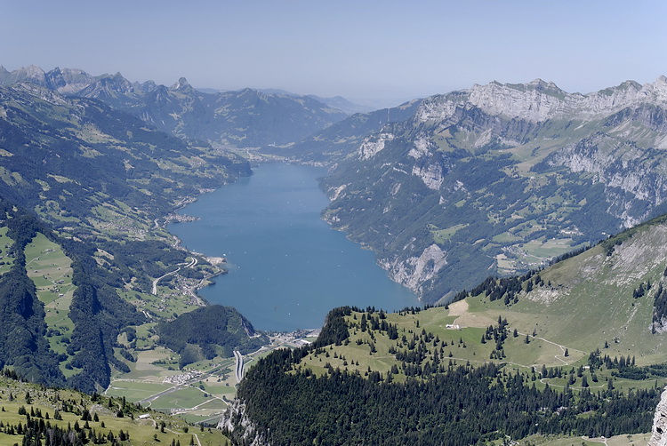
Tiefblick auf Walenstadt und Walensee, der nach der Eiszeit den Bodensee mit dem Zürichsee verband.
The town of Walenstadt and Lake Walensee which had been connecting Lake Constance and Lake Zurich after the ice age.
Gonzen
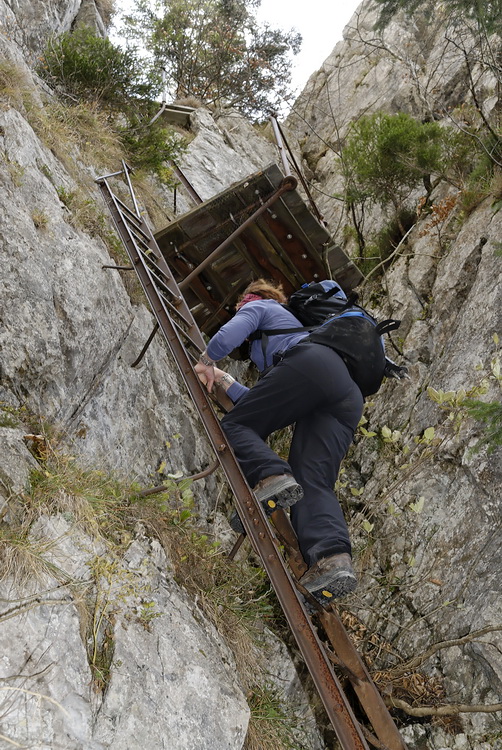 |
Der Gonzen ist der südöstlichste Eckpfeiler der Alviergruppe und überragt direkt bei Sargans das Rheintal um 1500m. Gleich am Einstieg von der Sarganser Seite überwindet man an steilen Leitern einen Felsriegel. The south-eastmost cornerstone of the Alvier Massif is called Gonzen. It is towering 1.500m above Sargans and the Rhine Valley. The tour starts near Sargans with a rock band which is climbed using some iron ladders. |

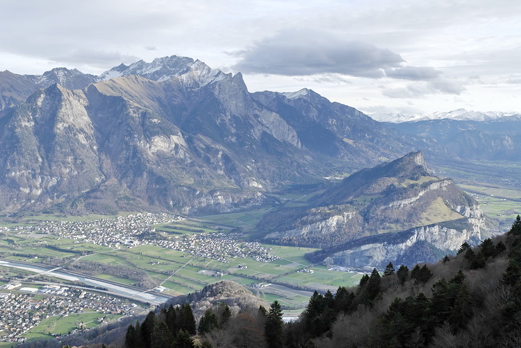
Im Nordosten reihen sich Gauschla, Alvier und Gamsberg. Hoch über dem Rheintal und der Autobahn bei Sargans reicht der Blick nach Süden zu Calanda und Pizol (mit Gipfelkreuz) und der Falknis (rechts), einem weiteren reizvollen Aussichtsberg.
In north-eastern direction Gauschla, Alvier and Gamsberg are lined up. High above the motorway near Sargans one has a nice view across the Rhine Valley to Calanda and Pizol (central picture) and Falknis (right) another worthwhile panorama summit.
Alvier (2384 m)
|
Der Hauptgipfel der Alviergruppe ist ein lohnender Aussichtsberg und ein rassiger Skiberg mit einer Steilstufe von etwa 45 Grad. |
 |
Die Nordseite des Alvier vom Hurst aus. Der Skianstieg erfolgt von links, die Abfahrt geht durch das Steilcouloir direkt in der Gipfelfalllinie. The north face of Alvier seen from the summit of Hurst. The ski route uses the ridge left of the summit while the descent leads through the steep couloir directly below the summit. |
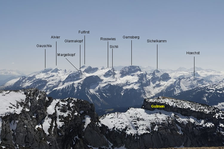
Blick vom Alviergipfel nach Nordwesten. Von links nach rechts: Chäserrugg, Gamsberg, das Firndreick der Rosswies und der Fulfirst (beides lohnende Skigipfel). Im Sommer ist der Alvier ein Wanderberg vom Alpengasthaus Malbun aus.
View from the summit of Alvier in north-western direction. From left to right: Chaeserrugg, Gamsberg, the white triangle of Rosswies and finally Fulfirst (both of them are nice ski tours). In summer Alvier is a nice hiking summit and mostly climbed from the Malbun restaurant.
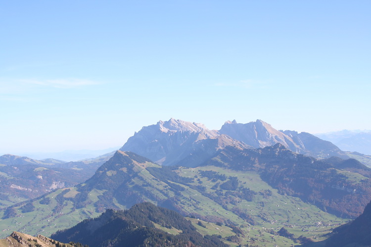
Gauschla und etwas rechts oberhalb der Bildmitte der Gonzen über Sargans, etwas weiter entfernt: der Eisgipfel des Tödi.
Gauschla and Gonzen (right of the center). In the distance: Toedi.
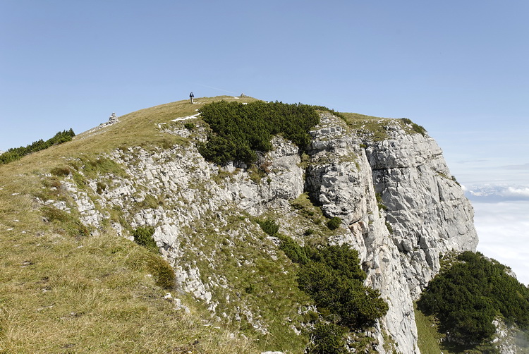
Margelkopf (2162 m)
|
Ein markanter Gipfel über dem Rheintal ist
der Margelkopf, den man in 2-3 Stunden von der Alp Malbun (1400 m)
oberhalb von Buchs ersteigt. |
Vom Anstieg zur Rosswies aus gesehen: Margelkopf (links) und Glannakopf. Über die rechte Kante (Südgrat) steigt man in leichtem Fels (I-II) auf das Gipfelplateau.
Seen from the ascent route to Rosswis: Margelkopf (left) and Glannakopf. The final 100 meters to the summit of Margelkopf afford some easy climbing (I-II) up the right edge - the south ridge.
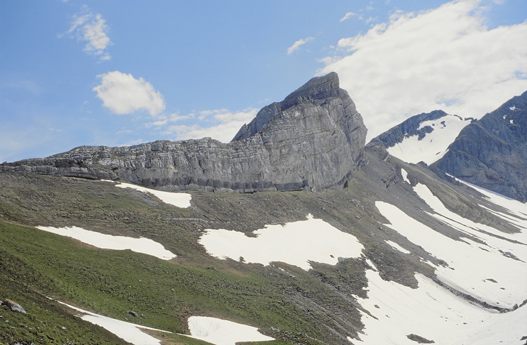 |
Die interessante Kalkformation des Glannakopfs, der zu Fuss oder mit Skiern von links (Osten) erstiegen werden kann. The interesting limestone formation of Glannakopf which can be climbed with or without skis from left to right (east side). |
Impressionen vom Aufstieg zum Margelkopf (Fulfirst und Glannakopf). Föhnwolke über dem Grossen und Kleinen Fulfirst.
Impressions on the way to Margelkopf (Fulfirst and Glannakopf). Foehn-cloud above the summits of Fulfirst.

Gipfelblick zu Fulfirst, Rosswies, Sichli und Gamsberg. Und natürlich ein letzter Blick nach Norden zum Alpstein.
Summit view of Fulfirst, Rosswies, Sichli and Gamsberg. And of course a final view of the Alpstein massif in northern direction.