Wallis: Allalinhorn - Strahlhorn
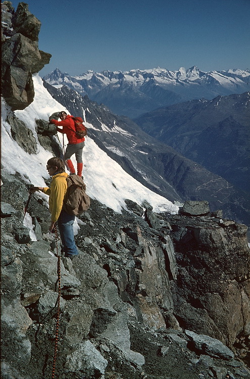
Durch seine leichte Erreichbarkeit von der Bergstation Felskinn zählt das Allalinhorn mittlerweile zu den leichtesten Viertausendern der Alpen und ist auch dementsprechend gut besucht. Wer es gerne etwas ruhiger hat, kann auch zu Fuß zur Britanniahütte aufsteigen und am nächsten Tag über den Hohlaubgrat zum Gipfel aufsteigen. Etwas länger und anstrengender ist die Route zum Strahlhorn, die zunächst 5 Kilometer über den Allalingletscher führt, bevor der Aufstieg zum Adlerpass und zum Strahlhorngipfel beginnt.
Due to its easy accessability (relatively - it is still a glacier tour) Allalinhorn is said to be one of the easiest 4000 m peaks in the alps and therefore also a very frequented one. A more quiet route starts at the Britannia Hut and follows the Hohlaub Ridge. Longer and more strenuous is the Strahlhorn tour which follows the Allalin Glacier for about 5 kms before the final ascent to the Adler Pass and Strahlhorn begins.
Allalinhorn (4027 m)
Die Mischabelgruppe von der Britanniahütte aus gesehen. Von links nach rechts: Täschhorn (4491 m) - Dom (4545 m) - Nadelhorn (4327 m) - Lenzspitze (4294 m).
The Mischabel group seen from the Britannia Hut. Left to right: Täschhorn (4491 m) - Dom (4545 m) - Nadelhorn (4327 m) - Lenzspitze (4294 m).

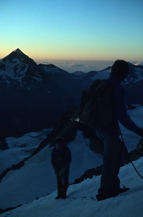
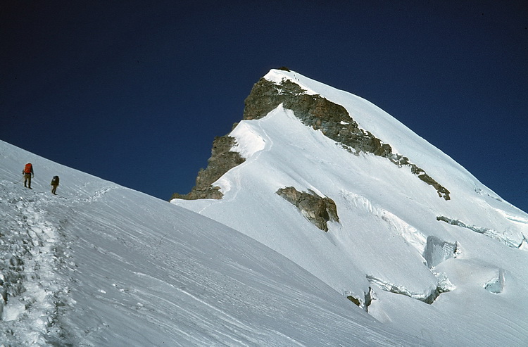
Aufstiegsroute auf das Allalinhorn (4027m) über den Hohlaubgrat. Der Weg führt über den Hohlaub Gletscher und nach links aufwärts über den Felsriegel zum Gipfel. Die Nächte auf der Briannia Hütte sind kurz und so konnten wir den Sonnenaufgang bereits am Grat geniessen.
Ascent route to Allalinhorn (4027m) via the Hohlaub Ridge. The ascent route crosses the Hohlaub Glacier and leads up the ridge to the left across the rock band. Nights at the Britannia Hut are quite short so that we could enjoy the sunrise already on the Hohlaub Ridge.
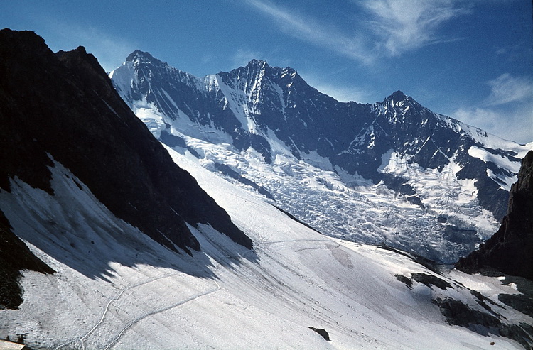
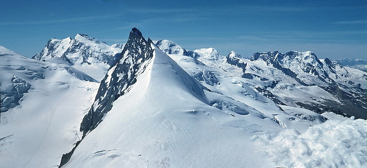
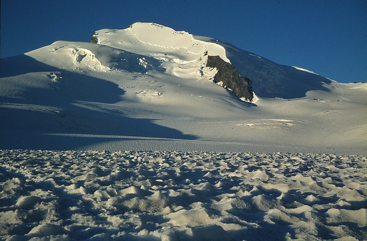
Fluchthorn (3790 m) und Strahlhorn (4190 m) vom oberen Teil des Hohlaubgrats aus gesehen. Die Spur führte damals (1979) immer am Grat entlang und über den Felsriegel zum Gipfel. Fluchthorn (3790 m) and Strahlhorn (4190 m) seen from the upper part of the Hohlaub Ridge. The track was always following the ridge (in 1979) passing the rock band on debris, snow and ice. |
|
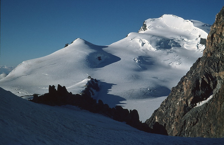
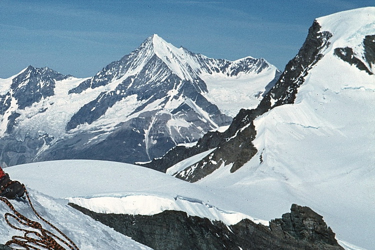
Gipfelblick vom Allalinhorn nach Süden: die Ostwand des Monte Rosa, Rimpfischhorn (4199 m), Lyskamm (4527 m), Castor (4228 m), Pollux (4092 m) und das Breithorn (4164 m).
The panorama from the summit of Allalinhorn: the east face of Monte Rosa, Rimpfischhorn (4199 m), Lyskamm (4527 m), Castor (4228 m), Pollux (4092 m) and finally Breithorn (4164 m).
Strahlhorn (4190 m)
 |
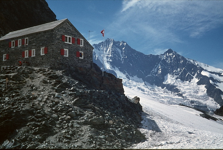
Strahlhorn (4190 m) von der Britanniahütte. Der Anstieg erfolgt über den Allalingletscher auf den Adlerpaß (3789 m) und dann nach links zum Gipfel. Strahlhorn from the Britannia Hut. The route crosses the 'Allalin Glacier' straight to the Adler Pass (3789 m) and leads left to the summit. |
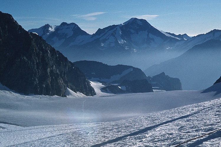 |
Unterhalb des Adlerpasses mit Blick Richtung Norden auf Fletschhorn (3993m) - Lagginhorn (4010m) und Weissmies (4023m). Am rechten Rand des Felsrückens im Mittelgrund liegt die Britanniahütte. Below the 'Adler Pass' looking north to Fletschhorn (3993m) - Lagginhorn (4010m) and Weissmies (4023m). The Britannia Hut is situated on the right end of the ridge in the centre. |
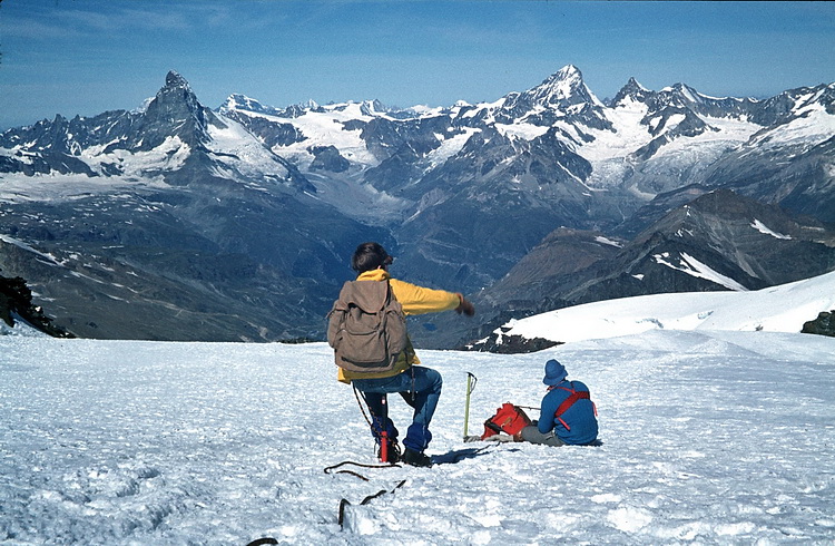 |
Oberhalb des Adlerpasses weitet sich die Aussicht nach Westen zu Mont Blanc (links hinter der Matterhorn), Grand Combin und den Walliser Viertausendern rund um Zermatt. Between Adler Pass and the summit of Strahlhorn the panorama widens in western direction and Mont Blanc (left of the Matterhorn), Grand Combin and the 4000 m peaks around Zermatt. |
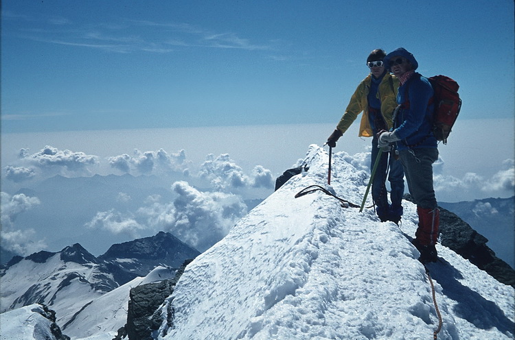
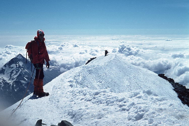
Viel Platz ist nicht am Gipfelgrat aber das Strahlhorn ist jeden Aufstiegsmeter wert.
The space on the summit ridge is very limited but worth every step of the ascent.