Ötztaler Alpen: Oberetteshütte - Weisskugel (1991)
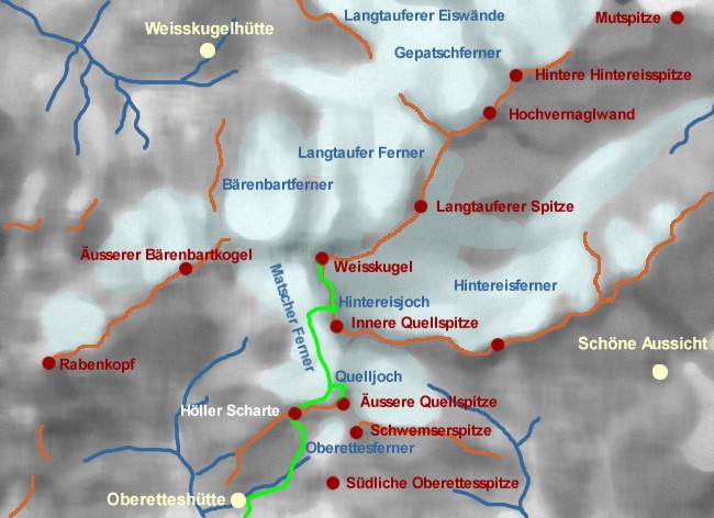
Die Weisskugel, mit 3738 m der zweithöchste Gipfel der Ötztaler Alpen, bildet das südwestliche Ende des Ötztaler Weisskamms, der sich nach Nordosten über die Wildspitze bis zur Äusseren Schwarzen Schneid erstreckt. Zwischen Reschenpass und Meran bieten sich drei Hütten als Stützpunkt an. Für den nordseitigen Anstieg ist die Weisskugelhütte oberhalb von Melag der richtige Ausgangspunkt. Die Oberetteshütte am Ende des Matscher Tals sowie die 'Schöne Aussicht' Hütte im Schnalstaler Skigebiet ermöglichen den südseitigen Anstieg über das Hintereisjoch. Für alle Anstiege sind Gletscherfahrung und -ausrüstung sind in jedem Fall erforderlich, die letzten Meter zum Gipfel erfordern darüberhinaus noch leichte Kletterei.
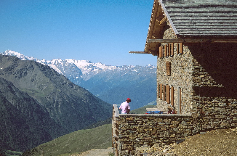
Unsere Aufstiegsroute führte zunächst zur Oberetteshütte, die in den 80er Jahren anstelle der früheren Höllerhütte errichtet wurde. Die gemütliche Hütte ist nicht nur aufgrund ihrer schönen Lage ein ganz besonderes Erlebnis. Hier lassen sich auch Schlechtwettertage überbrücken - zumindest 1991 fanden wir dort einen vollständigen Satz von Alpenvereinsbüchern aus den Anfängen des letzten Jahrhunderts vor - und es kann schon mal vorkommen, dass man unversehens an einer Dichterlesung über das Phänomen des 'Schwarzen Knotts' teilnimmt. Als Eingehtour zur Weisskugel empfiehlt sich beispielsweise die Äussere Quellspitze auf halbem Weg zur etwa 350 m höheren Weisskugel. Für beide Gipfel führt der Weg über Gletscherschutt zunächst zur Höllerscharte, wo man nach kurzem Abstieg den Matscher Ferner betritt (Randkluft). Die Äussere Quellspitze lässt man zunächst rechts liegen (möglichst weit, da Steinschlag), bis man nach rechts zum Quelljoch abzweigt und dem Felsgrat zum Gipfel folgt. Folgt man dem welligen Gletscher weiter bis zum Hintereisjoch, gelangt zunächst über einen Steilhang und zuletzt über einen kurzen Felsgrat zum Gipfel der Weisskugel mit seiner exzellenten Rundsicht. Die Gehzeiten betragen jeweils 2 und 4 Stunden.
The south-western end of the 'Ötztal White Ridge' is formed by the second highest summit of the Ötztal Alps, Weisskugel (or Palla Bianca - 3738 m). Between Reschen Pass and Meran three different huts can be used as basis for this climb. The northern side of Weisskugel is climbed from the Weisskugel Hut above the village of Melag. The Oberettes Hut at the end of the Matsch valley as well as the 'Bella Vista' hut in the Schnalstal ski area are used for the southern ascent via the Hintereis gap. All of these climbs need alpine glacier experience and equipment, the last part of the southern ascent also affords some rock climbing.
We chose the Oberettes Hut which was newly built in the late eighties to replace the former Höller Hut. The cosy hut is a very special experience, not only because of its nice environment. Even days of bad weather can easily bridged over - at least in 1991 we found a complete set of 'Alpenverein' books dated as of the beginning of the last century - and it might happen that you find yourself taking part in a poem reading about something like the 'Black Knott' phenomenon. A nice tour to start with is for example Äussere Quellspitze which is situated about half way up the Weisskugel and approx. 350 m lower. Both summits are reached via the Höller gap where a short descent leads onto the Matscher glacier (crevasse). We followed this glacier passing Quellspitze to the left (as far as necessary because of rockfall) until we turned right to the Quelljoch gap and reached the summit via its rocky nothern ridge. On our next tour we followed the glacier until to the Hintereis gap where a steep slope and the final rock ridge lead to the summit of Weisskugel with its excellent panorama. It takes about 2 hours to get to Äussere Quellspitze respectively 4 hours for the ascent of Weisskugel.
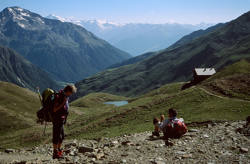
Die Oberetteshütte (frühere Höller Hütte) liegt im hintersten Matscher Tal und ist in 2,5 Std. vom Parkplatz der Glieshöfe erreichbar.
The Oberettes Hut (former Höller hut) is situated at the end of the valley of Matsch and can be reached in about 2.5 hours from the parking lot at the farmyard 'Glieshöfe'.
 |
Der Aufstieg zur Höllerscharte (3295 m) führt zunächst auf gutem Weg bis zur Moräne des Oberettesgletschers. The ascent to the Höller gap starts on a good footpath leading to the moraine of the Oberettes Glacier. |
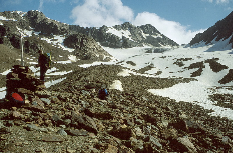
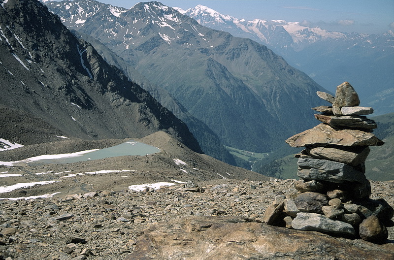
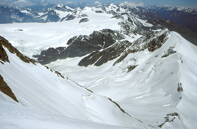
Danach folgt man den Steinmännern auf der Gletschermoräne. Im Hintergrund das Oberettesjoch mit dem Oberettesferner, daneben die Äussere Quellspitze (3385 m). Im Tal die Glieshöfe, wo der Anstieg zur Oberetteshütte beginnt.
From there just follow the cairns on top of the moraine. In the background Oberettes Gap and Oberettes Glacier, to the left Äussere Quellspitze (3385 m). In the valley below we can spot 'Glieshöfe' where we started our ascent to the Oberettes Hut.
 |
Am Oberettesgletscher zweigt der Weg zur Höllerscharte ab und führt nach links durch Geröll und Felsen. As reached the Oberettes Glacier we turned left, crossing scree slopes and rocks until we got to the Höller Gap. |
 |
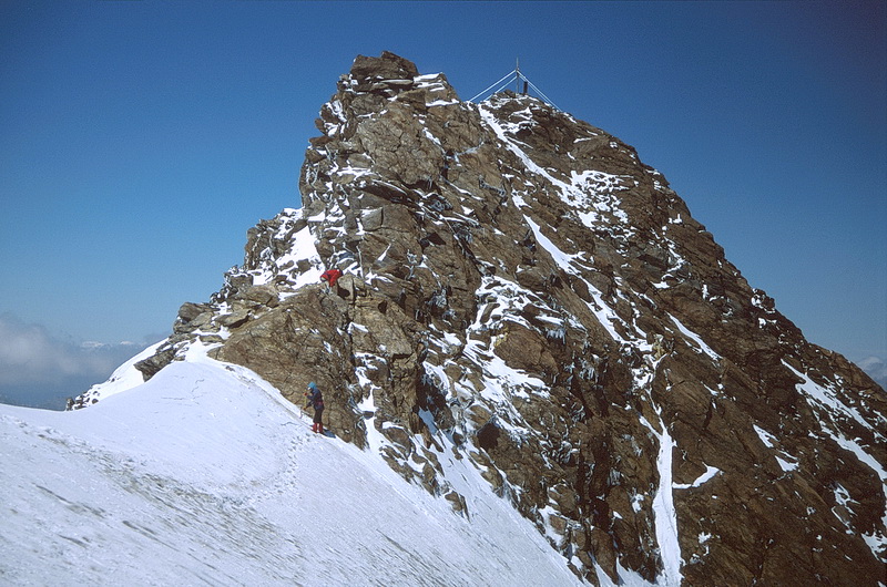
Die Höllerscharte (3295 m), über die man zur Weisskugel gelangt. Dahinter die Äussere Quellspitze von Westen (3385 m). The Höller Gap which we passed on our way to Weisskugel and Äussere Quellspitze (3385 m - in the background). |
 |
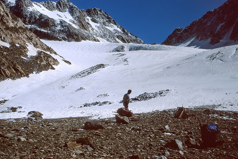
Weisskugel (3738 m) Nach einem Kaltlufteinbruch war es deutlich kühler geworden. Ein kurzer Abstieg führt von der Höllerscharte auf den Matscherferner und von dort zur Weisskugel (im Hintergrund). After a day of bad weather the temperatures dropped significantly. A short descent leads down from the Höller gap onto the Matscher glacier and from there to the summit of Weisskugel. |
Etwa auf Höhe des Hintereisjochs (3469 m) der Blick auf Presanella und die Ortlergruppe.
Near the Hintereis gap (3469 m) - southern view towards Presanella and Ortler Range.
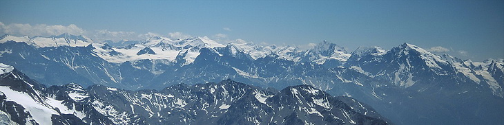
Kurz unterhalb des felsigen Gipfels der Weisskugel blickt man hinunter auf die Eisbrüche des Gepatschferners und der Ötztaler Weisskamm, der bis zur Wildspitze (ganz im Hintergrund) führt. Hier war für uns Endstation, die Neuschneeauflage auf den Gipfelfelsen schien uns doch etwas zu gefährlich.
Just below the summit of Weisskugel we had a nice view of the Gepatsch Glacier and the 'Ötztal White Ridge' which extends as far as Wildspitze. This was alos the highest point for us as the fresh snow on the summit rocks was not really inviting.