Kurze Wanderungen in der Dauphine
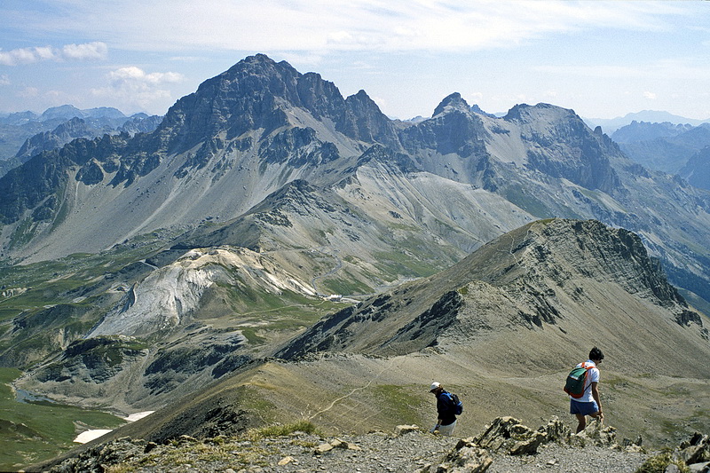
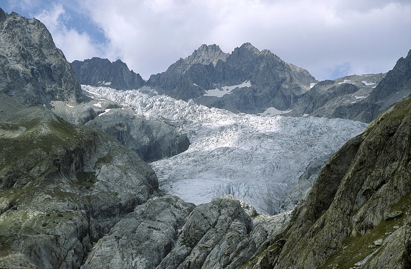
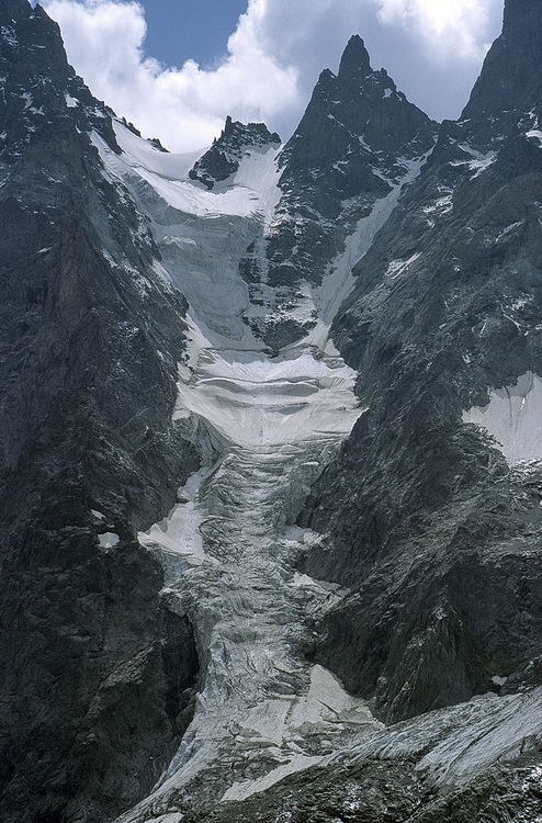
Ein leicht zu erreichender Aussichtspunkt mit schöner Rundsicht nicht nur auf die nahen Gipfel der Dauphine liegt westlich des Galibier Passes. Vom Parkplatz unterhalb der Passhöhe führt ein breiter Weg in etwas mehr als einer Stunde auf den Pic Blanc de Galibier (2955 m). Den Talschluss bei Ailefroide bildet die Ebene 'Pre de Madame Carle' mit dem Refuge Cezanne (1874 m) - dem Ausgangspunkt für die Besteigung der Barre des Ecrins. Wir begnügten uns mit einer leichten Wanderung zum Glacier Noir. Immer auf der Gletschermoräne führt der Weg bis zum Ende des Tals, von wo aus man einen guten Einblick in die Nordabstürze des Mont Pelvoux hat.
Pic Blanc de Galibier (2955 m) is a niceand easy to climb panorama summit west of the Galibier Pass. Starting at a parking area just below the pass the summit can be reached in less than two hours. The Cezanne Hut at 'Pre de Madame Carle'- a plain at the end of the valley near Ailefroide - is well known as the starting point for the ascent of Barre des Ecrins. We however were satisifed by doing an easy hike to the Glacier Noir. We followed the glacier moraine up to the end of the valley from where we had an impressive view towards the north face of Mont Pelvoux.
Pic Blanc de Galibier (2955 m)
 |
Blick vom Gipfel auf den Col de Galibier mit Grand Galibier (3229 m) dahinter. Rechts davon der Roc Termier (3078 m). |
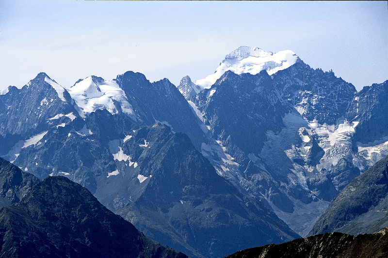 |
Im Süden die Barre des Ecrins (4102 m), der südlichste Viertausender der Alpen. In southern direction: Barre des Ecrins (4102 m) the southmost 4000 m peak in the Alps. |
 |
Rechts davon die Gruppe der Meije mit Pic Gaspard (3883 m), Bec de l' Homme (3454 m) und La Meije (3982 m). Followed to the right by the Meije Massif with Pic Gaspard (3883 m), Bec de l' Homme (3454 m) and finally La Meije (3982 m). |
 |
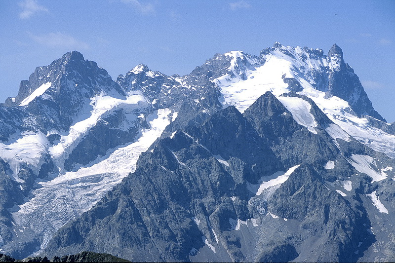
Teleaufnahme der Meije mit dem Pic Oriental (3891 m - links), Grand Pic (3982 m - Hauptgipfel) und dem Grand Doigt rechts daneben (3764 m). Gut sichtbar die Aufstiegsspur. Detailed view of the Meije with Pic Oriental (3891 m - left), Grand Pic (3982 m - main summit) and Grand Doigt to the right (3764 m). The track in the center is the main ascent route. |
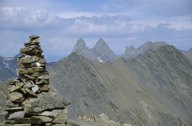 |
Daneben der Blick nach Nordwesten auf die Aiguilles des Arves (3510m - 3509m - 3363m). Rechts davon die Pointe Argentiere (3237 m). In northwestern direction the three summits of Aiguilles des Arves (3510m - 3509m - 3363m) and Pointe Argentiere (3237 m). |
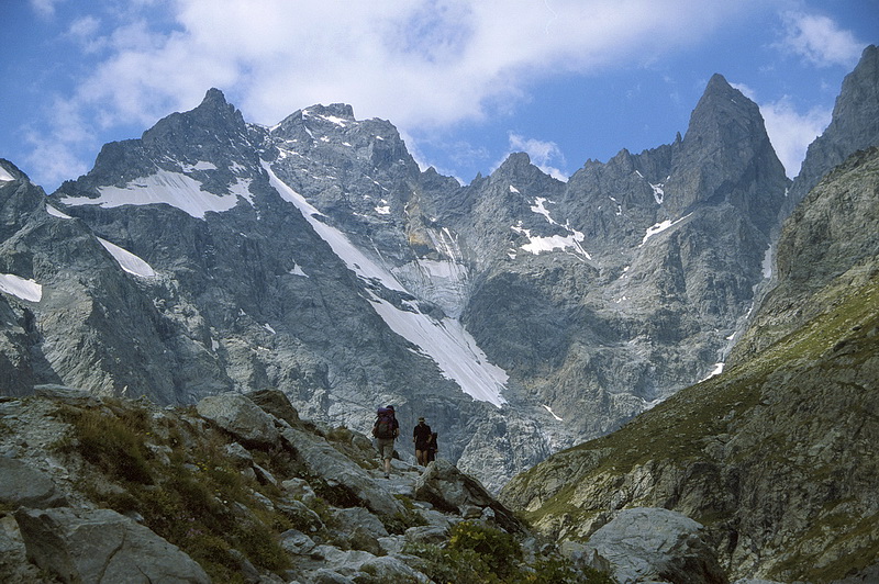
Ailefroide - Glacier Noir
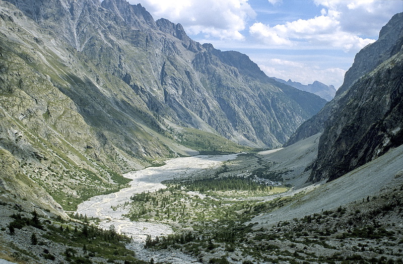
Blick auf Pre Madame Carle - dem Ausgangspunkt der Wanderung - mit dem Refuge Cezanne (1874 m). Darüber der Glacier Blanc über den der Aufstieg zur Ecrins Hütte und zur Barre des Ecrins führt.
Looking back to the starting point of our hike called 'Pre Madame Carle' and the Cezanne Hut (1874 m). High above Glacier Blanc - the white glacier which is crossed on the way to the Ecrins Hut and further to Barre des Ecrins.
 |
Während des Aufstiegs wird der Blick frei auf die During the ascent Ailefroide (3954 m - right), Col du Glacier Noir (3478 m) and Coup de Sabre (3699 m - left) become apparent. |
 |
Kurz vor 'Balme de Francois Blanc' auf ca 2400 m. In Bildmitte der Pic Coolidge (3775 m), rechts daneben Le Fifre (3699 m). Just below a place called 'Balme de Francois Blanc' at around 2400 m. In the centre Pic Coolidge with Le Fifre (3699 m) to the right. |
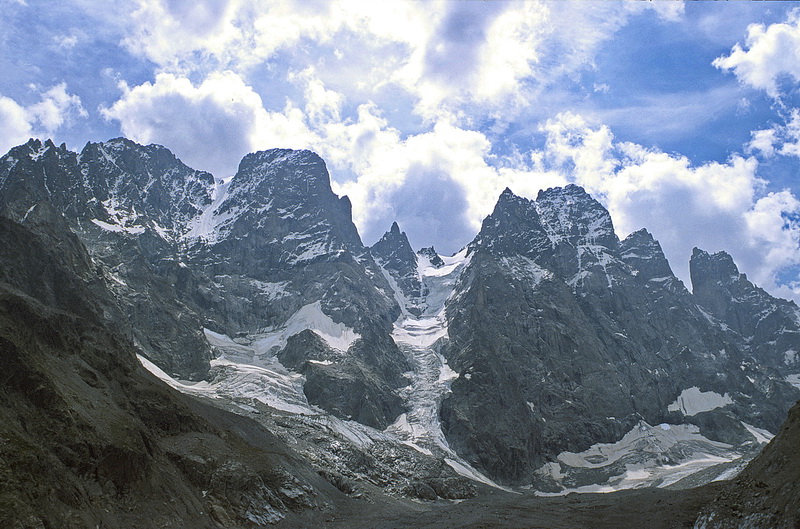 |
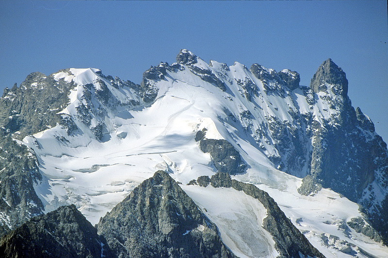
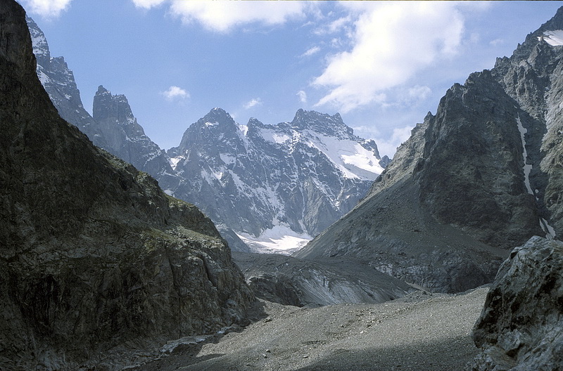
Am Ende des Tals wird der Blick frei auf den Mont Pelvoux (3943 m), die Aiguille de Pelvoux (3684 m) und den Pic Sans Nom (3913 m - rechts). At the end of the valley Mont Pelvoux (3943 m), Aiguille de Pelvoux (3684 m) and Pic Sans Nom (3913 m - right) become visible. |

Der westliche der beiden Cols de Pelvoux mit der Aiguille de Pelvoux und der Blick hinunter nach Pre Madame Carle.
The western Pelvoux Pass with the Aiguille de Pelvoux and the view back to Pre Madame Carle.