Skitouren in Marokko: Neltner Hütte / Jebel Toubkal
Von der Neltner Hütte bieten sich drei Touren an. Zunächst folgen wir dem Mizane Tal nach Süden zur Scharte 'Tizi n' Ouagane' (ca. 3750 m) wo sich der Blick nach Süden über den Anti-Atlas hinweg bis zu den Ausläufern der Wüste eröffnet. In leichter Kletterei über den Felsgrat und über die anschließenden ausladenden Schuttfelder überwinden wir die 300 Höhenmeter bis zum Doppelgipfel des Ras n' Ouanoukrim, der Timesguida befindet sich noch eine halbe Stunde entfernt. Nördlich davon befindet sich der Akioud, das Ziel des nächsten Tages. Am letzten Tag wenden wir uns von der Neltner Hütte direkt nach Osten in ein Seitental, das uns direkt zum höchsten Punkt Nordafrikas führt. Über die Toubkal Scharte (Tizi n' Toubkal) und den nachfolgenden Grat erreicht man unschwierig den Jebel Toubkal.
The Neltner Hut is the basis for three different ascents. On the first day we followed the Mizane valley south to the 'Tizi n' Ouagane' gap (3750 m) with its excellent southern view across the Anti-Atlas range. The following ridge was climbed easily and across large fields of debris we arrived at the twin peaks of Ras n' Ouanoukrim where the summit of Timesguida is only half an hour away. Akioud another 4000 m peak north of these summits was our aim of the next day. On our last day we followed a side valley east of the Neltner Hut which lead us directly to the highest point of Northern Africa. Via the Toubkal gap (Tizi n'Toubkal) and the following ridge we climbed Jebel Toubkal without further difficulties.

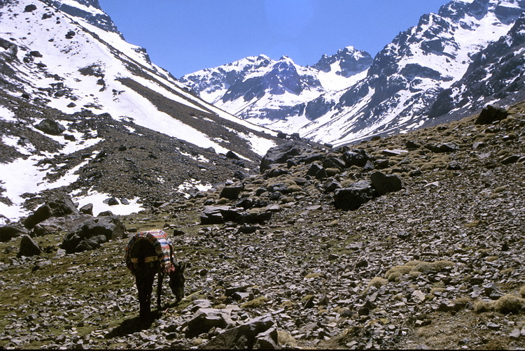
Skier auf Maultierrücken auf dem Weg zur Neltner Hütte. Die Hütte liegt um die Ecke, wo der Schnee anfängt.
Skis on horse (mule) back on the way to the Neltner Hut. The hut is situated around the corner where the snow fields start.
 |
Die 1999 errichtete Neubau der Neltner Hütte auf 3207 m soll mittlerweile bis zu 150 Personen aufnehmen können. Wer allerdings alpinen Komfort gewöhnt war, musste - zumindest im Frühjahr 2000 - ganz schnell umdenken. The Neltner Hut at 3207 m was rebuilt in 1999 and should by now have room for up to 150 people. However those of us who expected an alpine style hut - this was at least the case in spring 2000 - changed their view quickly. |
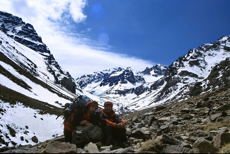
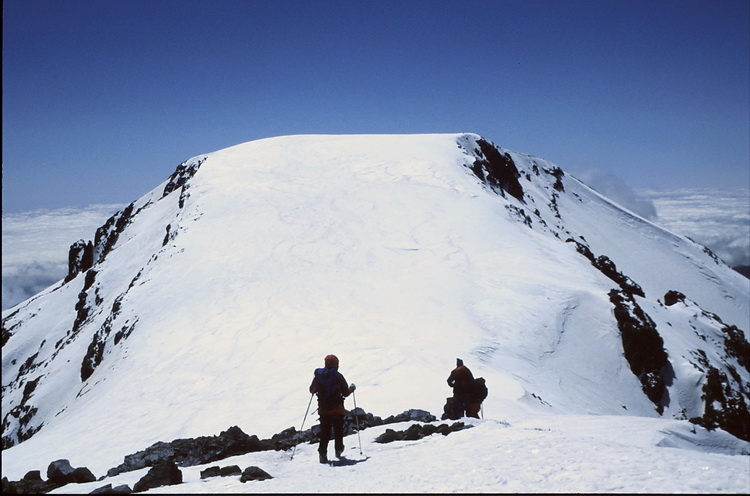
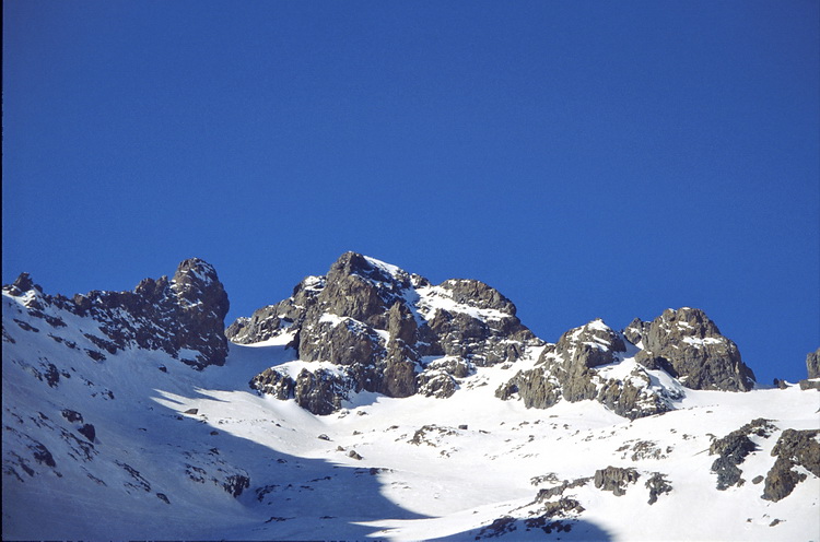
Ras n' Quanokrim (4083 m) - Timesguida (4089 m)
Von der Hütte erkennt man bereits die Scharte 'Tizi n'Quagne', den Ausgangspunkt für zwei Viertausender.
Already visible from the hut the gap 'Tizi n' Quagne' from where two 4000 m peaks can be climbed.
 |
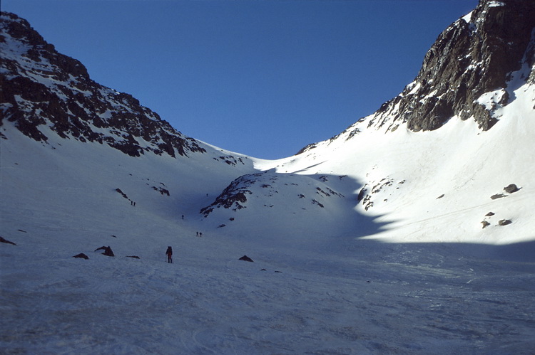
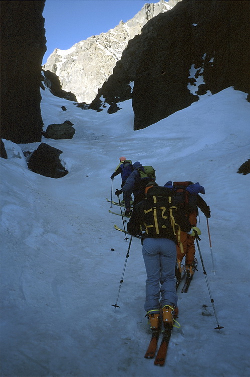
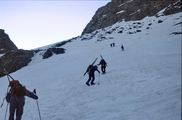
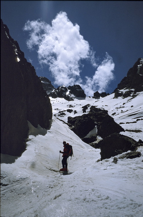
 Oberhalb der Scharte war unser Skidepot bei den zwei markanten Steinernen Jungfern. Die Spezialisten gehen mit Skiern weiter und fahren dann durch eines der vielen steilen Couloirs ab. Über steile Geröllklettereien erreicht man die flachen Schneefelder vor dem Gipfel des Ras n' Ouanokrim. Above the gap we deposited our skis near the two stony virgins. More experienced skiers take their skis to the summit and ski down one of the steep couloirs. After steep 'debris' climbing we reached the summit snow fields of Ras n'Ouanokrim. |
 |
Der Gipfel der Timesguida ist von dort nur eine halbe Stunde entfernt. The summit of Timesguida is only half an hour away. |
 |
 Steilstufe im Abstieg von der Timesguida mit Blick zur Südwestflanke des Toubkal. A steep couloir during the descent of Timesguida with the south-western face of Jebel Toubkal. |
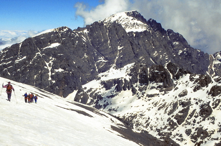
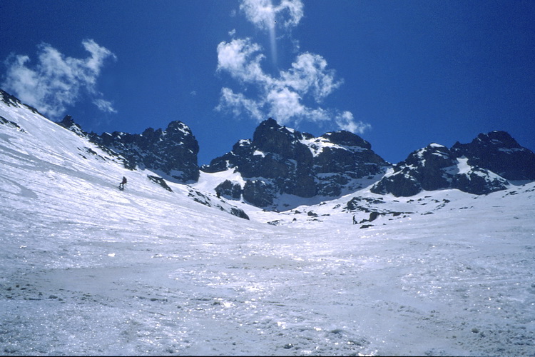
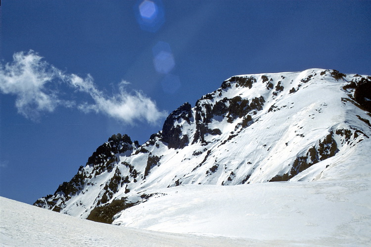
Akioud (4010 m)
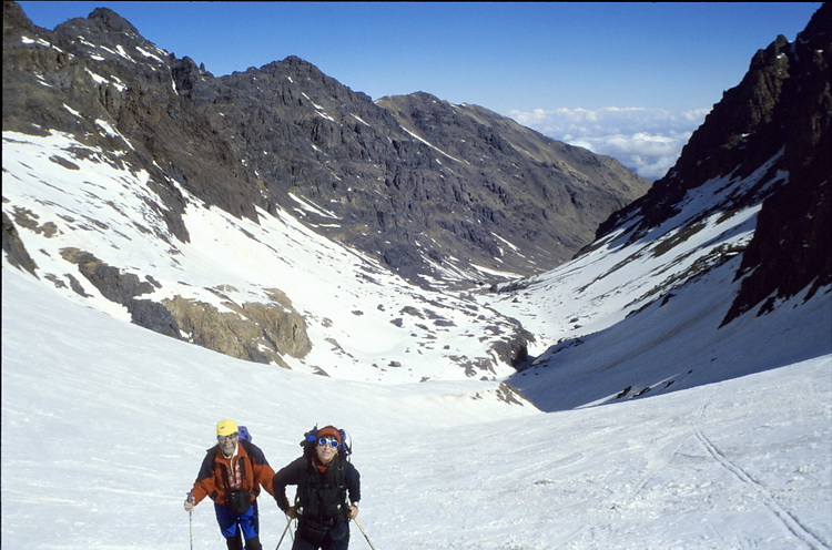
Der Anstieg führt durch eines der vielen Couloirs zu den Schneehängen unterhalb der Akioudscharte.
The ascent leads through one of the couloirs to the snow fields below the Akioud gap.
 |
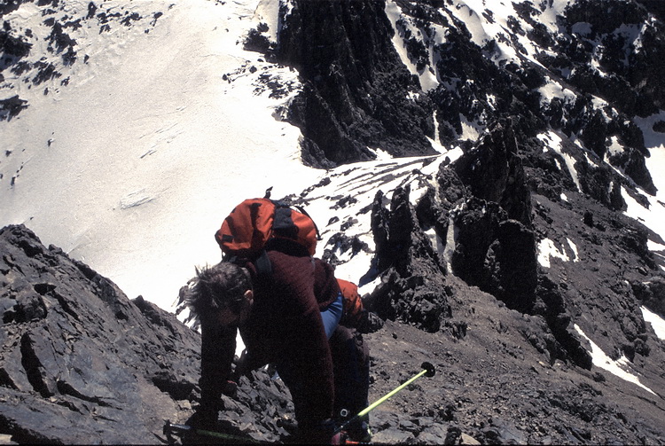
Alle Teilnehmer erreichten den Gipfel über die Scharte am rechten Bildrand. Weiter geht es über einen kurzzeitig steilen (Steigeisen erforderlich) Firngrat zum höchsten Punkt. We all reached the summit via the gap on the right side of the picture. A short and steep snow ridge (crampons are necessary) leads to the highest point. |
Jebel Toubkal (4167 m)
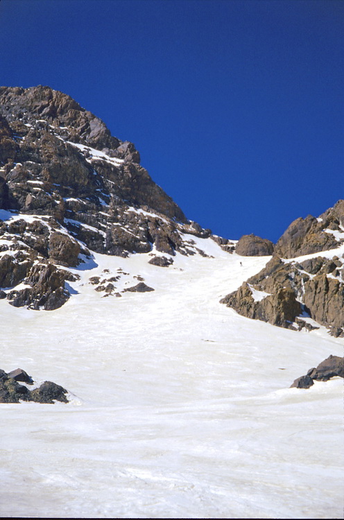
Über steile eisige Schneefelder geht es am Morgen des letzten Skitages los. Der Weg führt zum Nordostbecken am Toubkal.
On the morning of our last day we moved across icy snow fields towards the north-eastern basin of Jebel Toubkal.
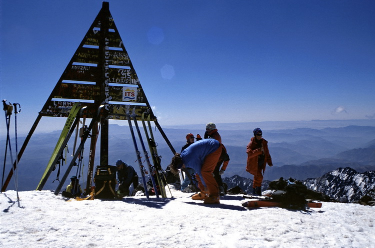 |
Der Gipfel des Jebel Toubkal (4167 m). The summit of Jebel Toubkal (4167 m). |
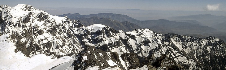
Blick vom Jebel Toubkal nach Süden. Am Horizont der Anti Atlas (laut Führer Hussain).
Summit view in southern direction. On the horizon one can see the Anti Atlas range (according to our guide Hussain).
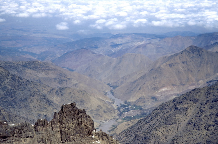
Blick vom Gipfel des Toubkal hinunter nach Imlil. Die Abfahrt führte über steile Grate und Rinnen.
View down to Imlil.
The descent followed steep ridges and couloirs.
 |
 Die letzten Schneerinnen nach einer halben Stunde Traumabfahrt über Afrikafirn. Das war der afrikanische Traum. Blick zurück auf die Hänge des Atlas und den Akioud. Am gleichen Tag ging es noch zurück nach Marrakesch. The final snow fields after half an hour of skiing down in phantastic conditions. At the end of our african dream the view back to the slopes of High Atlas and Akioud. On the same day we returned to Marrakech. |