Nordnorwegen: Narvik - Bodø
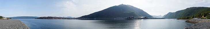

Ein letzter Blick zurück zur Halbinsel von Narvik, dem Fagernesfjellet mit dem Hafen von Fagernes und die Gipfel von Vomtinden (1494 m) und Stortinden (1633 m - verdeckt) am Ende des Beisfjorden.
A final view back to the Narvik peninsula, the port of Fagernes with Fagernesfjellet behind as well as the peaks of Vomtinden (1.494 m) and Stortinden (1.633m - partly hidden) at the end of Beisfjorden.
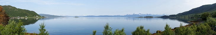
30 km weiter entlang des Ofotfjorden bei Råna: Die Insel Saltvikøya, dahinter der Skittendalstinden (1306 m) nordöstlich von Evenes.
20 miles further along the Ofotfjorden near Råna: The island of Saltvikøya and the summit of Skittendalstinden (1.306 m) north-east of Evenes.
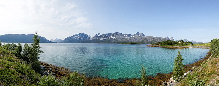
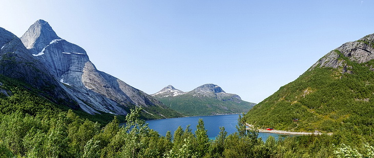
Einer der landschaftliche Höhepunkt des Tages. Kurz nach der Brücke bei Sætran (rechts im Bild) verlassen wir die E6 und nehmen den Umweg vorbei am Stetinden, Norwegens bekanntesten Gipfel,l bis nach Kjøpsvik.
One of the scenic highlights of this day. Just after the bridge near Sætran (right) we are leaving the E6 for a slight detour along the Efjorden. Passing Norway's most famous peak Stetinden we follow the road to Kjøpsvik.
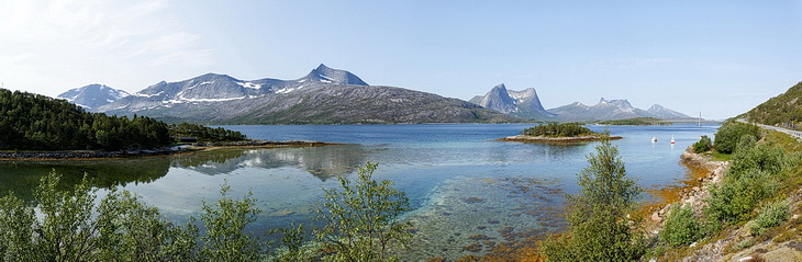
Huglhornet (961 m) ⇒ Doppelgipfel / Twin peak Stortinden / Eidtinden (847 m) ⇒ Rundtinden (798 m)
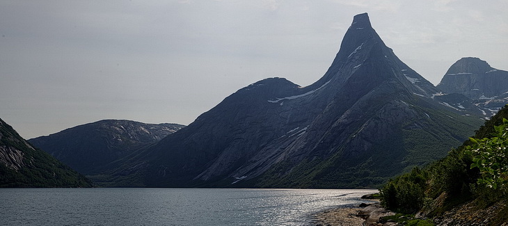
Die Nordflanke des Stetinden: Die Erstbesteigung erfolgte 1910 über den Südostgrat links vom Gipfel.
The north face of Stetinden: In 1910 Stetinden was first climbed via the south-east ridge left of the summit.
Wesentlich bekannter ist der Stetinden von seiner Nordwestseite am Stefjorden: Ein Paradies für Extremkletterer.
The north-west face seen from Stefjorden is much more popular and a paradise for extreme climbers.
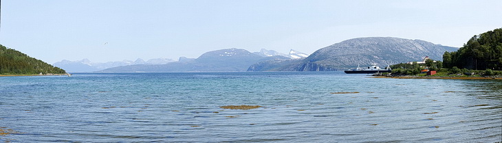
Auf der Fähre von Kjøpsvik nach Drag: Panorama des südlichen Tysfjords, rechts der dreigipflige Stolotindan (1089 m).
On the ferry from Kjøpsvik nach Drag: View across the southern part of Tysfjord and the three peaks of Stolotindan (1.089 m).
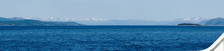
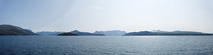
Im Norden sehen wir noch einmal die schneebedeckten Gipfel der Lofoten.
View northward to the snow-covered moutains of the Lofoten islands.
Der letzte Blick zum Stetinden (Bildmitte) von Fährehafen in Drag.
The last glimpse of Stetinden (center) from the ferry port in Drag.
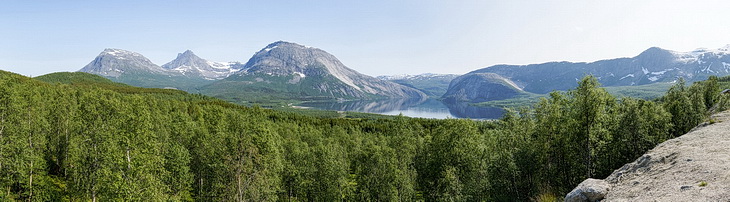
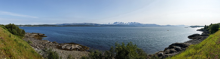
Ein kurzer Abstecher durch den 8 km langen Tunnel unter dem Veggfjellan-Massiv führt uns zum Sagfjorden: Panorama der Forsbukta Bucht mit den Bergen der Halbinsel Hamarøya und dem Veggfjellan rechts im Bild.
A 5 miles tunnel through the steep massif of Veggfjellan is leading to a lookout on the shore of Sagfjorden: Panorama of Forsbukta bay, the peaks of Hamarøya island and Vegfjellan in the right part of the picture.
Parkplatz oberhalb des Kobbvatnet / Parking above Kobbvatnet lake:
Gjerdalstinden (1.210 m) ⇒ Litletindan (1.422m) + Gasskatjåhkkå (1512m) ⇒ Veikdalsisen-Gletscher ⇒ Kviturfjellet (1.226m)
Zwischen Fauske und Bodø: Die Gipfel des Børvasstindan zeigen an, das unsere Reise so langsam zu Ende geht.
Between Fauske and Bodø: The summits of Børvasstindan are signalising that out journey is slowly coming to its end.

Auch wenn am Ende das Wetter schlechter wurde, für uns hatte sich es sich wieder einmal von seiner besten Seite gezeigt.
Even if the weather was getting worse at the end of the trip it had shown itself from its best side again.