Mercantour: Lac d' Allos - Mont Pelat
Auf der Südseite des Col d' Allos erreicht man über eine 13 km lange, teils schmale Strasse den Eingang zum Mercantour Nationalpark. Vom Parkplatz am Eingang des Nationalparks erreicht man in gut einer halben Stunde das Refuge du Col d' Allos (2229 m) über einen geologischen Wanderweg, der die Entstehung des Sees durch eiszeitliche Gletscher und die Vegetation auf zahlreichen Tafeln beschreibt. Etwa auf halber Strecke zweigt der Weg nach Norden ab und führt in langen Serpentinen zum Mont Pelat, dem höchsten Gipfel des Mercantour (3051 m). Das 360 Grad Panorama ist beeindruckend (auch wenn uns wegen Nebel 120 davon fehlen). Im Sommer empfiehlt sich ein früher Aufbruch, da der gesamte Aufstieg durch die Südflanke führt und es entsprechend heiss werden kann. Davon konnte am 1.9.2001 allerdings nicht die Rede sein, der starke Mistral und Temperaturen um die Null Grad verkürzten die Gipfelrast erheblich.
On the southern side of the Col d' Allos a narrow road leads to the entrance of the Mercantour National Park. A geological footpath describing the glacial origin of the Lac d' Allos and its flora took us to the Lac d'Allos Hut (2229 m) in about half an hour. Halfway up another path turns north to Mont Pelat, the highest peak of the Mercantour area (3051 m). The 360 degrees panorama is exceptional (although we missed 120 of it due to the clouds). In summer we recommend an early start because of the high temperatures on this south-sided ascent. However the conditions at the beginning of september 2001 were quite contrary caused by a strong Mistral wind and temperatures around zero degrees.
 |
Blick vom Col d' Allos (2240 m) nach Norden auf Barcelonnette. Im Hintergrund der Pain de Sucre (2560 m) und rechts davon der Chapeau de Gendarme ou Lan (2685 m). View to the north from the Allos Pass (2240 m) in direction Barcelonnette. Behind Pain du Sucre (2560 m - left) and Chapeau de Gendarme ou Lan (2685 m). |
 |
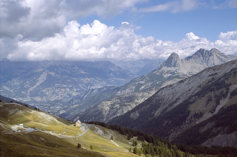
Vom Col d' Allos führt eine Kammwanderung zum Grand Cheval de Bois (2839 m) links außerhalb des Bildes. Im Hintergrund der Mont Pelat. Starting at the Col d' Allos a hike along the ridge leads to Grand Cheval de Bois (2839 m) outside the picture to the left. In the background Mont Pelat. |
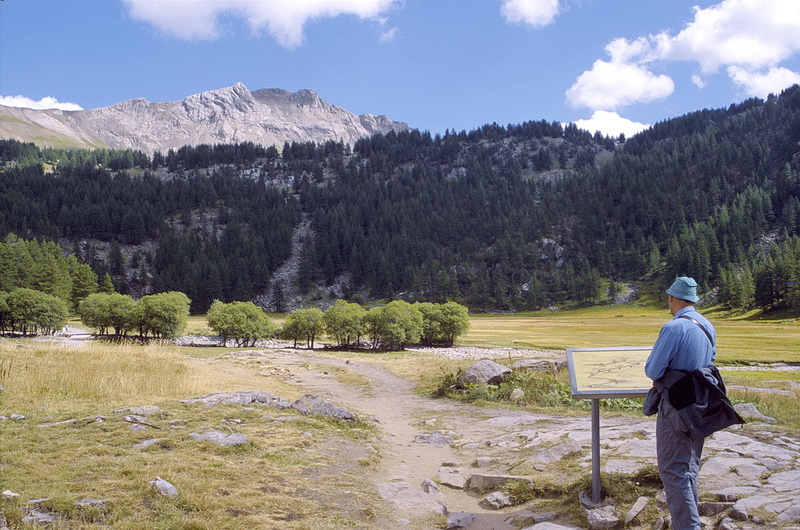
Ein geologischer Wanderweg führt hinauf zum schön gelegenen Refuge du Lac d' Allos mit Blick nach Norden auf Le Trou de L´Aigle (2962 m - unter der Wolke). Links der Ostgratrücken des Mont Pelat. Der Gipfel selbst befindet sich hinter den Bäumen.
A geological trail leads up to the nicely situated Refuge du Lac d' Allos. In the background Le Trou de L' Aigle (2962 m - below the cloud). Left of it the east-ridge of Mont Pelat, the summit itself is covered by trees.
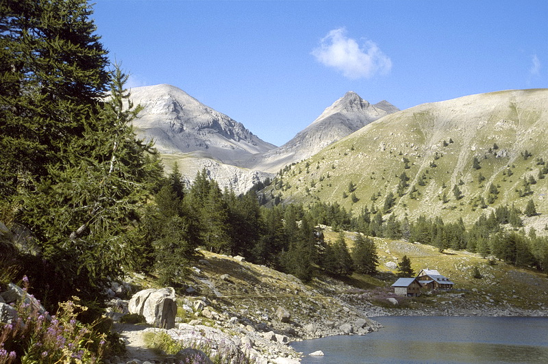
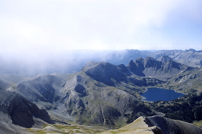
Das sehenswerte Panorama am Refuge du Lac d' Allos.
The worthwhile panorama at the Lac d' Allos Hut.
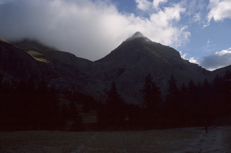 |
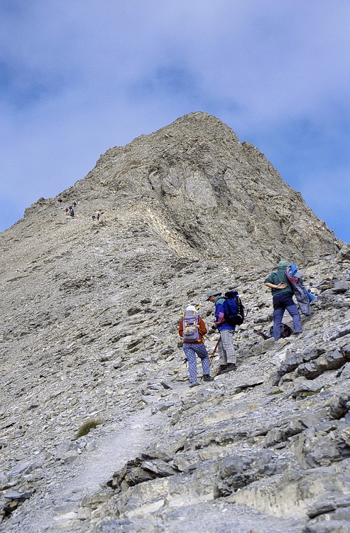
Erster Frost am ersten September. Der Mistral ist hier wie der Nordföhn ein kalter Fallwind und löst die Wolken auf der Südseite auf. In Bildmitte Le Trou de L' Aigle (2962 m), links der Ostgratrücken des Mont Pelat, unter dem der Weg in langen Kehren zum Gipfel führt. Frosty morning on the first of september. The Mistral is a cold fall wind which breaks up the clouds on the south side. In the centre Le Trou de L' Aigle (2962 m), to the left the eastern ridge of Mont Pelat where the path leads upwards in long turns. |
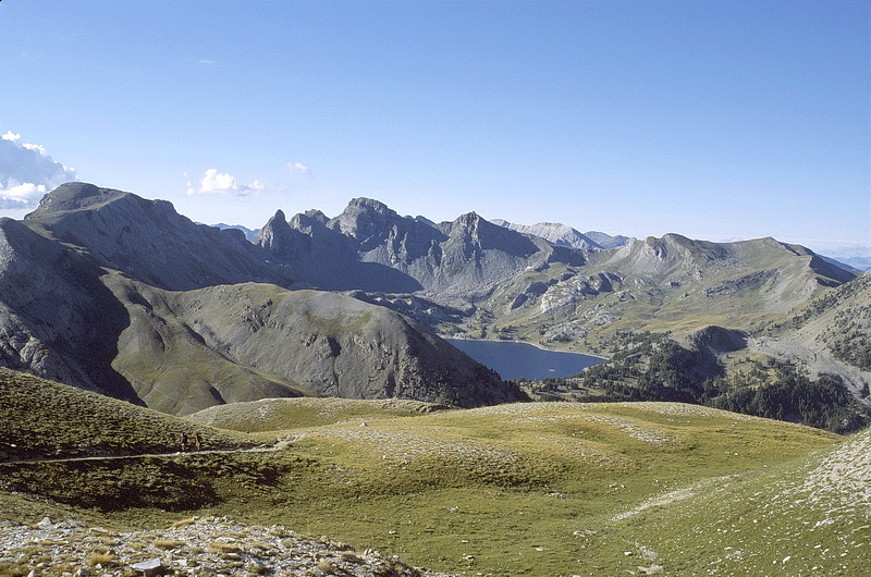 |
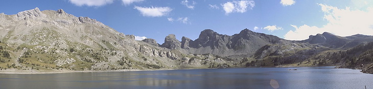
Blick vom Aufstieg zum Mont Pelat auf den Lac d' Allos. Das Wahrzeichen des Sees sind die Grandes Tours du Lac (2742 m) in der Bildmitte. View down to Lac d' Allos and the Grandes Tours du Lac (2742 m) in the centre. |
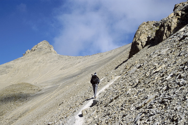
Unterhalb des Gipfels auf dem Ostgratrückens des Mont Pelat. Below the summit on the east ridge of Mont Pelat. |
 |
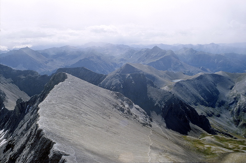
Der Ostgrat mit Anstiegsweg. Direkt dahinter die Felsen des Trou de L' Aigle hinter dem die Straße über den Col de Cayolle (2327 m) führt. Daneben der Lac d´Allos und die Grandes Tours du Lac (2742 m).
The east ridge with the ascent route and the rocks of Le Trou de l' Aigle behind which the Cayolle Pass route (2327 m) is situated. The right picture shows again Lac d' Allos and the Grandes Tours du Lac (2742 m).
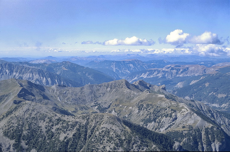

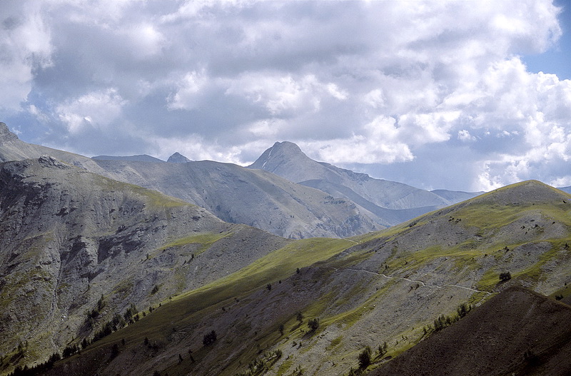
In südwestlicher Richtung die Berge der Provence und daran anschliessend der Tiefblick nach Allos, von wo aus die Strasse zum Nationalpark führt.
In south-western direction the Provence mountains and the view down to Allos, the starting point of the road to the National Park.