Garhwal Trek: Kuari Pass - Joshimath - Rishikesh
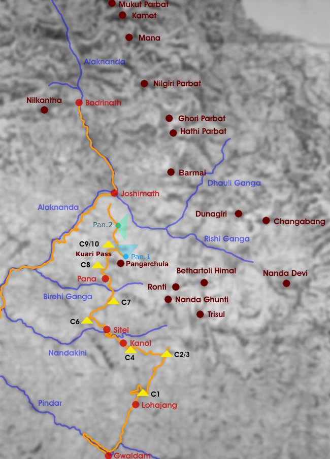
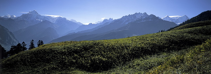
Der letzte Tag unseres Treks führte vom Lager 9/10 nach Auli oberhalb von Joshimath. Bevor wir jedoch das Skigebiet und die längste Seilbahn Asiens erreicht hatten, zeigten sich die Berge nochmals in ihrer vollen Pracht.
On the last day of our trek we descended from camp 9/10 to Auli above the town of Joshimath. However before we reached the ski-resort and the longest cableway of asia all the surrounding mountains presented themselves in all their splendour.
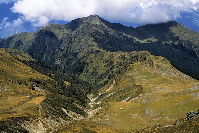
Auf dem linken Bild erkennt man Lager 9/10 und den daran anschliessenden Panoramaweg nach Auli, der zunächst über den Grat und dann nach rechts oberhalb der Waldgrenze verläuft. Das Panorama ist einzigartig und umfasst Nilkantha (6596 m), Kamet (7756 m), Mana (7272 m) und Nilgiri Parbat (6474 m).
On the left picture we can see camp 9/10 and the continuing panorama trail down to Auli which follows the ridge at first and then turns right above the timber line. The panorama is exceptional and includes Nilkantha (6596 m), Kamet (7756 m), Mana (7272 m) and Nilgiri Parbat (6474 m).
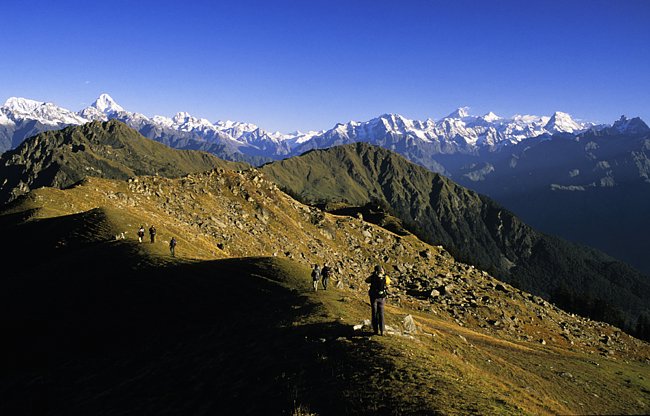
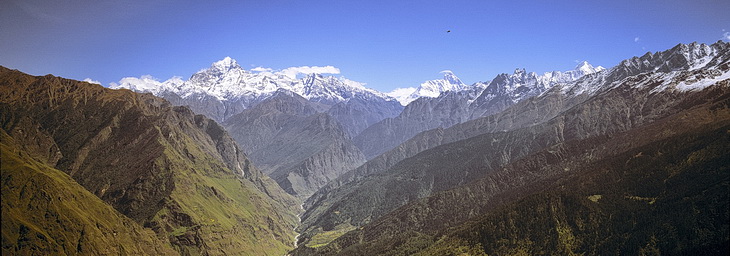
Auf dem Abstiegsweg nach Auli hat man einen schönen Blick auf Ghori Parbat (6708 m) und Hathi Parbat (6727m), Barmai (5879 m) und den Dunagiri (7066 m - rechts).
Another nice pnorama place is on the way down to Auli. The dominating peaks are from left to right Ghori Parbat (6708 m), Hathi Parbat (6727m) and Barmai (5879 m) as well as Dunagiri (7066 m - right).
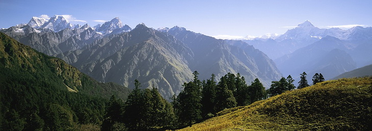
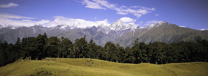
Mit dem Dunagiri beginnt auch dieses Bild, das sich nach rechts anschliesst. Auf der anderen Seite des Rishi Ganga Tals ist hinter den Felsnadeln die Nanda Devi zu erkennen. Ganz rechts die beiden Gipfel von Ronti (6063 m) und Nanda Ghunti (6309 m), dazwischen der Trisul (7120 m).
Continuing to the right this panorama also starts with Dunagiri. On the other side of the Rishi Gang Valley Nanda Devi (7816 m) is partly visible behind the rock needles in the center of the picture. The two peaks on the right side of the picture are Ronti (6063 m) and Nanda Ghunti (6309 m) with Trisul (7120 m) between.

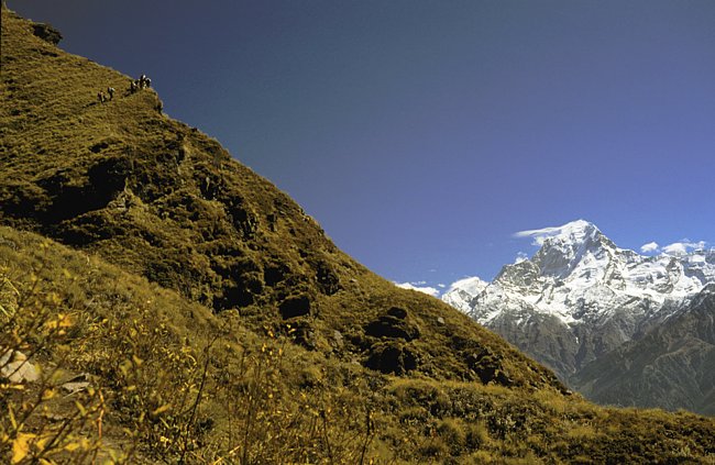
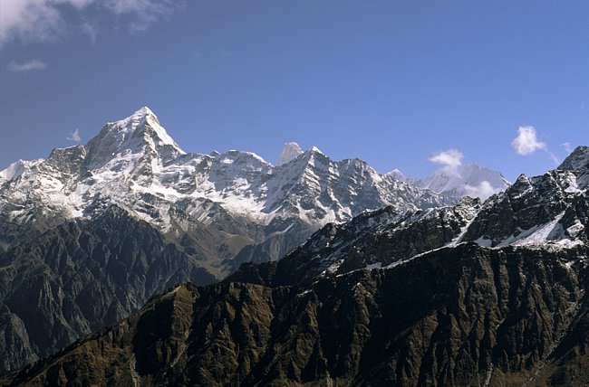

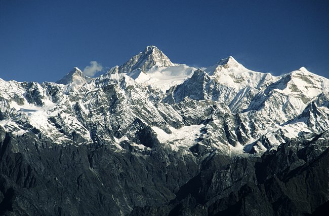
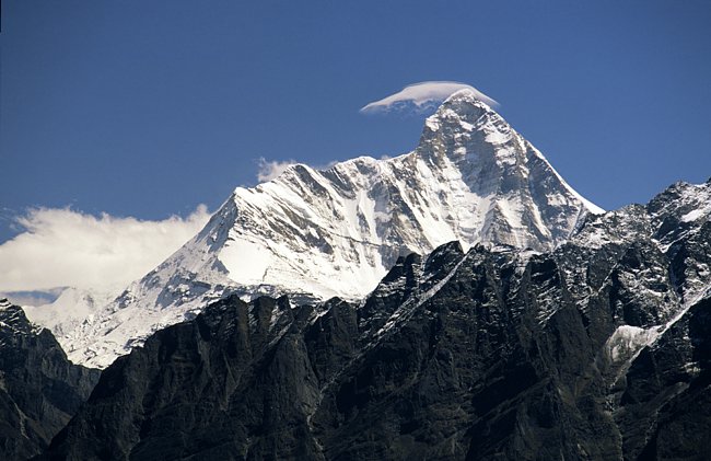
Bild 1/2: Der Weg entlang des Bergrückens ist eine 1a Panoramawanderung mit besten Ausblicken auf die 'high society' der Garhwal Gipfel:
Bild 3: Dunagiri (7066 m) mit der dahinterliegenden Spitze des Changabang (6864 m).
Bild 4: Ghori Parbat (6708 m) und Hathi Parbat (6727 m)
Bild 5: Kamet (7756 m) mit Mukut Parbat (7242 m - links davon) und Mana (7272 m - rechts).
Bild 6 zeigt den höchsten Berg Indiens: die Nanda Devi mit 7816 m.
Picture 1/2: The path along the ridge is a first class panorama hike with optimum views on Garhwals 'high society':
Picture 3: Dunagiri (7066 m) with the needle of Changabang (6864 m) behind.
Picture 4:
Ghori Parbat (6708 m) and Hathi Parbat (6727 m)
Picture 5:
Kamet (7756 m) with Mukut Parbat (7242 m - left of it) and Mana (7272 m - right).
Picture 6: shows the highest mountain of India: Nanda Devi (7816 m).
Dunagiri (7066 m), Rishi Kot (6236 m), Nanda Devi (7816 m) und Bethartoli Himal (6352 m). Unten die Rishi Ganga Schlucht. Der dunkle Fleck über der Nanda Devi wurde von uns als Adler definiert.
Dunagiri (7066 m), Rishi Kot (6236 m), Nanda Devi (7816 m) and Bethartoli Himal (6352 m) high above the Rishi Ganga Canyon. The dark spot above Nanda Devi was most probably an eagle.
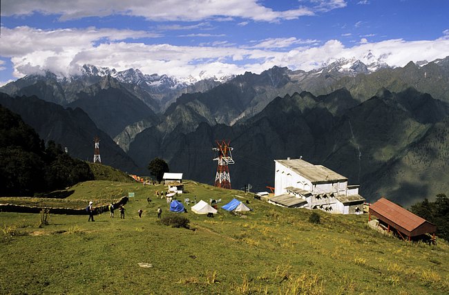
Die längste Seilbahn Asiens mit fast 4 km Länge führt von Joshimath nach Gorsain oberhalb des beliebten Wintersportortes Auli. Wäre man nicht von Sechstausendern umgeben, könnte man sich fast wie in den Alpen fühlen. Die Berge im Hintergrund sind Ghori- und Hathi Parbat (in Wolken) und Barmai rechts.
Asias longest cableway is nearly 4 km long and leads from Joshimath to Gorsain above the ski resort of Auli. If we weren't surrounded by 6000 m peaks we could have mentioned ourselves in the Alps.The mountains in the background are Ghori- and Hathi Parbat (in clouds) and Barmai to the right.
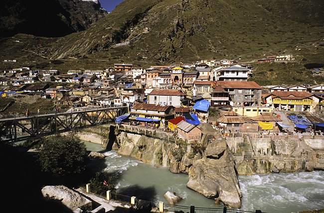
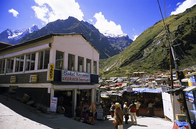
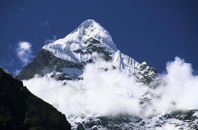
An der Bergstation der Seilbahn von Joshimath nach Gorson, der längsten Drahtseilbahn Asiens endete der aktive Teil dieses Treks. Mit dem Bus fahren wir weiter nach Badrinath am Alaknanda Fluss das vom fast 3500 m höheren Nilkantha (6596 m) überragt wird.
The top of the cableway from Joshimath to Gorson, the longest cableway of Asia was the end point of our trek. At Joshimath we took the bus and followed the Alaknanda River to Badrinath which is towered by Nilkantha (6596 m).
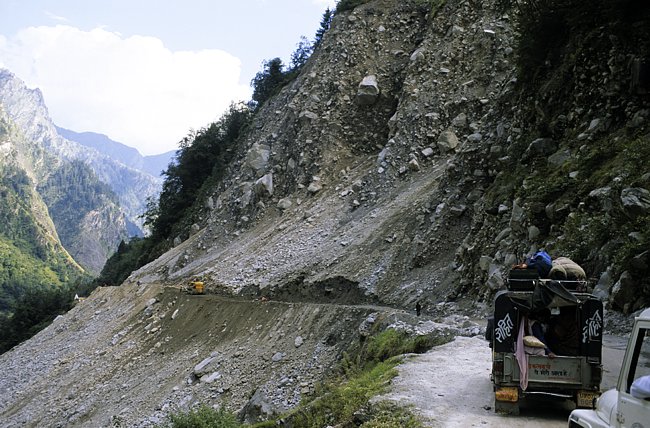
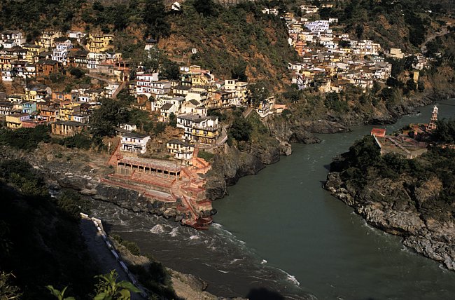
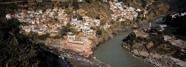
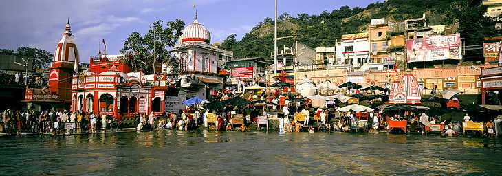
Die Rückfahrt durch das Tal der Alaknanda wurde durch einen Bergsturz etwas verzögert aber schliesslich erreichten wir Devaprayag, wo sich Bhagirati und Alaknanda zum heiligen Fluss Ganges vereinigen.
The trip back through the Alaknanda Valley was a little bit delayed by a landslide but eventually we reached Devaprayag, where Bhagirati and Akalknanda unite to create the holy river Ganges.
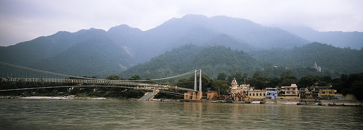
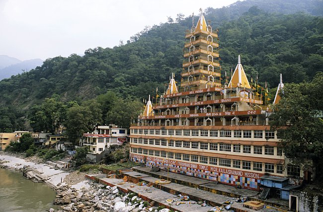
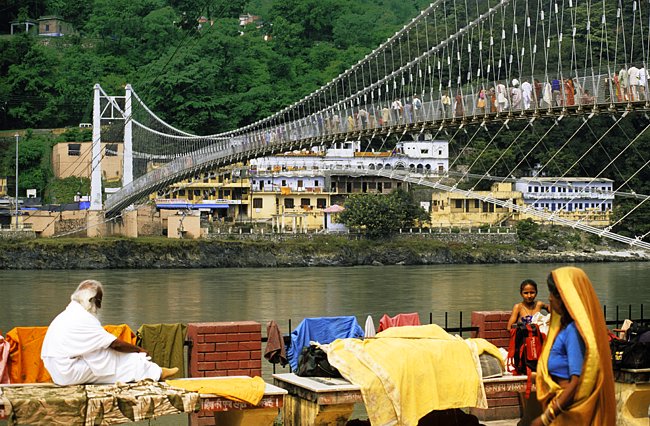
Der Trayambakeshwar Tempel in Rishikesh und die Ramjhula Brücke bilden den Abschluss dieser eindrucksvollen Reise.
The Trayambakeshwar Temple in Rishikesh and the Ramjhula Bridge were the final impressions of the impressive trek.