Ötztaler Alpen: Hauslabkogel - Similaun
Über die Ötztaler Alpen gibt es jede Menge Tourenbeschreibungen und Internetberichte. Wir fügen noch ein paar Bilder von einem Osterwochenende hinzu, an dem wir ideale Wetter- und Skitourenverhältnisse hatten. Ziele waren der Hauslabkogel und der Similaun vom der Martin-Busch-Haus aus.
A lot is written about hikes and climbs in the Ötztal Mountains and numerous reports can be found on the internet. We are just adding one more ski tour which we did one easter weekend some years ago. Starting at the Martin-Busch-Hut we climbed Hauslabkogel and Similaun in perfect weather conditions.
Hauslabkogel (3402 m)
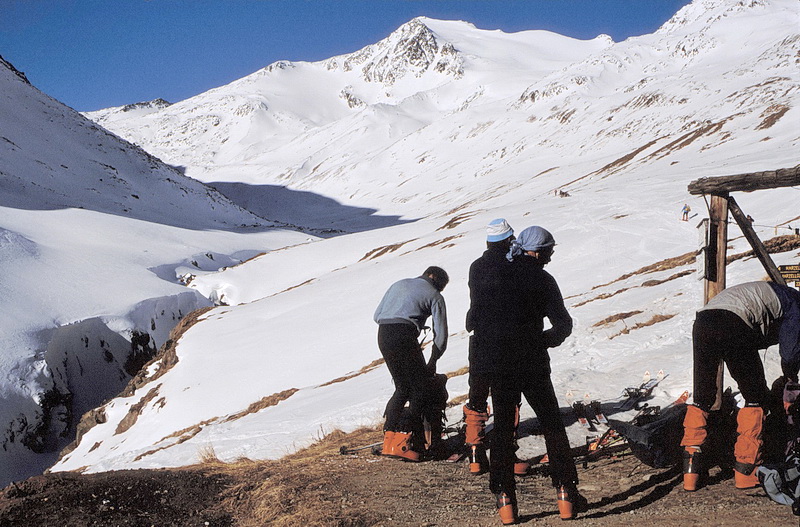 |
Morgendlicher Aufbruch vom Martin-Busch-Haus (2501 m) zum Hauslabkogel (3402 m) im Hintergrund, in dessen Nähe einige Jahre nach unserer Tour Ötzi gefunden wurde. Early morning start at the Martin-Busch-Hut (2501 m) towards Hauslabkogel (3402 m - in the background) where the famous mummy called 'Oetzi' was found a few years after this tour. |
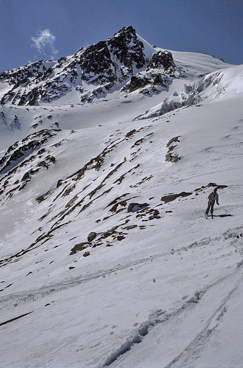 |
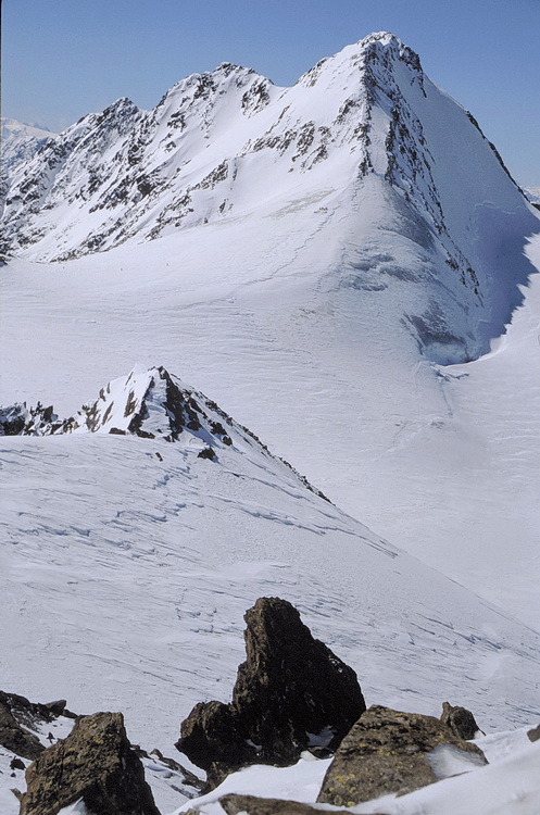
Den Gipfel des Hauslabkogels erreicht man über einen kleinen Gletscher, den Sayferner, der sich zwischen Say- und Hauslabkogel in östliche Richtung herunterzieht. The summit of Hauslabkogel is reached by crossing the small Say Glacier which flows down between Saykogel and Hauslabkogel in eastern direction. |
 |
Unterhalb der Gipfelfelsen des Hauslabkogels: links die Mutmalspitze (3540 m) rechts davon die Hintere Schwärze (3628 m). Links, hinter der Mutmalspitze versteckt, die Karlesspitze (3465 m). Just below the summit rocks of Hauslabkogel. To the left we can see Karlesspitze (3465 m) partly hidden by Mutmalspitze (3540 m) and right of it Hintere Schwärze (3628 m). |
 |
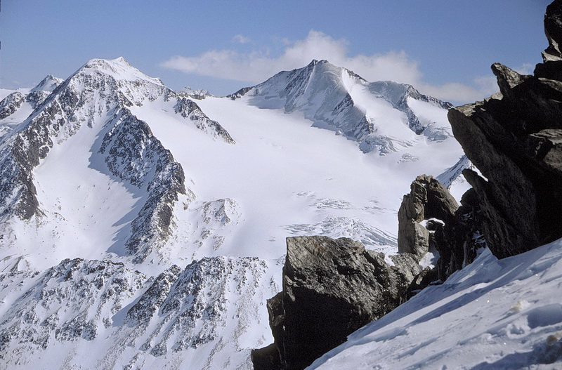
Einen besseren Überblick hat man schliesslich vom Gipfel auf die Hintere Schwärze und die Marzellspitzen (3555 m) rechts davon.
The complete panorama of Hintere Schwärze and Marzellspitzen (3555 m) can be enjoyed at the summit of Hauslabkogel. |
 |
Die Fineilspitze (3514 m) im Profil, vom Hauslabkogel nach Südwesten gesehen. Darunter das durch Ötzi bekannt gewordene Hauslabjoch.
The profile of Fineilspitze (3514 m) south-west of Hauslabkogel and the Hauslab Saddle below, the place of 'Oetzis' discovery. |
 |
Blick vom Gipfel des Hauslabkogel nach Süden. |
 |
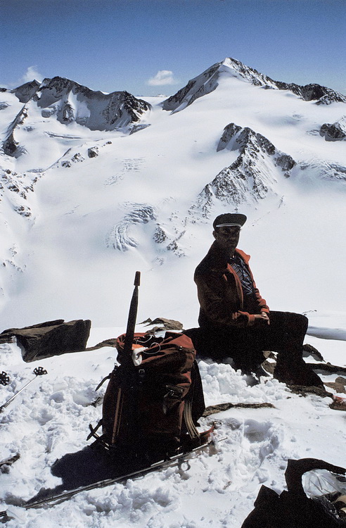
Im Norden dominiert die Wildspitze (3772 m), der höchste Gipfel der Ötztaler Alpen. Im Mittelgrund vor dem Sennkogel (3396 m) der Saykogel (3355 m) mit einer flachen Zunge des Hochjochferners. Dahinter rechts die Kreuzspitze (3457 m), der viel gerühmte Aussichtsberg der Martin-Busch-Hütte. In northern direction Wildspitze (3772 m) the highest peak in the Ötztal Range is doministing. In the center of the picture we can see Saykogel (3355 m) with the flat tongue of Hochjoch Glacier and Sennkogel (3396 m) behind of it. Kreuzspitze (3457 m - right in the background) is the famous panorama summit of the Martin-Busch-Hut. |
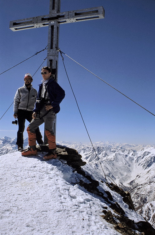
Similaun (3606 m)

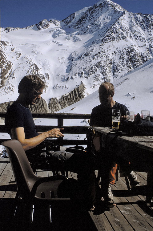
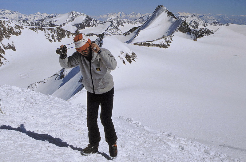
Der Similaun, von dessen einstmals berühmter Eiswand heute nicht mehr viel übrig ist. Der Anstieg von Vent zum Martin-Busch-Haus ist etwa 7 km lang, der Höhenunterschied beträgt rund 600 m. Die Abfahrt nach Vent kann bei eisigen Verhältnissen nerven, weil man fast immer den rechten (Tal-) Ski belastet.
Years ago the ice-face of Similaun (3606 m) was quite famous but nowadays there is not much left of it. The ascent from Vent to the Martin-Busch-Hut is about 7 km long and the difference in altitude is 600 m. In icy conditions or very hard snow the descent to Vent can be quite tiresome as one is always putting weight on the right (lower) ski.
 |
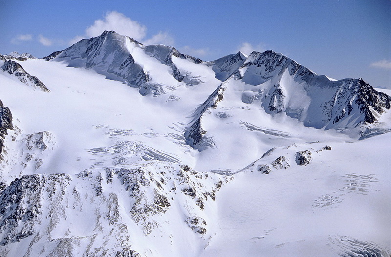
Vom Gipfel des Hauslabkogel überblickt man den Gletscheranstieg auf den Similaun. Vom Martin Busch Haus folgt man dem Niederjochbach bis zur Zunge des Niederjochferners. Diesen quert man diagonal von links unten bis zum Skidepot rechts oben unterhalb der Gipfelpyramide. Die Abfahrt kann oberhalb der Felsinsel im Niederjochferner auch nach rechts zur Similaunhütte erfolgen und von dort zurück zum Martin-Busch-Haus. The summit of Hauslabkogel is a fine place to study the ascent route to Similaun. Starting at the Martin-Busch-Hut one is following the brook until to the tongue of Niederjoch Glacier. Diagonally from left below the glacier is crossed until to the summit pyramid right above below which the skis are deposited. Other than descending the same route it is also possible to ski down to the Similaun Hut right of the rocky spur in the glacier and then return to the Martin-Busch-Hut. |
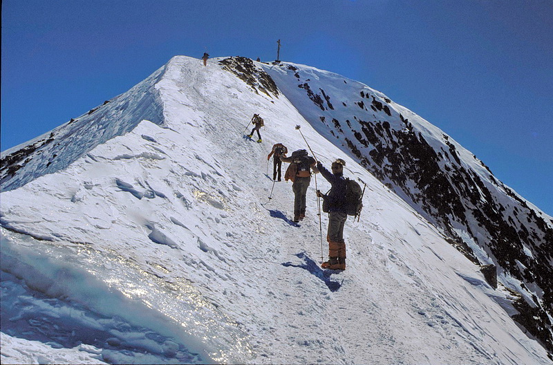 Uns erschien der Gipfelgrat auf den Similaun nicht besonders luftig und ausgesetzt, wie manchmal geschrieben wird. Dies mag aber sehr von den jeweiligen Schneeverhältnissen abhängen. The summit ridge of Similaun didn't seem to be as exposed as it is described one or the other time but this might be changing due to the actual snow conditions. |
 |
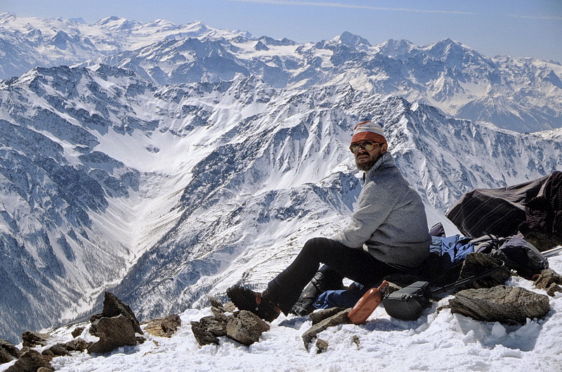
Blick vom Gipfel des Similaun nach Osten: Links der Bildmitte die westliche Marzellspitze (3540 m), rechts dahinter der höchste Gipfel des Gebiets, die Hintere Schwärze (3628 m). In der Mitte zwischen linkem Bildrand und der Hinteren Schwärze der Schalfkogel (3540 m). Ganz im Hintergrund die Stubaier Alpen.
Im Süden erkennt man das Dreigestirn Königsspitze, Gran Zebru und Ortler rechts der Bildmitte. Nach links schliessen sich an: Cevedale, Zufallspitze, Palon della Mare, Monte Vioz und die dunkle Nordwand des Adamello.
Summit view in eastern direction: The dominating peak to the right is Hintere Schwärze (3628 m), the highest peak in this area. The pyramid between Hintere Schwärze and the left side of the picture is Schalfkogel (3540 m) behind which the mountains of the Stubai Range are situated.
In southern direction Königsspitze, Gran Zebru and Ortler (right of the center) are visible. Continuing to the left there are Cevedale, Zufallspitze, Palon della Mare, Monte Vioz and the dark north face of Adamello.
 |
Regenmessstation an der Similaunhütte. Ganz links die Felsinsel im Similaungletscher, rechts der Bildmitte der Similaun. Das Skidepot liegt üblicherweise unterhalb des steilen Gipfelhanges. Rain collector near the Similaun Hut. Right of the center the summit of Similaun which is climbed leaving the skis just below the steep summit slope. |